Lynn Moorman: Finding the Way with Geo-Literacy
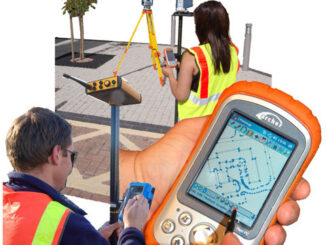
At first glance, navigating the world has never been easier. Getting from Point A to Point B is a snap; just pop an address into your Global Positioning System (GPS) or pull up a map […]
To continue celebrating women in GIS/Geomatics we would like to introduce Tara Seitz, a GIS Quality Manager and Facilitator at GiQ Inc…. GoGeomatics: Tell us a little bit about yourself. How did your interest in Geomatics […]
2013 Canadian Geomatics Conferences: Attending GIS, Remote Sensing, Surveying, Cartography, Geography Conferences Please note that we have an updated 2013 Canadian Geomatics Conference list available. With an eye on 2013 GoGeomatics Canada is looking at […]
The Free and Open Source Software (FOSS) model provides interacting tools, plugs ins and processes with which Geospatial Analyst (GA) can create, barter, trade software and knowledge. FOSS GA are motivated by many factors but […]
Modern Canada is internationally renowned for its cartographic practices and strong mapping systems. Canada is host to vast landscapes and diverse in climates and topography. These lands and waters were mapped and surveyed, by many […]
I recently interviewed Dr. Nancy McKeown, who in 2010, gave a talk at the SETI Institute entitled: What Clays Can Tell us About Past Climate at Mawrth Vallis, Mars and last year, presented at the community […]
When Jon Murphy asked me to write something about ‘Surveying and CAD’ this month I thought, “no problem, when do you need it?” Upon more reflection, it occurred to me that I should write about […]
Fast forward to 2011. I was conducting research on latest trends in education re web 2.0; and, with my Intermediate/Secondary group of pre-service Social Studies teachers at Memorial University, decided to learn Twitter. This resulted […]