Surface
Environmental GIS – City of Toronto Light Pollution Initiative
Nathan Heazlewood, in one of his recent articles, urges us Geomatics practitioners to be proud of the Geospatial profession. GIS…
Mapping the Land Underwater
With the ocean covering a whopping 71% of the Earth’s surface, the ocean floor is largely unexplored. The benefits of…
GIS Technology and the Franklin Expedition: An Opportunity for Our Geomatics Sector
It’s taken nearly 170 years to uncover wreckage from the infamous Franklin Expedition, one of Canada’s biggest mysteries. Last week,…
UrtheCast To Present At World Satellite Business Week
VANCOUVER – UrtheCast Corp. (TSX:UR) (“UrtheCast” or the “Company”) is pleased to announce that its President and COO, Wade Larson, will…
UNB Prof. Emmanuel Stefanakis Authors Book on GIS
A new textbook on geographic information systems by GGE’s Professor Emmanuel Stefanakis has just been published by CreateSpace. Entitled Geographic…
Communications & Power Industries Canada Receives Contract for Earth Observation Mission
GEORGETOWN, Ontario – Communications & Power Industries Canada Inc. (CPI Canada) has been awarded a $3.3 million contract from the…
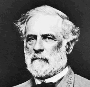
Gettysburg: What Could Lee See?
In an age devoid of modern communications methods and digital maps, military generals often made tactical decisions based on what…
SimActive’s Software Purchased by Mexican Firm IMT
Montreal, Canada, July 3rd, 2014 – SimActive Inc., a world-leading developer of photogrammetry software, is pleased to announce that Mexican…
All the Geomatics Acronyms You Wanted to Know but were Too Afraid to Ask
Here in Canada, there are many geomatics acronyms that get tossed around. During the recent “Team Canada” event that the…
MDA to further concept for Canadian Hyperspectral Mission
Richmond, BC – MacDonald, Dettwiler and Associates Ltd. (“MDA” or the “Company”) (TSX: MDA), a global communications and information company,…
NRCan talks to the United Nations about Geomatics
At the end of last year, I came across what I think is an excellent synopsis of what NRCan and…
GeoEd: Where Surveyors Can Learn and Connect
Present day technology has the ability to facilitate so many things that it’s sometimes hard to comprehend how fast it…


