Landscape and Language: Haida Gwaii
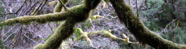
Over the Easter break, I was walking along the North shore of Graham Island towards Tow Hill (pictured below). At the foot of Tow Hill in Haida, Taaw Tldaaw – literally Grease Mountain – there […]
GoGeomatics has always provided HR services to Canadian geomatics companies, including the largest and most popular job board specializing in geomatics in Canada. Now, we’re excited to announce that we are offering staffing solutions and […]
Intergraph®, a global leader in public safety solutions, and Esri®, a global leader in GIS technology, are collaborating to enhance geospatial capabilities for public safety and security agencies. Through the collaboration, the companies will work […]
Financial Contribution to Support Research and Development of Ultra High Resolution, Real Time 3D Seabed Imaging ST. JOHN’S, NL – Kraken Sonar Inc. announced today that its wholly-owned subsidiary, Kraken Sonar Systems Inc. (“Kraken”) has […]
Students don’t need to be located in Nanaimo, British Columbia to get a post-graduate diploma in GIS applications from Vancouver Island University. VIU offers their Advanced Diploma in GIS Applications (ADGISA) in both Face-to-Face and […]
We’re pleased to announce a new series of talks at the upcoming GoGeomatics Socials in Ottawa and Toronto. Brad Schmidt from Intergraph Canada will be stopping by our March socials in Ottawa and Toronto to […]
One-stop shop for infrastructure and land development projects HUNTSVILLE, Ontario – Tuesday, February 24th, 2015 – Tulloch Engineering and A.J. Clarke and Associates Ltd. are pleased to announce that they have joined forces. A.J. Clarke […]
The Canadian geomatics community is full of awards, scholarships, and bursaries recognizing outstanding work and contributions. We’re putting together a comprehensive list of Canadian awards in geomatics, GIS, remote sensing, cartography, and geography. See the […]