Trees
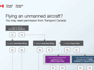
UAVs in Canada – Key Exposures to Loss and Ways to Protect Yourself
This article was written by Mark Sampson for the Association of Ontario Land Surveyors. Mark’s contact details are at the…
How Pokémon Go can encourage a love of outdoors … and family …
In a prior piece, Jonathan Murphy pointed out that fun and geospatial awareness can go together through a game. I…
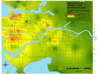
Professional Certification: Population Health Data Analysis in British Columbia
Population health research is inherently interdisciplinary, multifaceted and firmly rooted in the evolving connections between place, time and related socioeconomic…
Innovative solutions for bathymetry at Oceanology International 2016
March 7, 2016 — Teledyne Optech is pleased to announce that it is taking its most powerful and flexible surveying…
Optech Titan wins Grand Award and Award for Technology Innovation at MAPPS 2016
February 9, 2016 — Teledyne Optech is pleased to announce that its Optech Titan multispectral airborne lidar has won both…
New results from Optech Titan field tests
New results from Optech Titan field tests at AGU Fall Meeting December 8, 2015 — Teledyne Optech is pleased to…
Elevation Web Services: Limitations and Prospects
Elevation Web Services: Limitations and Prospects Elevation data is necessary for a wide range of geospatial applications such as creating…
Teledyne Optech a sponsor at 2015 Asian Conference on Remote Sensing
October 14, 2015 — Teledyne Optech is pleased to announce we are a sponsor at the Asian Conference on Remote…
Ground Truthing
In the world of Remote Sensing, one of the key concepts is ground truthing. This has both a positional component,…
Storytelling: Haida Gwaii
Haida Gwaii is a rich source for stories. There are many perspectives and many different formats. In the Haida culture…
Findings Released from European Space Agency Earth Observation for Oil and Gas Project
Over the past 20 years, oil and gas companies have used satellite earth observation technology through the entire project lifecycle,…
Remote sensing sheds light on Earth’s surface at UVic
The University of Victoria is partnering with the province to develop new ways of using airborne sensors to gather information…