Ukraine
International Geospatial Digest for April 15th 2024
US Warns Allies of China’s Military Assistance to Russia The US has issued warnings to its allies about China’s provision…
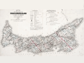
Canadian Geospatial Briefing May 2nd: 1. RCGS releases map in solidarity with Ukraine. 2. YVR launches its digital twin 3. Kraken’s Robotics as a Service (RaaS) contract with the Royal Canadian Navy. 4. 19th-century atlas of PEI
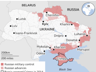
RCGS (Royal Canadian Geographical Society) releases a new map in solidarity with Ukraine. The Royal Canadian Geographical Society produced this…
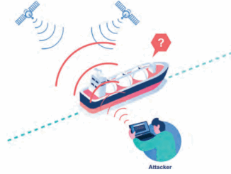
GNSS Jamming vs. Spoofing
On March 17, 2022, the European Union Aviation Safety Agency (EASA) released a safety information bulletin titled “Global Navigation Satellite…
International Geospatial Briefing March 28th: 1. Ukraine War Called ‘Catalyst’ for Space-Based Remote Sensing Industry 2. International Sea Level Satellite Takes Over From Predecessor 3. Nvidia launched a mapping product for the autonomous vehicle industry 4. Infotech Partners with Cultivate Geospatial Solutions 5. Nasa Urged to extend life of key climate sensor that maps world’s forests
Ukraine War Called ‘Catalyst’ for Space-Based Remote Sensing Industry The war in Ukraine is bringing remote sensing technology to the…
Ukraine at War: Impacts of Geomatics, Geospatial & Earth Observation Technologies
Russia’s invasion of Ukraine on February 24, 2022, sent shockwaves through the global community. As tension escalated in the months…
International Geospatial Briefing March 14th: 1. Amazon Heading Towards “Tipping Point” 2. Rising Geospatial Stars of 2022 3. New Software from Locana for Mobile Workers 4. Enabling Clarity in the Face of Disaster 5. Ukraine: Geospatial Stories from the War
Satellite Imagery Shows Amazon Rainforest Heading Towards Tipping Point New research in the Amazon rainforest shows the alarming rate of…