• facebook
  • Twitter
  • Linkedin
  • Youtube
  • Linkedin Group
  • Post a Job
  • Post an Ad
  • Post an Event
  • Post a Directory Listing
  • Post a Press Release
  • Media Kit
  • My Account
  • Login
GoGeomatics
  • MAGAZINE
    • BIM & GIS
    • Community
    • Conference news
    • Earth Observation
    • Education & Careers
    • GEOAI
    • Announcements
    • Reality Capture & Lidar
    • Science
    • Technology
  • Directories
    • ASSOCIATION
    • INDUSTRY
    • EDUCATION
    • Open Data
  • EVENTS
    • GeoIgnite Events
    • Events Calendar
    • GoGeomatics Meetups
  • Services
    • Advertising
    • Marketing
    • Post a Job
    • Post an Ad
    • Post an Event
    • Post a Press Release
    • Post a Directory Listing
    • Media Kit
    • Web Design
  • Find a Job
  • Volunteer
    • Start a GoGeomatics Group
    • Editors & Writers Group
  • About Us
    • About Us
    • Contact Us
    • Frequently Asked Questions
  • Videos
HomeUNB

UNB

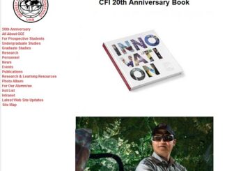
Newsmakers & Press Releases

In the Book: Dr. Yun Zhang & UNB EarthView3D Project Team Develop 3D Line Maps (VR) Visualization

12 June 2017 GoGeomatics Newsmakers | Canada

Funded by the Canada Foundation for Innovation (CFI), Canada Research Chairs program, and the New Brunswick Innovation Foundation Research Technicians Initiative, Dr. Yun Zhang and his EarthView3D project team in the Department of Geodesy and […]

|
Community

UNB: Spring Graduate Seminar and Student Technical Conference

28 March 2017 GoGeomatics Newsmakers | 2017

  The GGE Spring 2017 Graduate Seminar and Student Technical Conference was held on Thursday, 16 March. The well-attended activity showcased the work of five Ph.D., four M.Sc.E., one M.Eng, and one visiting student, making […]

|
Education & Careers

Geospatial Development: Enhancing GIS curricula with programming skills at UNB

29 November 2016 Emmanuel Stefanakis | 2014

Geospatial information science and technology (GIS&T) has rapidly evolved over the last few decades. This evolution has created a highly demanding job market for GIS professionals [3,4]. Recently, students, graduates, and professionals are more and […]

|||||
Technology

How Canadian Remote Sensing Was Made Commercially Successful & Exportable

7 September 2016 Robert Ryerson | activity

This piece started as a note on some of my experience as an international consultant in remote sensing specifically and geomatics more generally. But as I looked more and more at the role of consulting, […]

No Picture
Education & Careers

UNB Student Wins American Fellowship Award

26 April 2016 University of New Brunswick | 2015

Ryan White, a Ph.D. student working with Prof. Richard Langley in the Department of Geodesy and Geomatics Engineering, has won the American Association for Geodetic Surveying (AAGS) 2015 Graduate Fellowship Award. Each year, the U.S. […]

No Picture
Community

Location Encoding Systems – Could geographic coordinates be replaced and at what cost?

11 March 2016 Emmanuel Stefanakis | 2015

Geocoding is the process of converting a street address into a physical location that can be described with a pair of geographic coordinates. It is estimated that over 40% of the world population is physically […]

No Picture
Education & Careers

Remembering Roger Tomlinson & Early History of GIS in Canada

9 February 2016 Robert Maher | 2013

It’s two years now since Roger Tomlinson passed away.  Roger’s and my career path have crossed several times over the last fifty years and what follows is my remembrance of the man and some of […]

No Picture
Community

Fredericton’s New Old Centennial Survey Monument

4 February 2016 University of New Brunswick | 2015

In June 1967, the Centennial Survey Monument (the “Globe”) was unveiled in Fredericton at a prominent location opposite the new (at the time) Centennial Building on King Street. The globe was located in the “Centennial […]

Posts pagination

« 1 2 3 … 6 »

Events

Notice
There are no upcoming events.

View All Events

Services

  • Post a Job
  • Post an Ad
  • Post an Event
  • Post a Directory Listing
  • Post a Press Release
  • Media Kit
  • My Account
  • Login

Jobs

Post a Job
  • Canada Maps and Poster Gallery Volunteer Leads — GeoIgnite 2026
    remote
  • GIS & Data Analytics Lead
    Beaumont, AB
  • Lead Surveyor, Projects/Arpenteur-géomètre principal, projets; arpenteuse-géomètre principale, projets
    North Bay, Thunder Bay
  • Senior GIS Developer
    Calgary, AB
View All Jobs
  • Directories
    • Associations Directory
    • Industry Directory
    • Education Programs
    • Open Data
  • Volunteer
    • Start a GoGeomatics Group
    • Editors & Writers Group
  • About Us
    • GoGeomatics Media Kit
    • Who We Are
    • Contact Us
    • FAQ’s
    • Advertising
    • Marketing
  • Subscribe
GoGeomatics
GoGeomatics is the largest and most popular communications hub promoting the Canadian geospatial community. The business was incorporated in 2011. GoGeomatics hosts over 100 fun, free, location technology networking events each year in cities across Canada.

© 2025 GoGeomatics

  • facebook
  • Twitter
  • Linkedin
  • Youtube
  • Linkedin Group