Community
GIS Health Studies: Conduct Spatial Exposure Assessments
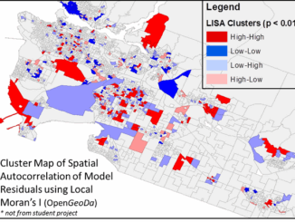
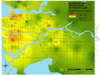
Interested in how to conduct different types of spatial exposure assessments for air pollution or other exposures to a population? PHDA04: Spatial Epidemiology and Outbreak Detection is a great place to start. Exposure assessment is the […]