USA
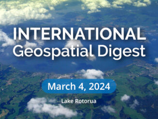
International Geospatial Digest for March 4th, 2024
Lake Rotorua’s Hidden Secrets Revealed Empowering Disaster Resilience: Geospatial Training in Bangladesh Russia’s Pursuit of Nuclear-Powered Space Warfare: A Looming…
Geo Week Conference Program Announced!
200+ speakers and 50+ sessions slated for the 2023 edition of Geo Week in Denver, CO Portland, Maine – USA,…
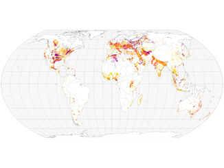
International Geospatial Briefing Jan 31st: 1. Exploring the World’s Food Sources; 2. Tracking Sinkholes with Satellites; 3. New Map Shows 2016 Methane Emissions Worldwide; 4. AI and McDonald’s Locations; 5. Satellites Proving Useful in Aftermath of Tonga Eruption
New Interactive Map Explores World’s Food Sources A new application recently published by Visual Capitalist allows users to explore food…
Geo Week Announces Massive Early Support for 2022 Event
PORTLAND, MAINE – USA, June 22, 2021 – Organizers of Geo Week, the single powerhouse event that champions the coming…
Commercial UAV Expo Americas Announces 70+ Exhibitors to Date for 2021 Event
Best-in-class UAS solutions providers have booked booths for the 2021 edition of CUAV Americas PORTLAND, MAINE – USA, May 25,…
International Geospatial Briefing March 8th: Geography, a cause for inequality; Drone Survey of a Wind Farm Access Road; Loss of soil study using satellite imagery; Japanese noisy children map; Minority-owned businesses map
Geography can become a root cause for inequality when cities are built in a way that fragments social networks A…
International Geospatial Briefing Jan 26th: Sentinel Hub Script Contest; Google AI powered Tree Canopy Lab; Lidar on the iPhone 12 Pro; 3D Laser Scan using SLAM and UAV; 5,500 public sector organizations’ access to local data
Sentinel Hub Custom Script Contest Sentinel Hub is a platform that everyone can explore earth observation data with a free…
International Geospatial briefing for 14th December: Youngest drone cartographer; COVID-19 impact on satellite data services market; Drone-integrated metal detection sys; Initiative for more accessible data
Young drone cartographer puts record-breaking on the map Nathan Lu from the USA is featured as the youngest drone cartographer…
The “New” GoGeomatics Canada: Relaunching Our Magazine
A team of really intelligent squirrels and I have been working on the new GoGeomatics magazine. I’m taking a break…
M.A. or M.Sc. Opportunity – Environmental Assessment and Resource Mgt
M.A. or M.Sc. Graduate Research Opportunity Department of Geography and Planning University of Saskatchewan Opportunity: The Department of Geography…
One of the Best Geomatics events in Canada: GeoAlberta 2017
I had a chance to attend the 2017 GeoAlberta conference earlier this month in Calgary, Alberta. This was my first…
The Open Geospatial Consortium (OGC): proposed GeoRSS Community Standard
The Open Geospatial Consortium (OGC®) is requesting public comment on the proposed GeoRSS Community Standard. First available in 2006, GeoRSS…