
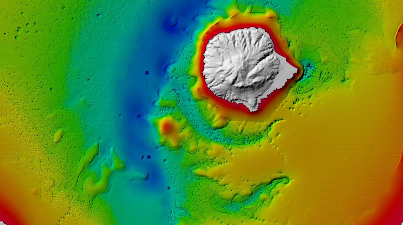
- Lake Rotorua’s Hidden Secrets Revealed
- Empowering Disaster Resilience: Geospatial Training in Bangladesh
- Russia’s Pursuit of Nuclear-Powered Space Warfare: A Looming Threat
- SimActive’s Goal to Enhance 3D Mapping with Multi-Camera Drone Payloads
- Mapping the World’s Coral Reefs Using Satellite Imagery and Machine Learning
- AI-Powered Method Revolutionizes Satellite Design for Earth Observation
Lake Rotorua’s Hidden Secrets Revealed
Empowering Disaster Resilience: Geospatial Training in Bangladesh
In a bid to strengthen Bangladesh’s resilience against a myriad of disasters, a comprehensive geospatial training program was conducted in Dhaka from 19 to 30 November 2023. Supported by NORAD (Norwegian Agency for Development Cooperation), the project aimed to enhance disaster risk management through advanced GIS techniques. Participants mastered QGIS software, Earth observation, flood analysis, and map design, resulting in a remarkable increase in confidence and competence (Before the training, only 1% considered themselves at a moderate to high level. After completion, a significant shift occurred, with 88.4% now viewing themselves at a moderate to high level). To learn more about this important training, click here.
Russia’s Pursuit of Nuclear-Powered Space Warfare: A Looming Threat
Recent alarms from House Intelligence Committee Chair Mike Turner regarding Russia’s space-related activities have sparked concerns about a potential national security threat. While initial fears of nuclear weapons in space have been downplayed, the focus has shifted to Russia’s development of a nuclear-powered electronic warfare (EW) capability in space. Such a weapon could disrupt critical satellite operations, posing a significant challenge to U.S. space-dependent technologies like GPS. To read more about this threat and what it could mean, click here.
SimActive’s Goal to Enhance 3D Mapping with Multi-Camera Drone Payloads
SimActive, a developer of photogrammetry software, has announced the integration of its Correlator3D product with multi-camera drone payloads to improve 3D mapping capabilities. With the advent of multi-camera payloads like the Oblique D2M from Quantum-Systems, drone mappers can now capture detailed textures of buildings and infrastructures from various angles. SimActive’s Correlator3D streamlines the process by simplifying project setup and aerial triangulation, making it easier to handle complex multi-camera data. To read more about this exciting development, click here.
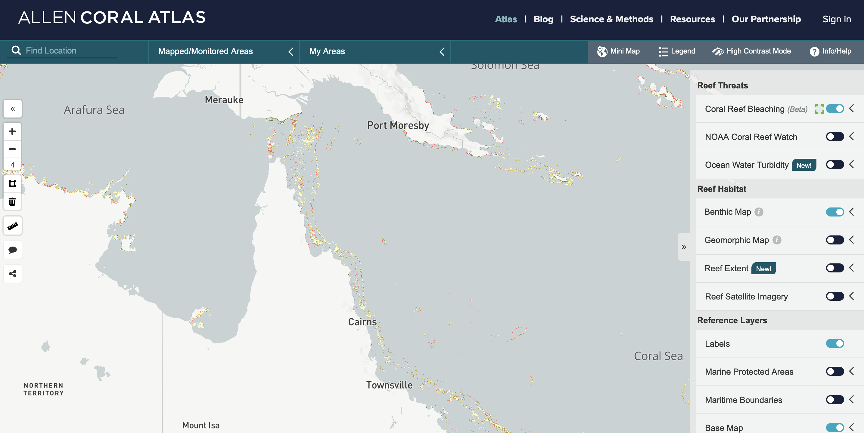
Mapping the World’s Coral Reefs Using Satellite Imagery and Machine Learning
AI-Powered Method Revolutionizes Satellite Design for Earth Observation
A groundbreaking study, led by Swinburne University of Technology and global Earth observation data provider Planet Labs, introduces a new AI-powered approach to enhance Earth observation satellite designs. Published in Remote Sensing Letters, the method aims to reduce satellite costs while maintaining image quality. Dr. Steve Petrie, a key contributor, highlights AI’s role in compensating for hardware limitations, particularly in lens quality. The innovation holds promise for diverse applications, including climate monitoring and disaster tracking, by improving satellite data accessibility and affordability. To learn more, click here.


Be the first to comment