Wildfire
Canadian Geospatial Briefing July 19th, Drone spraying research promising; B.C. wildfire map; Manitoba Infrastructure Projects Map; N.B. COVID dashboard; New database of P.E.I. trails maps
Drone spraying research promising Drone spraying would be ideal for touch-ups and misses in a field after a large sprayer…
International Geospatial Briefing July 12th, 2021: Mapping the hot hotspots in the world; Esri’s book calling for action for conservation; June ArcGIS Living Atlas Updates; Telecomm giant maps climate resilience; Map the graveyards and trace you family tree; LiDAR to stop texting and driving; Digital Twin of the News
Mapping the hottest temperatures around the world June was an exceptionally hot month for several countries in the northern hemisphere. A…
Responding to Wildfires and Emergencies: Increasing Situational Awareness with Avenza Maps and Geospatial Data
In Canada, an estimated 3,600 wildfires burned approximately 581,004 acres in 2020 alone.1 Similarly, in the United States, an estimated…
International Geospatial Briefing March 22nd: Detect wildfire from space; Geospatial evidence of pirates; Disaster preparedness with geospatial technology; Indoor navigation without GPS; Virtual Easter eggs on Google Maps
Australia’s first satellite that can help detect bushfires within one minute of ignition set for launch An Australian company is…
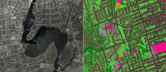
Post-Wildfire Landscape Metrics & Transition Characteristics in Cariboo Regional District, 2017
The summer of 2017 marked one of the worst fire seasons in British Columbia’s history. By October, wildfires had covered…
Your Canadian Geospatial Briefing for June 29th: New tech against wildfires; Bathymetric Lidar mapping; COVID-19 effect Heat maps; Eastern Canada DOT Power Platform; Tim Kopra as Vice President, Robotics and Space Operations of MDA
Scientists armed with new tech and cool gadgets face off against wildfires More extreme weather each spring makes wildfires a…
Hatfield releases R-BAM algorithm to all Canadian wildfire agencies
The Rapid Burned Area Mapping (R-BAM) technology was developed over the last three years by Hatfield Consultants and aims to…
Fire GIS Uses Maps, Data, & Social Media–A Hot Tool for BC Residents, Travellers
Every summer in British Columbia, along with long days, sunshine, heat, and little rain comes an all-too-familiar reality: hundreds of…
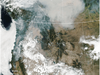
Seeing Through Wildfire Smoke in Fort McMurray, Alberta with Infrared Imaging
Images of the massive wildfire that engulfed Fort McMurray, Alberta earlier this year have been seared into our collective consciousness.…
UAV Technology in the Canadian Forestry Sector
The Unmanned Aerial Vehicle (UAV) industry is soaring! Civilian drones are being applied in various global industries ranging from agriculture…
SkyIMD and Phase One Industrial Announce SkyIMD’s Introduction of FAA-Approved Mounts
Approved for commercial aviation in 56 countries SAN FRANCISCO and COPENHAGEN, Feb. 26, 2015 — Sky Imaging Mapping Data (SkyIMD),…
Sight Surveillance Provides Mobile Command Centres Using Geomatics
The Canadian geomatics industry is full of small and medium-sized companies offering innovative products and services. One such company is…