
Across Canada, geomatics and geospatial education are facing a reckoning. Programs are shrinking or disappearing altogether, funding is increasingly scarce, and institutions are being forced to make difficult decisions about what to sustain. Meanwhile, the need for skilled geospatial professionals has never been greater. There is a growing disconnect between what the country needs and what our academic system can deliver.
This gap becomes even more urgent as Canada prepares for a new era of infrastructure development. With a federal election underway, both major parties have signaled their intent to fast-track large-scale, nation-building projects aimed at enhancing sovereignty, energy security, and economic independence. These initiatives go beyond pipelines or railways — they represent a reimagining of how Canada moves energy, goods, and data across the country and out to global markets.
The Infrastructure Behind Infrastructure
Behind each of these projects is a critical, often overlooked foundation: geomatics. Surveying, geographic analysis, remote sensing, mapping, BIM, and in the future, the use of digital twins. These are the tools that make planning, execution, and long-term maintenance possible.
Yet, while Canada’s infrastructure agenda is expanding. And the talent pool needed to support it is shrinking.
Comprehensive national data on geomatics and GIS program closures is limited, but what we do know is concerning. Several respected programs have been cut in just the past two years.
In 2024, Fleming College (Ontario) and Vancouver Island University (British Columbia) — both long-standing leaders in GIS education — discontinued their programs. The closures were driven by financial strain and declining enrollment, particularly among international students, who had traditionally made up a significant portion of their intake.
More recently, Mohawk College (Ontario) announced that its Geographic Information Systems (GIS) certificate program would stop accepting new students as of Spring 2025. Similarly, Fanshawe College (Ontario) announced it would suspend 40 programs starting this fall. Among the cancelled offerings are the BIM and Integrated Practice programs.
What we’re seeing is not simply a few isolated closures — it’s a reflection of a deeper, systemic failure to treat geospatial education. There is a lack of national coordination, minimal promotion of geospatial career paths, and an outdated perception of geomatics as a narrow technical specialty rather than an updated narrative that reflects the critical role geomatics now plays in climate resilience, digital transformation, and infrastructure development.
Growing Disconnect Between Classrooms and the Real World
The consequences of Canada’s fragmented geospatial education system are becoming increasingly visible. Employers across the country report growing difficulty finding graduates with the technical skills, certifications, and real-world readiness the industry demands.
At GoGeomatics Canada, we work closely with students, professionals, and employers nationwide, and we hear this firsthand. Whether at our national career fairs or the GoGeomatics Expo, the message is consistent: the talent pipeline is thinning, the workforce is aging, and post-secondary institutions are graduating fewer qualified geomatics professionals than they did even a decade ago.
Part of the challenge lies in the structure itself. Education is a provincial responsibility in Canada, which means there is no unified national approach to developing geospatial talent. As a result, programs vary widely in scope, quality, and alignment with industry needs — making it harder to respond to shifting technologies and labour demands in a coordinated way.
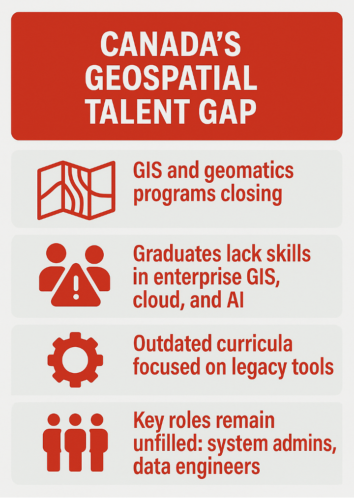
Even the programs that remain active are often falling behind the pace of change. Curriculums still emphasize legacy tools while underpreparing students in areas like enterprise GIS, system architecture, and cloud-based geospatial platforms. The result is a growing mismatch: too many students are trained as general GIS users, yet few graduate with the ability to design, manage, or integrate the complex systems that now define the profession.
In disciplines like surveying and mapping, course content continues to lean heavily on outdated analog techniques. But the demands of today’s roles go far beyond that — they require spatial data management, applied mathematics, programming, and hands-on field experience. Even graduates from specialized institutions often lack exposure to current tools and workflows used in industry.
At the same time, critical roles — such as geospatial system administration, spatial data engineering, and applied AI — remain difficult to fill. Employers are calling for broader cross-training and a more flexible approach to talent development, drawing on fields such as computer science, environmental modeling, and data analytics. But without a coordinated effort to modernize academic programs, that talent pipeline simply won’t emerge.
This isn’t just a disconnect between classroom and career — it’s a structural failure to align the evolution of Canada’s geospatial sector with the institutions responsible for training its future workforce.
And the stakes are high. The large-scale infrastructure projects now on the table — some valued at over $100 billion — will require thousands of geospatial professionals skilled in UAV data collection, real-time analytics, 3D modeling, and integrated digital systems.
Without a robust domestic talent pipeline, we face three critical risks: project delays, increased reliance on foreign service providers, and a missed opportunity to build sovereign capacity in one of Canada’s most strategically important sectors.
In short, we risk becoming dependent on foreign firms and outsourced expertise to build and manage the very infrastructure that is meant to secure our sovereignty.
The SAIT Connector: A Model That Works
This is why programs like the SAIT Connector Lab in Calgary deserve national attention.
Since 2022, the Connector Lab has supported over 150 student-led projects involving more than 1,200 learners from across SAIT’s schools. These projects include drone-based wildfire assessments, 3D scans of historical structures, environmental monitoring using sensors, and digital modeling for urban infrastructure. They require students to navigate data, design, analysis, and fieldwork, developing the kind of practical insight the geospatial workforce demands.
Crucially, the Connector Lab brings students from multiple disciplines — engineering, environmental science, digital technology, and trades — into shared projects that reflect how infrastructure is built in the real world. It also reaches beyond campus, engaging Indigenous youth, high school students, and underrepresented groups through mentorship, outreach, and community partnerships.
The SAIT is a model of applied, collaborative, industry-integrated education. Students work with more than $1.5 million in hardware and software, benefit from vendor partnerships, gain access to Transport Canada drone certification, and take part in field projects and national competitions. These opportunities are rare.
SAIT students who come through the Connector aren’t just technically capable – they are confident, connected, and ready to contribute. Whether participating at the GoGeomatics Expo or engaging in national career events, they consistently demonstrate the kind of practical insight and collaborative spirit that employers value.
And yet, despite its success, there are now reports of the SAIT Connector facing funding uncertainty. That should concern all of us.
A National Coordinated Action Plan
This is where we need to be clear-eyed. If Canada is serious about remaining competitive in the global geospatial economy — and intends to deliver on its infrastructure promises — it must invest in the talent that will turn those plans into action.
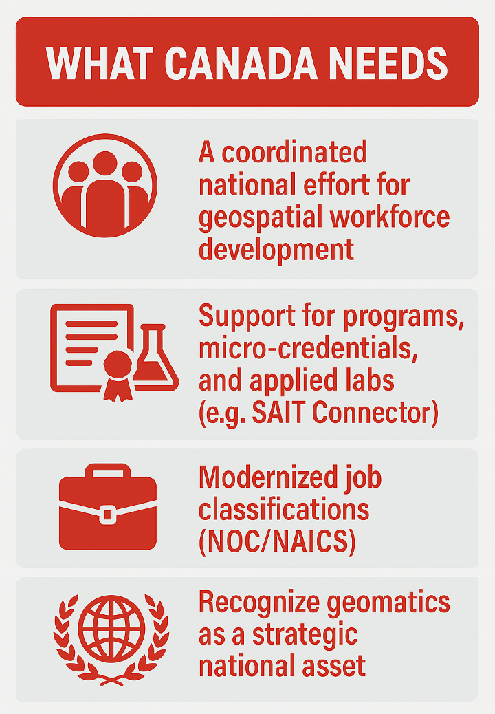
We need a coordinated national effort — one that brings together provinces, industry, post-secondary institutions, and the federal government to strengthen the geospatial talent pipeline.
That means targeted funding for education and applied labs, recognizing geospatial roles in workforce and immigration planning, and supporting micro-credentials and work-integrated learning aligned with real-world needs. Industry associations, employers, and institutions can lead the way — by updating curricula, sharing labour market insights, and co-developing training models that reflect today’s evolving geospatial landscape. This kind of collaboration isn’t unprecedented.
We have seen it work in clean tech, cybersecurity, and the skilled trades — sectors where national priorities intersect with local delivery. Geomatics isn’t a niche field. It’s foundational to Canada’s digital infrastructure, environmental resilience, and economic future. It’s time we treated it that way.
If you care about where Canada’s geospatial sector is headed — from workforce gaps to national innovation — come be part of the conversation at our open forum happening at GeoIgnite 2025 — Canada’s Geospatial Future: Innovation & Self-Reliance, at 9:00 AM on Monday, May 12, 2025, at the Ottawa Conference and Event Centre during. More details here


Be the first to comment