
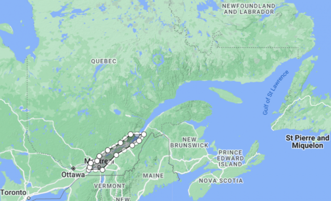
Just a year after unveiling its bold vision for hydro spatial innovation, Canada is turning strategy into action. On June 17, 2025, Fisheries and Oceans Canada officially launched the S-100 Sea Trials on the St. Lawrence River, marking a major milestone in the country’s commitment to advancing the future of digital marine navigation.
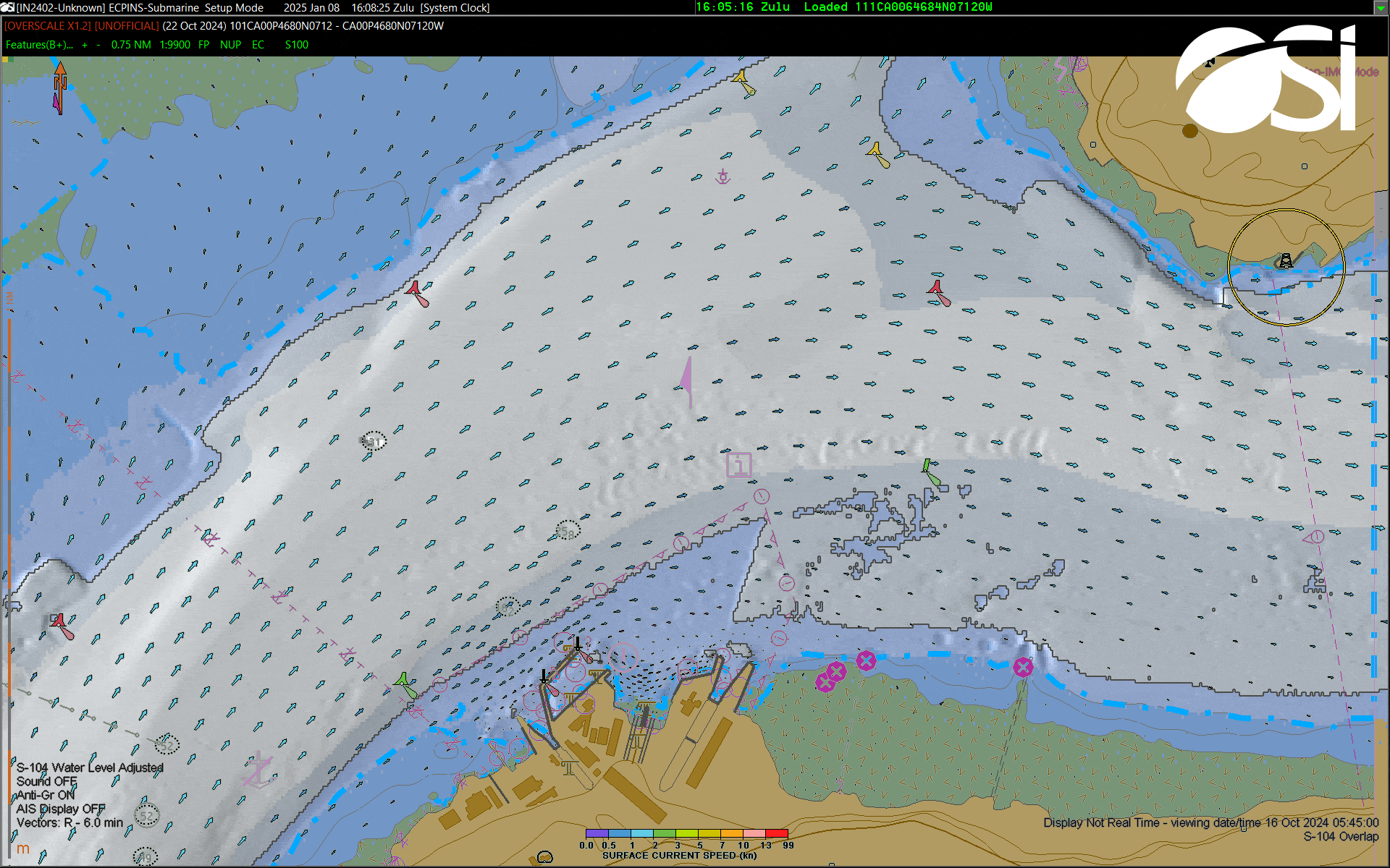
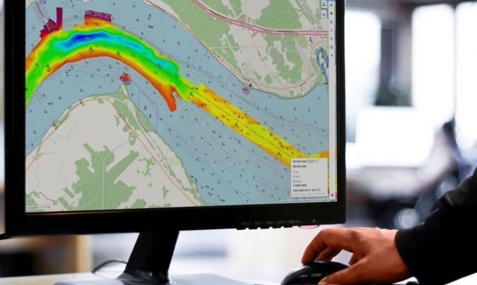
The S-100 standard, developed by the International Hydrographic Organization (IHO), represents a major evolution in how we understand and navigate marine environments. Unlike traditional paper or static electronic charts, S-100 offers layered, real-time digital data, allowing mariners to access up-to-date information on tides, currents, water depths, and navigational hazards all in a dynamic, integrated format. This opens the door to smarter, safer routing and more efficient decision-making at sea.
Canada is the first nation to offer the full S-100 Phase 1, providing vital navigational data like water levels, currents, navigational warnings, and high-resolution bathymetry. Endorsed by the International Hydrographic Organization (IHO) and in partnership with the Canadian Coast Guard (CCG), these trials will deliver real-time S-100 data along a 350-km stretch of the St. Lawrence Waterway, running from June 1 to November 30, 2025.
Last month, Manon Larocque, Hydrographer General of Canada, gave the details in her keynote at GeoIgnite 2025. This article — How Canada’s S-100 Strategy is Shaping the Future of Hydrospatial Innovation — also captures further details.
Tthese trials now underway, that strategy has moved from the conceptual to the practical signaling that Canada is serious about redefining the future of marine navigation.
A Living Lab on the St. Lawrence
The St. Lawrence River is more than just a strategic waterway; it’s an ideal testing ground. With its shifting currents, complex topography, and dense maritime traffic, it offers the perfect environment to evaluate how S-100 products perform under real-world conditions. Until November 2025, Canada is providing free access to its S-100 digital navigation tools for developers, stakeholders, and mariners to test and provide feedback.
These trials are not only technical evaluations, but they’re a collaborative effort. Organizations like the Canadian Coast Guard, Teledyne Geospatial, ECC, and PRIMAR are working alongside CHS to ensure the success of this initiative and its eventual global implementation starting in 2026.
Source: Hydro-international
From Innovation to Impact
Canada’s proactive approach demonstrates more than leadership. It shows how innovation can translate into action. By offering tools, engaging stakeholders, and building real-world evidence, Canada is helping set the stage for global adoption of interoperable marine data standards.
This isn’t just about safer shipping. It’s about enabling climate resilience, environmental protection, and data-driven maritime governance. It’s a shift toward intelligent oceans.
The S-100 Sea Trials are a powerful reminder of how vision, collaboration, and technical excellence can chart a better course for Canada and for the world.


Be the first to comment