
Access to timely and quality health care is an important determinant of health and well-being.
Despite universal health coverage in Canada, there exists socio-demographic, financial and physical geographic barriers that limit the accessibility to health care resulting in health disparities across the population.
The ability to link administrative health and census data to small or large geographic areas facilitates the study of such health disparities and can provide guidance for overarching policy and/or targeted intervention. A great example of this can be found in a research article entitled Spatial Accessibility to Health Care Services: Identifying under-Serviced Neighbourhoods in Canadian Urban Areas (PLOS | One).
In Population Health and Geographic Information Systems, students learn how and when to apply various spatial techniques for the analysis of health data.
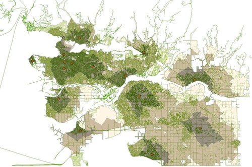
For example, the image to the right was created as a part of a weekly lab assignment. It shows the hospital catchment zones based on travel time in the Metro Vancouver region in British Columbia, Canada.
This process can be expanded to the provincial scale to explore travel times to health clinics in rural areas or other under-served areas. Want to learn how you can incorporate spatial analysis within your health research?
Learn more about the Professional Specialization in Population Health Data Analysis at UVic.


Be the first to comment