
Anyone who has worked in field data collection for more than a few seasons knows the realities: the GNSS signal drops out as you move under canopy, a pole sits in a traffic lane you can’t safely occupy, or a manhole is tucked behind an obstruction you can’t reach. For decades, these situations have meant compromises—either you accept incomplete data or you send crews back for another attempt.
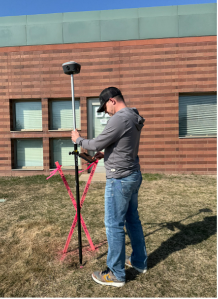
Today, technologies such as the Tersus Oscar Trek are changing that workflow. By pairing a survey-grade GNSS receiver with a high-resolution global-shutter camera and Inertial Measurement Unit (IMU) tilt sensor, visual positioning makes it possible to collect accurate points from imagery and maintain reliable tracking in areas where GNSS alone struggles. It brings a level of flexibility into the field that simply didn’t exist a few years ago.
Why Visual Positioning Matters
Traditional GNSS workflows require maintaining satellite visibility and physically occupying each point. That approach works well in open sky, but many field environments don’t offer ideal conditions. Crews still need accuracy and fast turnaround, yet often default to traditional survey methods. Conventional gear is extremely precise, but it can be inefficient for quick point capture, especially on busy sites, around obstructed features, or across widely distributed assets.
The Oscar Trek introduces a more flexible workflow. After establishing a GNSS fix, it uses visual positioning to simplify point capture and make it easier to collect features that are difficult or unsafe to occupy directly. This reduces the need to physically stand on every point while still delivering the precision required for professional-grade field work.
How the Oscar Trek Implements Visual Positioning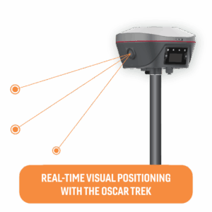

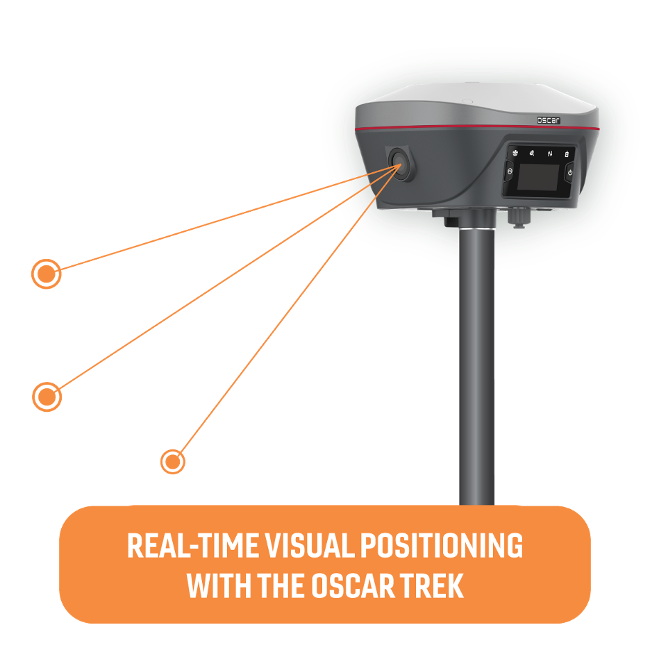
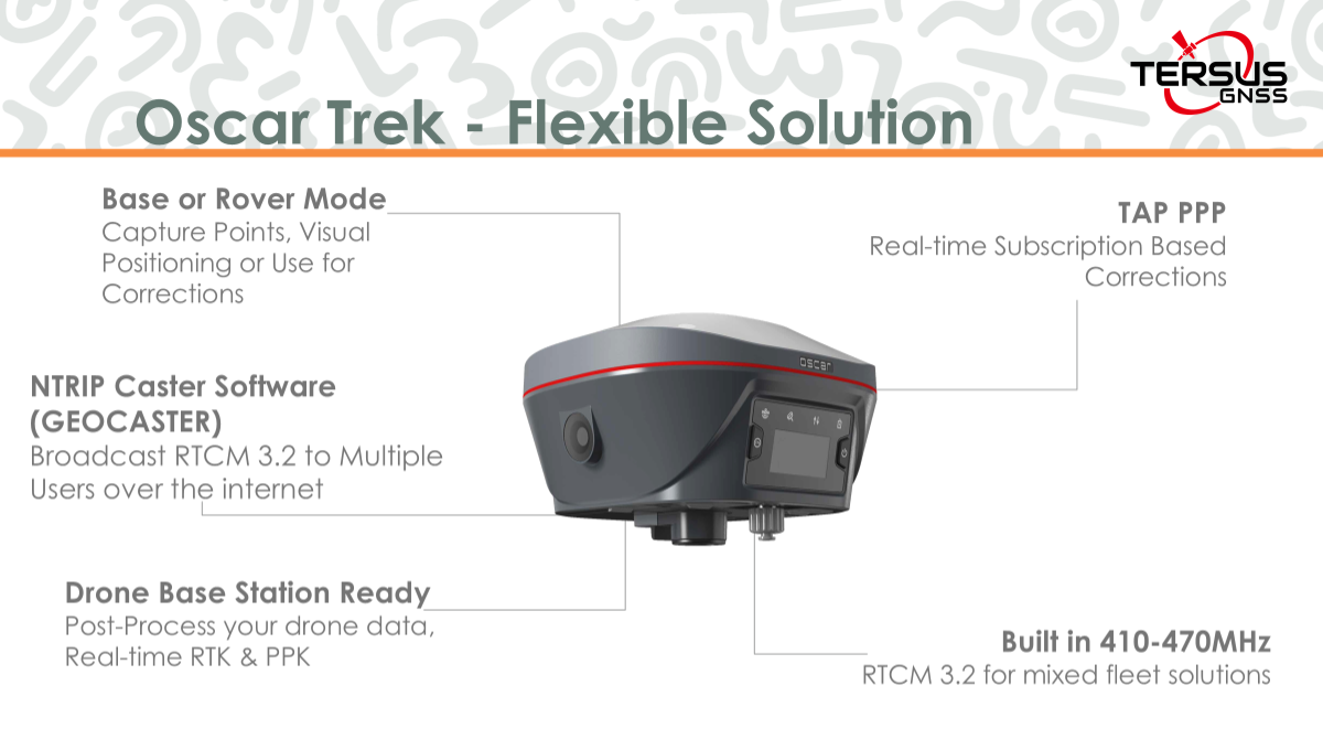
Inside the Oscar Trek are three tightly integrated components:
- RTK GNSS engine for centimeter-level accuracy.
- Inertial Measurement Unit (IMU) tilt sensor for maintaining orientation and positional awareness.
- High-resolution global-shutter camera for geotagged image capture.
The workflow is driven by the Nuwa Field App, a feature-rich Android software platform (iOS support expected in 2026). The process is designed to be intuitive:
- Capture: Walk the site with the Oscar Trek receiver, camera oriented toward the area of interest. The system collects overlapping images for visual positioning.
- Process: Nuwa software fuses GNSS + IMU data with imagery to reconstruct survey-grade coordinates in real time.
- Measure and Extract: Select points directly from photos, or generate dense point clouds with centimeter-level accuracy, directly on the tablet.
- Export: Export results immediately in LAS, SHP, CSV, DXF, LandXML, or KML for use in GIS, BIM or photogrammetry office software.
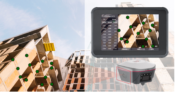
Because the system processes point clouds on the controller itself, crews can confirm they have the data they need before leaving the site. Office teams receive both coordinate outputs and the associated imagery, providing a clear visual reference for every measurement.
Accuracy and Practical Reliability
With correction services delivered through NTRIP, UHF radio, or the Tersus TAP PPP service, the Oscar Trek consistently delivers 2-4 cm accuracy. Dense point clouds generated through visual positioning can achieve 2-3 cm feature accuracy when captured with consistent overlap.
Visual positioning doesn’t replace traditional GNSS or total station workflows—it enhances them. The process still begins with a fixed RTK solution. Once that initial fix is established, the camera and IMU allow users to continue capturing data as they move. This enables crews to collect data safely and efficiently in areas where traditional workflows would be slow, difficult, or unsafe.
A Flexible System for Multiple Roles
The Oscar Trek’s flexibility makes it practical for organizations with varied field needs. A single receiver can be used as:
- An RTK rover for traditional GNSS point collection.
- A visual-positioning system for image-based measurement and point-cloud extraction.
- A base station broadcasting corrections via UHF or GeoCaster NTRIP.
- A drone base supporting RTK and PPK base station workflows and capturing ground control points (GCPs).
This reduces the amount of equipment teams need to manage and streamlines training. For GIS-focused organizations, the Trek in standard rover mode using GNSS and tilt mode (not visual positioning) works smoothly with ArcGIS Field Maps, Survey123, and QuickCapture, ensuring high-accuracy data flows directly into enterprise mapping environments.
Surveying and Mapping: Surveyors often encounter features they cannot safely access or occupy. With the Trek, those features can be measured from a distance, maintaining accuracy without exposing crews to unnecessary risk.
 Utilities and Asset Management: Many assets, including manholes, valves, and poles, are located in areas with limited access. Visual positioning makes it easy to capture them quickly and safely while keeping a clear photographic record.
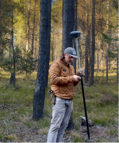
Natural Resources and Environmental Work: Foresters and environmental professionals frequently operate in partial canopy or uneven terrain. After establishing a fix in open sky, the Trek allows measurements to continue deeper into obstructed areas.
Construction and Site Inspection: Inspectors may not have time to run complex GNSS equipment. Nuwa’s straightforward interface makes single-photo point collection simple, allowing crews to produce accurate, well-documented site conditions without specialized training.
Across these use cases, the benefit is consistent: more complete data on the first visit, with less time spent navigating around site constraints.
Complementary Tools for a Complete Workflow
The Oscar Trek is part of Tersus’s GNSS-based visual positioning solutions, ideal for outdoor environments with clear satellite visibility. Their portfolio also includes solutions for indoor, outdoor, and aerial-based data acquisition. Mapping indoors, under a canopy, or in tight corridors is challenging because GNSS signals are often unreliable. The Metaverse Painter S2 (MVP S2) addresses this with SLAM-based 3D scanning, generating dense point clouds in real time as you move through complex spaces. With centimeter-level accuracy, flexible handheld or backpack modes, and intelligent filtering, it allows crews to capture data faster, safer, and more efficiently than traditional workflows. And unlike standard SLAM scanners, its onboard GNSS receiver lets you georeference point clouds in real time, providing accurate real-world coordinates directly in the field for combined indoor and outdoor collection.
The Oscar Trek is optimized for GNSS-based visual positioning in outdoor environments, but when projects demand wide-area, airborne mapping, the Tersus MVP 400 provides a powerful alternative. The MVP 400 is a high-performance mobile mapping system that integrates a long-range LiDAR scanner with a tightly coupled GNSS/INS navigation module and interchangeable high-resolution cameras. It delivers centimeter-level precision even across dense vegetation or steep terrain, generating rich, georeferenced point clouds from the air. With pulse rates up to 1,000 kHz and multiple echo returns, the MVP 400 is ideal for applications such as power line inspection, emergency response, transportation infrastructure measurement, and smart city modeling — anywhere survey-grade airborne data is required. While GNSS is often the default for routine workflows, teams may adopt SLAM or drone-mounted LiDAR on larger projects to expedite the capture of extensive datasets.
Precision Doesn’t Have to be Complicated or Expensive
With Oscar Trek, precision doesn’t have to be complicated or expensive. A single receiver supports multiple roles — from surveying and GIS mapping to drone base station workflows — all in one compact system. Enabling multi‑point measurements without requiring physical access to each location reduces field time and enhances safety in hard‑to‑reach areas. Seamless office integrations ensure that teams can validate measurements, review real‑world conditions, and maintain photo‑based records from the field, creating a complete, efficient, and reliable workflow from capture to delivery.


Be the first to comment