Earth Observations for the Sustainable Development Goals (EO4SDG) launched the GEO SDG (Sustainability Development Goals) award in 2019 with the vision of establishing and acknowledging earth observation and geospatial information to advance the United Nations 2030 Agenda and promoting improvement in society through the achievement of sustainable development goals.
EO4SDG Vision – Countries, stakeholders, and the global community desire additional Earth observations and geospatial information to continue progress on improved social, economic, and environmental sustainability.
Two kinds of awards are offered through the GEO SDG Awards. Sectoral Category Awards honor different types of organizations. Particularly important principles linked to the combination of Earth observation and sustainable development are honored with Special Category Awards.
Each nomination for the 5th annual GEO SDG Awards was thoroughly examined by eight different judges from different industries and nations. The prospect of replication at the global level, expansion, and overall impact, quality, and validity of the Earth observation efforts were evaluated for each submission. Let us look at the winners.
SECTORAL AWARDS
2023 Sectoral Awards went to:
GEO Participating Organization: Committee on Earth Observation Satellites (CEOS) SDG Coordination Group
The Committee on Earth Observation Satellites (CEOS) enables data sharing with the goal of maximizing societal benefits and driving decision-making to promote a successful and sustainable future for humanity. It also assures worldwide coordination of civil space-based Earth observation programs.
The SDG Coordination Group, formerly known as the “ad hoc team on SDG,” or SDG AHT, acts as the central point for all SDG-related initiatives. It also offers external partners, such as GEO, satellite Earth observation expertise and emphasizes the critical role that satellite-based monitoring plays in helping to track and accomplish SDGs. More recently, global SDG experts and Custodian Agencies have created a number of priceless resources for reporting indicators, including details on possibilities and techniques, observation gaps and needs, and the availability of satellite data for certain indicators.
SDG Custodian Agency: Food and Agriculture Organization of the UN (FAO)
Monitoring land and water productivity by Remote Sensing, FAO WaPOR
Access to remotely sensed data is made possible by the FAO’s WaPOR portal, which also tracks and reports on agricultural water productivity in almost real-time starting in 2009. Its worldwide version was introduced on October 4, 2023, during the FAO Rome Water Dialogue.
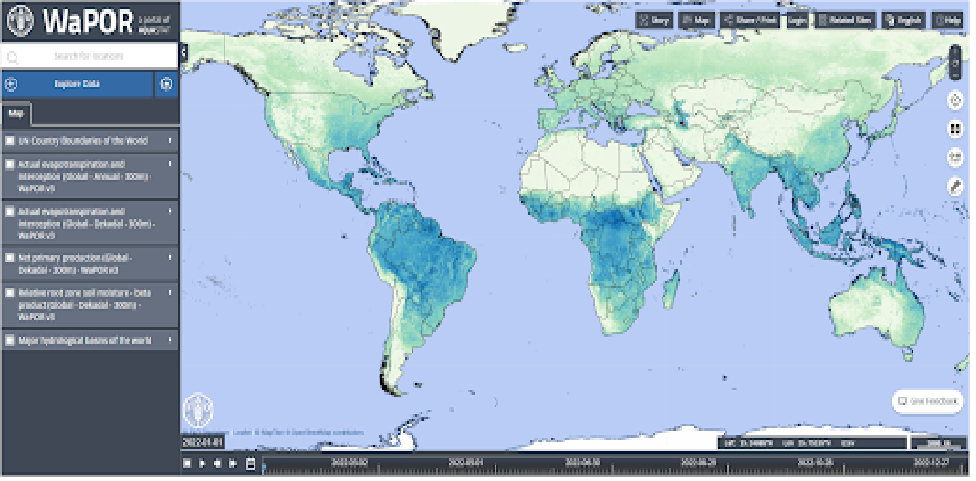
View of the WaPOR dashboard
The WaPOR data are a collection of geographical datasets with a range of resolutions (from 300 m to 20 m) that are mostly obtained from satellite measurements of the productivity of agricultural land and water use (evapotranspiration). The most important information is on “water productivity,” which is defined as the yield of agriculture generated per kilogram of water used (kg/m³). This is also known as “more crop per drop” and is pertinent to SDG 6.4.1 reporting on water-use efficiency, which is under the purview of FAO as the custodian agency.
Civil Society: World Resources Institute (WRI)
Energy Access Explorer(EAE)
EAE is the first, open-source, online, and interactive geospatial platform that allows energy planners, clean energy entrepreneurs, donors, and development institutions to identify high-priority areas for energy access interventions.
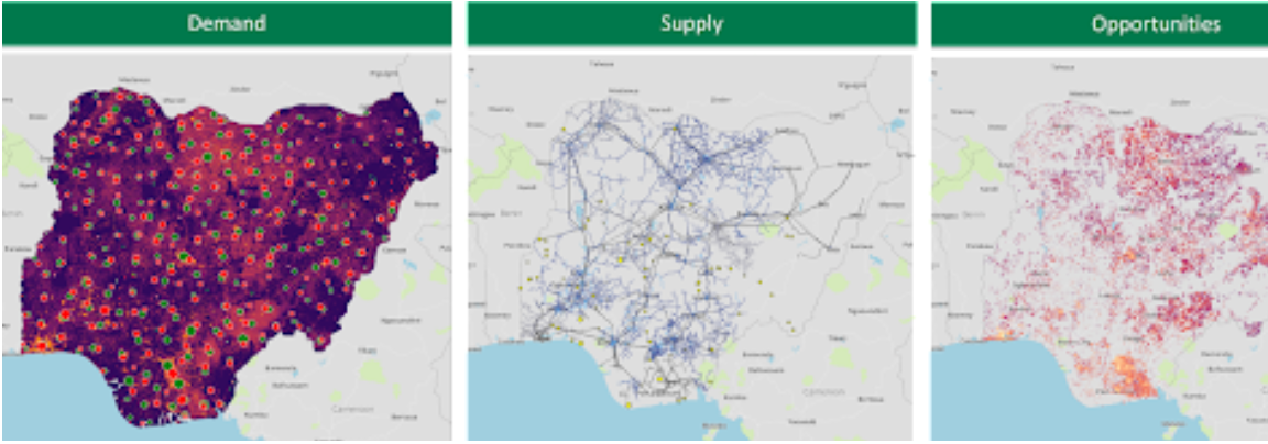
Market analysis of Nigeria for the Clean Energy Africa Minigrid program
EAE serves as a dynamic information system as well, bringing down the cost of software engineering and data transactions for both users and data suppliers, while promoting data management and governance.
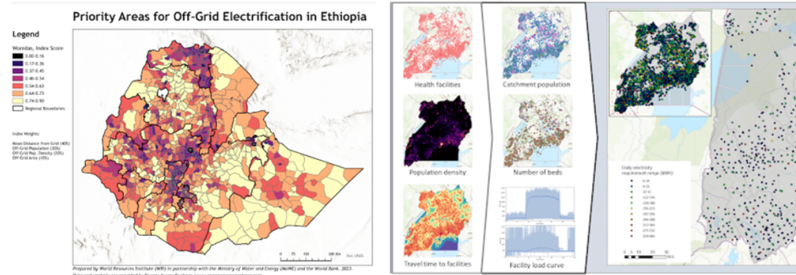
Map of off-grid electricity needs in Ethiopia (left) and available health-related datasets on the EAE platform (right)
Through this effort, cross-sectoral EAE working groups were established, paving the way for an inclusive and integrated approach to energy planning. The success of this platform is demonstrated by the use cases of Ethiopia, Kenya, Zambia, Uganda, and Nigeria.
SPECIAL AWARDS
2023 special awards went to:
Statistical-Geospatial Integration: Lesotho Bureau of Statistics and FAO Lesotho
EOSTAT: EO for monitoring land cover, ecosystems, and reporting on SDG 15.4.2
The Bureau of Statistics of Lesotho and the FAO Office of Lesotho have developed a solution that enables on-fly computation of nationwide capture of the mountain green cover index (MGCI). Using Sentinel-2 land cover data with a 10m resolution, EOSTAT is divided into elevation zones. Prior to this, the inability to update the 2015 national Land Cover baseline, prevented reporting on SDG 15.4.2 from being possible.

View of the EOSTAT Dashboard (left) and attendees of a training held on the use of the EOSTAT dashboard in partnership with the ReNOKA Integrated Catchment Management program in 2022 (right)
This powerful EO-based solution has changed the dynamics in this area by satisfying numerous reporting requirements using national land cover and land cover change information. As a result, field survey operations can be significantly reduced in cost, and significant data gaps can be filled with confirmed granularity, timeliness, and accuracy.
EOSTAT is used by the National Meteorological Services to pinpoint hotspots of vegetation degradation, monitor the impact of land restoration projects, and examine the impact of climate change on the status of ecosystems.
Innovation: Politeknik Statistika STIS
Granular Poverty Mapping from Space
Politeknik Statistika STIS, Indonesia, has been a frontrunner in making excellent use of Earth observation big data for poverty mapping, especially in Indonesia. Various geographical outlooks related to poor areas are obtained by analyzing multi-source satellite imagery and other geospatial big data.
A machine learning-based model to gauge poverty for up to 1 km grid level has been developed. This promising field is then expanded in terms of its application for granular child poverty mapping in order to support SDG target 1.2.
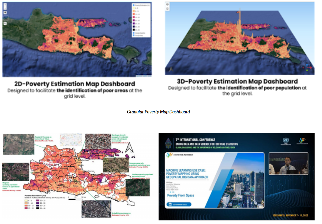
Identification of area with poverty distribution (left) and project presentation at the United Nations 7th International Conference on Big Data and Data Science for Official Statistics (right)
The mapping results are accessible to non-technical users on a 2D and 3D dashboard, enhancing its use in helping poverty-related decision-making. While the 3D dashboard focuses mainly on determining the poor population distribution, the 2D dashboard is intended to make it easier to identify specific impoverished locations. To learn more about these awards go here.

Be the first to comment