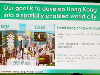
The future is fewer maps
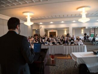
At the first Longitude meetup in the U.K., organized by Ben Flanagan, Kenneth Field, and Chris Wesson, Ed Parsons presented his perspective on one of the directions to expect from geospatial in the future. It […]
GeoIgnite sponsors make new partnership Mapbox and Spatial Networks are joining forces to help customers leverage geospatial technology. By integrating Spatial Networks’ Fulcrum application and Mapbox Atlas, the companies can now offer an end-to-end mapping […]
The last month has been a lot of fun and a lot of work. Now that we are just weeks away from our first national conference and everything is coming together. First, the support from […]
Integrated geospatial and BIM is increasingly being recognized as essential for full lifecycle construction and for enabling urban digital twins. At this year’s Geo Business in London the importance of integrating these technologies was asserted […]
PCI Geomatics is pleased to announce that we are hosting a free user group meeting on June 17th, 2019, from 1pm-5pm in Ottawa. We will be showing our latest technology, many of our staff will […]
A very interesting recent academic study from the University of Birmingham investigates the effectiveness of the British PAS128 standard for underground utilities. Four different utility survey specialist firms were invited to locate (without potholing) underground […]
Every year there are 400,000 incidents of damage to underground utilities during excavation in the U.S. This is a world wide problem but some jurisdictions have found ways to reduce the number of underground utility […]
Mayor Jim Watson to open GeoIgnite 2019 GeoIgnite is excited to announce that Mayor Jim Watson will be introducing the plenary day of GeoIgnite 2019! As the new national conference is taking place in Canada’s […]