Technology
The Innovation of Geocoding
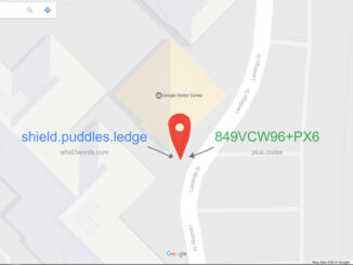
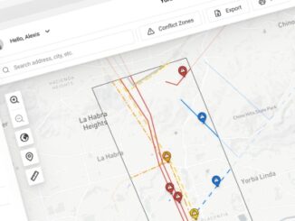
According to Esri, a geocode transforms a description of a location to a real location on the Earth. The description can be an address, coordinates, or a name of a place. It is an essential […]
According to Esri, a geocode transforms a description of a location to a real location on the Earth. The description can be an address, coordinates, or a name of a place. It is an essential […]
Drone technology uses thermal imaging to identify feral pests on farmland Two airplane pilots and one aircraft engineer are using drone technology to identify the presence of any pests on farmland in the Australian state […]

The recently held Annual and Executive Board Meetings came out with announcements on new Members, the incoming Executive Board, and newly elected Office Bearers and Committee Chairs Amersfoort, The Netherlands, May 27, 2021 – The […]
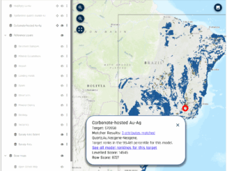
Since the days of the first Gold Rush, when a prospector would head off into the bush with a shovel, a gold pan, and a compass, maps have played an essential role in mineral exploration. […]
How would like to support, or even participate in what could become the most ambitious 3D surveying and mapping project ever? It could be the opportunity of a lifetime. A unique, global initiative is leveraging […]

Guest post by Wade Anderson, Vice President, SMB, IQGeo 5G is predicted to have the same economic impact on the US as commercializing the internet did 25 years ago. The technology is the motor of […]
With all the buzz about investing in, expanding, and modernizing infrastructure, one key aspect seems to be almost universally overlooked: the unknowns about what lies beneath the ground. This is especially true for underground assets. […]
An unequal post-pandemic recovery: mapping the aftermath Mapping the COVID-19 pandemic’s secondary health impacts is co-led by SFU geography professors Valorie Crooks and Nadine Schuurman outlining how the COVID-19 pandemic’s long-term impacts will affect communities across […]