Between the Poles – The Geoff Zeiss Archives
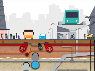
UK’s Geospatial Commission estimates ROI of £30 benefit for every £1 invested in National Underground Asset Register
It is estimated that accidental underground utility strikes cost the UK economy £2.4 billion every year. A top priority of the the Geospatial Commission, an agency of the UK government tasked with extracting more value […]