Feb 8th UBC Master of Geomatics for Environmental Management Career Networking
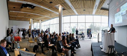
The University of British Columbia’s Master of Geomatics for Environmental Management (MGEM) Program is hosting their 2nd annual Geomatics Career Networking Event on Friday February 8 from 1-3:30 pm. The MGEM is a 9 month course-based Masters program which provides the blend of quantitative geospatial skills and landscape ecology needed to tackle a wide range of pressing environmental management challenges. Graduates have gone on to apply their skills across many sectors, including government, NGOs, private, commercial, consulting, and academia.
The 2nd annual Geomatics Career Networking Event is an opportunity for organizations which use geomatics to meet soon-to-be Masters-level (or higher) graduates from across UBC. Last year 11 organizations from across BC’s lower mainland attended, each providing a brief overview – including how they use geomatics – and current or upcoming volunteering, internship or employment opportunities. Following overviews, there was plenty of time to interact with 50+ soon-to-be graduates from Masters-level (or higher) programs from across UBC.
If your organization has current or upcoming employment, internship or volunteering opportunities, and you would like to attend this year’s Geomatics Career Networking Event, please contact tracy.wong@ubc.ca. Confirmation must be received by January 31, 2019.
If you are a graduate student whose work involves geomatics and you would like to attend please also contact tracy.wong@ubc.ca. Confirmation must also be received by January 31, 2019.


