Observing the Peace-Athabasca Delta and Wetland Climate Stress from Space
In the far northern reaches of Canada’s Saskatchewan Province, the Athabasca River and Peace River flow into the Peace-Athabasca Delta, the largest boreal delta in the world and home to a variety of diverse habitats in shallow lakes, mudflats, marshes, and grasslands. This complex biome supports more than 200 species of birds, some of them at risk, and thousands of buffalo.
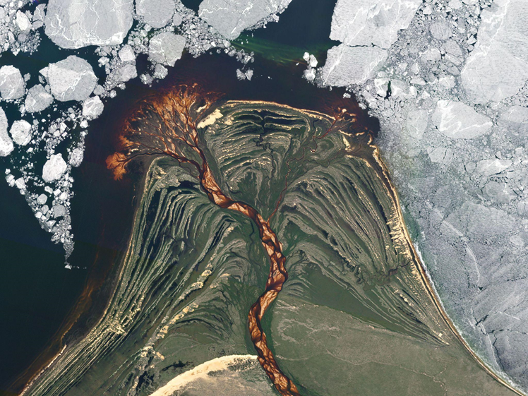
The Peace-Athabasca Delta is in a relatively remote area of Wood Buffalo National Park, but is still vulnerable to industrial activity and climate change impacts, putting one of the largest inland freshwater deltas, and an indigenous homeland, in decline. Similar to many other important coastal and inland ecosystems, the Peace-Athabasca Delta is growing increasingly “at-risk” due to invasive species, illegal land use, industrial pollution, and a variety of other climate stressors. The lower Athabasca River that feeds into the delta runs through oil sands and past tailings ponds that can leak waste into the downstream environment, polluting the broader system. In 2019, the Government of Canada and its partners developed an action plan to protect the “Outstanding Universal Value of Wood Buffalo National Park” and the wildlife that relies on that ecosystem. However, broader and more frequent monitoring may be needed to accurately report on policy measures and see change.
Both government oversight bodies and mining companies are taking a closer look at properly managing tailings from mining operations and building the appropriate infrastructure and emergency response procedures to prevent pollution from spilling into key habitats like the Peace-Athabasca Delta. High-frequency monitoring of these areas for reporting and inspecting is becoming increasingly important to meet policy goals and protect local communities.
Satellite imagery is proving to be a key tool to oversee these operations in more remote areas spanning large quantities of land. Near-daily satellite data, coupled with 50 cm resolution on-demand imagery, offers a consistent and reliable view of these remote areas for continuous monitoring and change detection. Archive imagery from a near-daily dataset offers a historical record of environmental conditions over time across different seasons in order to monitor disaster mitigation efforts.
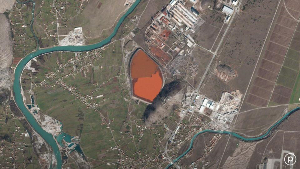
Tailings can be wet or dry in nature. A key concern in the wetter seasons is monitoring water levels and ensuring wet tailings are not leaking into the surrounding environment. High-frequency satellite imagery helps measure water levels to catch early signs of leaks. In wetter seasons, tailings management facilities are expected to have more water. Using daily or weekly satellite imagery, operators can check in on their facilities from anywhere in the world to observe any sudden drops in water levels that may indicate a leak.
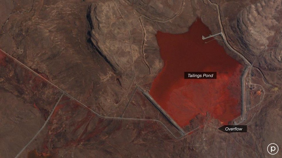
Similar stressors and high-risk operations threaten similar ecosystems all around the world. Near-daily satellite imagery is proving to be a safety net and important tool for helping to preserve natural resources and protect local communities from climate risks and manmade disasters. Increasingly, water resource and land management teams are leveraging satellite data as a complementary tool to make more data driven decisions and successfully track conservation programs.
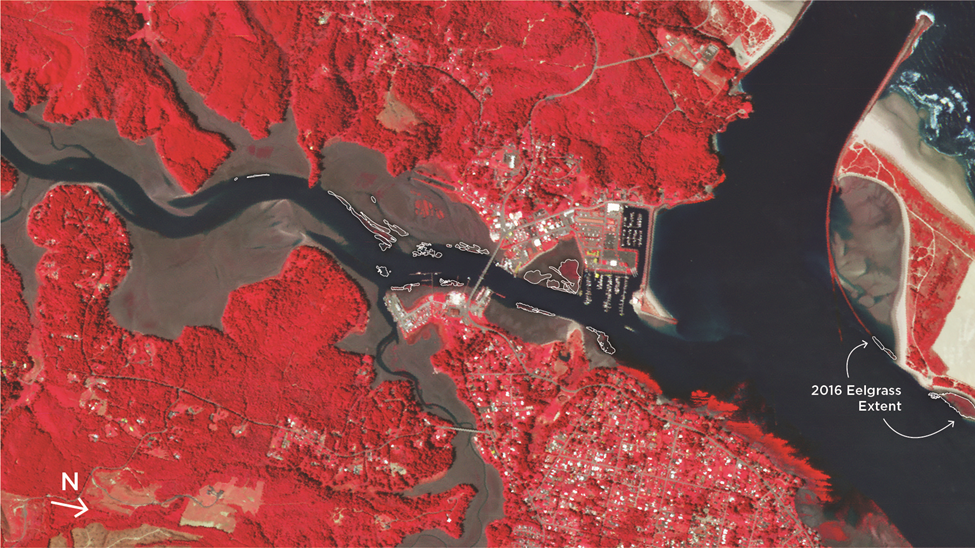
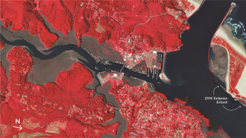
As another example, satellite imagery can serve as a simpler way to monitor vegetation in aquatic habitats that support fish, mollusks, and crustaceans species. Overlaid in the image above of Oregon’s South Slough Reserve is the distribution of eelgrass in the reserve that enables tracking of eelgrass habitats that support coastal fishing communities. Kelp and eelgrass beds provide one of the most productive marine ecosystems and are key to supporting Oregon’s fisheries and habitat. Their decline along the Oregon coastline over the last several years has been difficult to quantify mainly due to cost-prohibited aerial surveys. High-frequency satellite imagery helps water resource management teams make data-driven decisions to successfully drive and track conservation efforts that support local communities and keystone species.


