International Geospatial Briefing September 19, 2022
- Underwater Robots Allow for Glacial Seafloor Mapping
- Earth Observation Technology Helping to Mitigate Agricultural Crisis
- FARO Acquires Mobile Mapping Company GeoSLAM
- New Portal from US Administration Identifies Community Climate Hazards
- Learning From and Predicting Natural Disasters with Geospatial
Underwater Robots Allow for Glacial Seafloor Mapping
The Thwaites glacier in Antarctica is known as the world’s widest glacier and has the potential to one day raise sea level by up to 10 feet. Understanding this glacier and its melting is, resultingly, of high importance. A joint team of researchers from Sweden, the U.K. and the U.S. released a new study that incorporates seafloor mapping that the team hopes will help paint a historical picture of the glaciers’ retreat. They hope to make predictions about its future behaviour by analyzing its past. To learn more about this important mapping of the Thwaites Glacier, check out the full story here.

A 3D-rendered view of the multibeam bathymetry (seafloor shape) colored by depth, collected by Ranacross, shows a seabed ridge just in front of the Thwaites Ice Shelf. Alastair Graham, University of South Florida.
Earth Observation Helping to Mitigate Agricultural Crisis
In a world where we are seeing higher food costs and more scarcity, we can look to geospatial technology to offer helpful solutions. From the Ukraine-Russia war to droughts, and increasing fuel costs, food scarcity and shortages seem to be forever looming on the horizon. But we are seeing the applications of Earth Observation technology in agriculture at a critical time. From crop monitoring and yield prediction to drone-led farming and management, we are seeing the implementation of these geospatial technologies provide real solutions in an industry seeking to maximize outputs and efficiency in a critical time. To learn more about how geospatial is encouraging the next agricultural revolution, check out this detailed article from Geospatial World.
FARO Acquires Mobile Mapping Company GeoSLAM
UK-based mobile mapping company GeoSLAM has been acquired by FARO adding to their broad array of data-capture technologies. “Joining with FARO represents the next step in the growth of GeoSLAM and the establishment of mobile mapping as a driver for growth in the way businesses map and understand their spaces,” added Andy Parr, GeoSLAM CEO. To learn more about this acquisition, click here.
New Portal from US Administration Identifies Community Climate Hazards
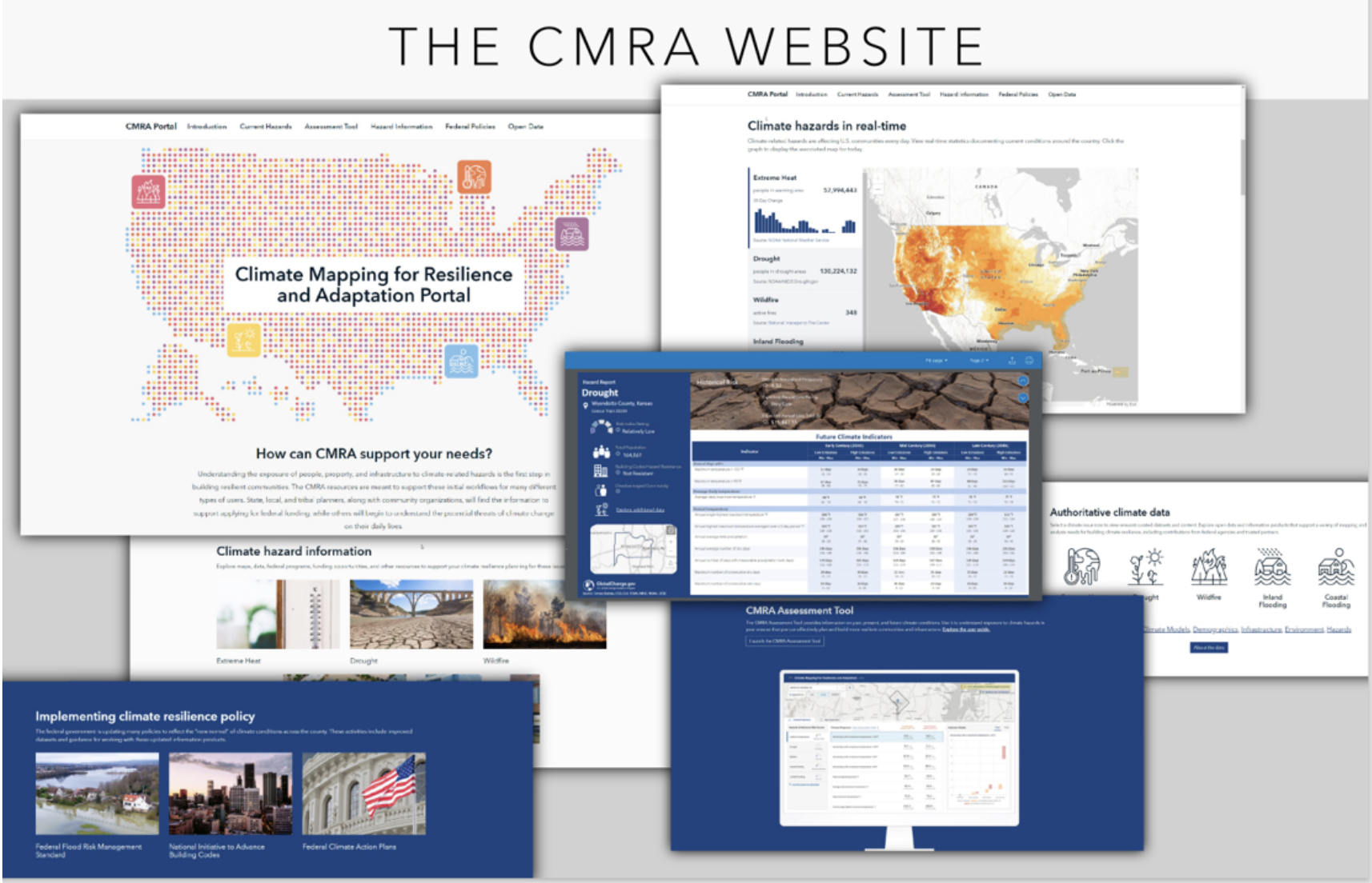
In a partnership with NOAA and the Department of the Interior, the Biden Administration recently unveiled a website aimed at helping communities understand the hazards they face from climate change. Looking at both short and long-term hazards, the Climate Mapping for Resilience and Adaptation portal (CMRA) is an important tool for those communities at greatest risk from climate-related hazards. Integrating layers that range from decision-relevant climate data to non-climate-related data such as building codes, the Portal provides some incredible tools to allow communities to assess their risk based on past events and future predictions. To learn more about this incredible tool, click here.

This screenshot shows components of the Climate Mapping for Resilience and Adaptation website at resilience.climate.gov. The site was developed by a collaborative interagency group and Esri, a private partner, to provide comprehensive information on climate hazards and support community climate resilience. (ESRI)
Learning From and Predicting Natural Disasters with Geospatial
In a story very closely related to the new CMRA tool put out by the Biden administration, we look at all the ways geospatial technology is allowing us to improve resilience in the face of natural disasters. By using available technology to track, analyze, and record major natural events, we can improve our chances of avoiding catastrophic results in future scenarios. While the ability to quantify and extract important data from these events is critical to developing a scientific understanding, the abilities provided by geospatial reach far beyond the realm of logistics and disaster response. For example, by overlaying remote sensing and GIS data, users can quickly assess critically damaged regions in the aftermath of disasters, ensuring help finds those most in need first. To learn about other ways geospatial technology is helping in the face of natural disasters, check out the full story here.


