The Enduring Legacy of Carleton’s Geomatics and Cartography Research Centre
Like everywhere else, there has been a major transition from paper to digital. This transition has been a driver for the research and development activities at the Geomatics and Cartography Research Centre (GCRC) at Carleton University, in Ottawa, Ontario.
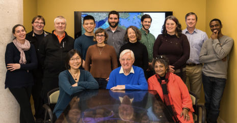
Members of the GCRC serve on a number of national and international committees and advisory boards. The Centre includes faculty members from a several disciplines, managerial and technical staff with different skills and expertise, postdoctoral fellows, multidisciplinary PhD and MA students, and some of the world’s leading individuals in geomatics and cartography.
History
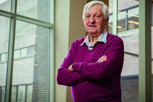
The GCRC was established in 2002 by one of the world’s top cartographers, Dr. Fraser Taylor. He is a Distinguished Research Professor of International Affairs and Geography and Environmental Studies. Taylor is also the Director of the GCRC, as well as a Fellow of the Royal Society of Canada. In 2021, Dr. Taylor was appointed to the order of Canada.
In 1997, Taylor’s concept of Cybercartography was introduced to describe, predict and inform the transition to digital cartography. It became, and still is, an intensely important and highly-researched topic at the centre.

Fraser Taylor
The early 2000s saw the creation of a strong foundation for cybercartography at the Centre. Several national sources provided research funding leading to the 2002 creation of the GCRC. Funding from the Initiative on the New Economy (INE) program, grants from the Canadian Foundation for Initiative (CFI) and from the Ontario Research Fund (ORF) helped establish the Human Computer Interaction Building at Carleton. It holds the laboratory that GCRC uses to develop Nunaliit (it means “community” in Inuktituut), an open source software technological platform. Nunaliit is used with project parteners to create cybercartographic atlases. The development of Nunaliit has been led by Amos Hayes, the Centre’s Technical Lead.
The research and related tools provided a multi-sensory, multimedia, interactive mapping format going back to 2003, well before current platform. There was an integration of cultural, historical, linguistic, economic, social data and cartographic information with the use of location as the organizing principle.
What is the GCRC working on now?
Current Projects
The GCRC is involved in many projects ranging from enhancing spatial dSouth Aricaata interoperability, to mapping languages, to working with Indigenous communities to help share their knowledge in ethical and culturally appropriate ways. Over the past decade GCRC has done training on the Nunaliit Platform in Denmark, Mexico, and Brazil, in partnership with Indigenous and local communities, researchers, and environmental groups. The GCRC has agreements with national and international organizations, Natural Resources Canada, and Indigenous communities in Canada, and has had productive partnerships with those communities for over 20 years. The GCRC has been working alongside Indigenous communities and organizations to develop a new domain of cartography.
“We are drawing on the visual, the semiotical presentations, and graphic images, together with mapping teams to deepen the understanding of locational impact,” says Romola Thumbadoo, PhD Geography, SSHRC Postdoctoral Research Fellow, and Executive Assistant to The Director, Dr. Taylor.
 A few of the ongoing projects at the centre include the mapping of Indigenous residential schools and lands, as well as children’s mapping work in South Africa and Brazil. Dr. Taylor has been part of Indigenous mapping initiatives for over 30 years and Romola Thumbadoo has been working with child and youth care workers in South Africa and Brazil on the ever evolving project of cybercartography and photo atlasing.
As an example, in June, 2020, the Residential Schools Land Memory Atlas (RSLMA) was released. The RSLMA identifies residential schools all over the country, sharing knowledge and information of the schools and their sites, as well as survivor perspectives. It hold images and maps with archival and experience-based knowledge, incorporated with digital archival and related research. This type of research is ongoing and Dr. Taylor remains involved.
Dr. Taylor said, “It’s not so much the technology, as how the technology is used and the stories that the people tell with that technology. So the stories and the applications are much more important than the development of the technology itself.”
“The work with child and youth care workers in South Africa uses cartography as an analytical and policy tool in entirely new ways,” says Dr. Taylor.
Thumbadoo says this initiative is creating a conscious, graphic way of mapping one’s own story.
They are combining the geo-sciences and social sciences. Children are encouraged to draw how they view their environment and how they would like to see it evolve. The information reveals elements like homes, schools, clinics, as well as environmental issues, power shortages, and safe and unsafe) zones. The art and drawing leads to the extraction of issues.
“We are engaged in a new innovation in children’s mapping, initiated by the Children’s Mapping Competition of International Cartographic Association in 1993,” Thumbadoo says. “It’s taking on new levels of development with collaboration with marketable new partners.
The Photo atlasing project has been going on over the past year, with collaboration with a German professor. It includes the graphic new form of atlasing, being locational. It includes photos and images that contribute to semiotic importance Analysis comes from the textural, graphics, image and the influence of the elements.
Prof. Peter Pulsifer joined the GCRC in 2019 as Associate Director (although he completed his PhD in 2008 under Taylor’s supervision). Pulsifer is combining his research in data management, spatial data interoperability (the easy sharing of data across technical and knowledge systems), and visualization to serve the needs of a wide variety of applications and end users. This includes acting as the technical lead of the Canadian Consortium for Arctic Data Interoperability, and working the Black Entrepreneurship Knowledge Hub to create a map of the Black entrepreneurial ecosystem in Canada. Most recently the GCRC is working with GoGeomatics and other partners under the Geoff Zeiss Urban Infrastructure Mapping Fund to make these critical data more interoperable and accessible to those who need them.
With all the ongoing projects, those at the GCRC know there is still much work to be done.
Dr. Taylor says, “The talented team at GCRC continues to grow and adds innovative new theory and practice in an expanding number of application areas. Our longstanding partnerships with the peoples of Canada’s North is of special value.”
“What we are doing now is drawing science into the voice of people and the social issues that are out there,” says Thumbadoo. “ We are hoping to see the influence of the geomatics and cartographic research centre. With the move to the cybercartography, it became a creation of digital story telling atlases, and moved away from older styles of cartography that focused strictly on the map.
Websites:


