International Geospatial Digest May 8th, 2023
- US neighborhoods with more people of color suffer worse air pollution
- European Space and Telecoms Players Sign Partnership Agreement
- Climate change: Satellite maps warming impact on global glaciers
- The Growing Importance of Location Intelligence
- UK to pilot use of innovative EO technology for public services
- Maxar eyes summer launch of WorldView Legion imaging satellites
- Navigating by touch with 3D maps
US neighborhoods with more people of color suffer worse air pollution
The article focuses on the census data relationship between air pollution and communities of low-income people of color. With models created by teams of researchers from several university institutions across the US, the data points towards a result that “shows the more people of color who live in a neighborhood, the higher the fine particulate air pollution levels are likely to be”. This poor air quality over time affects many people and causes respiratory distress and disorders.
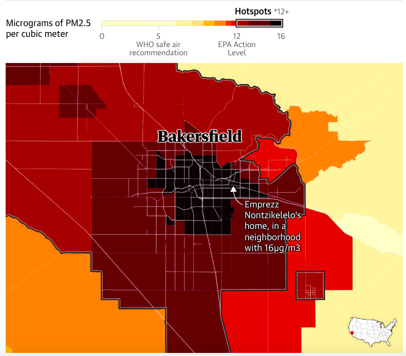
Guardian graphic. Sources: Center for Air, Climate and Energy Solutions and US Census Bureau. Note: Data is the average from 2011-15. *In California, the state with the nation’s worst air pollution, the hotspot range starts at 12µg/m3.
Despite the initiation of Clean Air Act over the past five decades, there is still a wide gap of air quality in these communities. This article best demonstrates this through its intractable map included with the article. Some of the key hotspots for some of the worst air pollution is located in Bakersfield, CA, Los Angeles, CA, and Chicago IL. The article goes into detail over how it was able to fill in the gaps of spatial data down to the neighbourhood block level. By using the combination of satellite, land use and other data, predictive models helped fill in those gaps for such a large scale project. Read more here and see the intractable map here.
European Space and Telecoms Players Sign Partnership Agreement
The European Commission has put out a call to their space and telecommunications players for a partnership for the future IRIS² (Infrastructure for Resilience, Interconnectivity and Security by Satellite). The joint association between European governments and Airbus Defence and Space, Eutelsat, Hispasat, SES and Thales Alenia Space, “aims to bring a new secure and resilient connectivity infrastructure to European governments, businesses and citizens”.

IRIS² (Infrastructure for Resilience, Interconnectivity and Security by Satellite)
This joint partnership will ideally bring about more grass routes and smaller companies to collaborate to improve on secure satellite communications solutions. The article continues on how the this benefits stakeholders and consumers here.
Climate change: Satellite maps warming impact on global glaciers
As climate transitions continue, more data is being collected on the effects this has on the world’s glaciers. With the help of Europe’s Cryosat spacecraft, approximately 200,000 glaciers were tracked over ten years. The results show a significant global loss of 2,720bn tonnes over this time period.
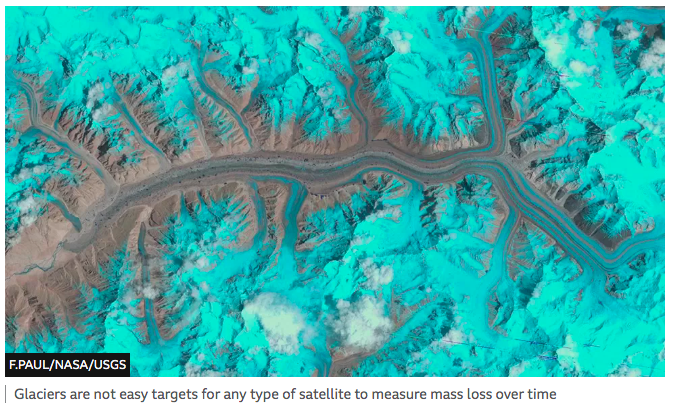
The importance of glaciers on a global scale are responsible for both fresh drinking water and albedo influence, which is a direct feedback loop to climate transitions. Advances in data processing has made capture far more accurate and efficient in previous years, giving far more accurate data to work off of. The article continues with the cause and effect of these transitioning temperatures, which can be read here.
The Growing Importance of Location Intelligence
Location intelligence involves the use of layering multiple geospatial data sets over each other to solve specific problems. By combining multiple data sets in a specific frame, the applications can give industry specific solutions from multiple sources. This data combination can provide service specific solutions spanning over multiple aspects of society such as “culture, lifestyle, labor, healthcare, cost of living, crime, economic climate, and education”.
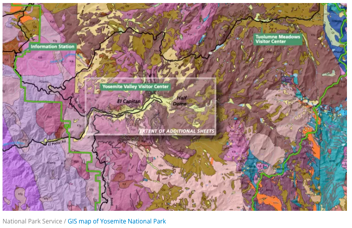
This short article ties into a full story by ESRI about “important issues such as infrastructure modernization, sustainability, climate change, environmental management, and social equity”. Read the article here and ESRI’s full story here.
UK to pilot use of innovative EO technology for public services
UK organisations in the public sector have been granted Earth Observation resources to help pilot test public service innovations by utilising Earth Observation derived data. The Geospatial Commission, part of the Department for Science, Innovation and Technology (DSIT), has granted public access to these resources in hopes that this open source data distribution will encourage competition and bring about new innovations to help boost innovative applications of geospatial data in the public sector.
The growing satellite market is generating a number of new sources of Earth Observation derived data that could help transform analysis in key policy areas, including land use, environmental monitoring and emergency response
The pilot project is available for twelve months for eligible UK participants. Furher background on the project can be read here.
Maxar eyes summer launch of WorldView Legion imaging satellites
Maxar Technologies is preparing to finally launch its six WorldView Legions after years long schedule delays. Supply chain delays were part of the reason for the delays, and is a fair observation since this issue has been affecting all aspects of the modern world, with hardware supplier being no . Additionally, Maxar is preparing to be acquired by Advent International by April 19.
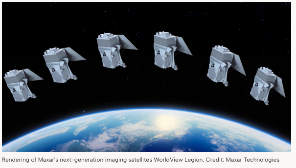
The plan is to also launch two additional WorldView Legion satellites. The push for space based data, both for military use and commercial, is steadily increasing which means higher demand for high accuracy and quality based data. You can read more on Maxar’s WorldView Legions and their official responses here.
Navigating by touch with 3D maps
New and interesting ways to represent Geography, GIS and cartography will shine a light on the artistic side of geospatial data. At the Geospatial World Forum, a showcase of how an interesting method to bridge the gap between mapping and the visually impaired.
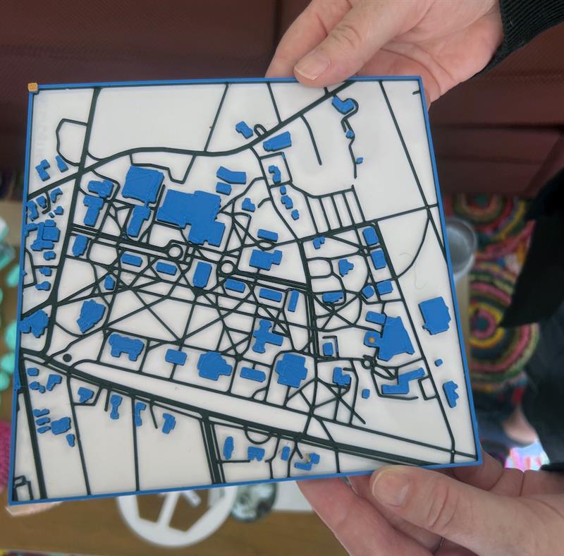
A “touchable” map of Bowdoin College campus, with raised buildings, walkways, and roads, and is an alternative to paper maps handed out to visitors.
The presentation showcased a pilot set of 3D printed maps which utilises “ridges, indentations, and braille to help orient [people] through touch”. These “Tactile Maps” have spread around the geospatial community and has the potential to be made as a deliverable tool to assist to whoever may benefit from it. More details and an interview video can be found in this article here.


