International Geospatial Digest July 31st, 2023
- Using Lidar sensors, Hesai and NavVis revolutionize reality capturing
- Climate Mapping Tool Promoted by NOAA for Better Resilience Planning
- Localized mapping improves navigation in Southeast Asia
- Google.org grants $5 million to monitor glacier thaw using AI
- Better geospatial data analysis could help fight rhinoceros poaching
- How will the role of the surveyor change in the future?
Using Lidar sensors, Hesai and NavVis revolutionize reality capturing
NavVis partnered with Hesai as the only source of Lidar sensors for its NavVis VLX 3 device, which is utilized for reality capture and fast scan-to-BIM operations. Hesai is a global pioneer in Lidar sensor technologies, whereas NavVis is known for providing detailed reality capture data for digital twin and industrial applications. The VLX 3 will use Hesai’s powerful XT32M2X Lidar sensor, which has a 120m range and precision with 32 laser channels. This collaboration represents a big step forward in reality capture, allowing experts to scan and analyze complex surroundings with unprecedented accuracy and efficiency. Read more in detail here.
Climate Mapping Tool Promoted by NOAA for Better Resilience Planning

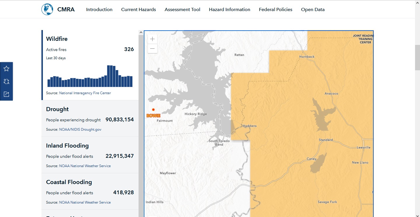
According to data from the agency’s Climate Mapping for Resilience and Adaptation webpage, 90 million Americans are now experiencing drought. Source: ENR Engineering News-Record
The National Oceanic and Atmospheric Administration (NOAA) created the Climate Mapping for Resilience and Adaptation (CMRA) site to assist building owners and decision-makers in making informed decisions regarding climate-related building and infrastructure projects. CMRA connects hundreds of Esri base maps to federal government data on climate risks in the United States, such as heat hazards, sea-level rise forecasts, and community evaluations. The 2021 Infrastructure Investment and Jobs Act financed the site, which provides frequently updated climatic data with an emphasis on decision assistance for building projects, insurance, and reinsurance businesses. NOAA urges the federal government as a whole to use CMRA for building decisions. Find out more here.
Localized Mapping Improves Navigation in Southeast Asia

Southeast Asia region, Source: Geospatial World
Grab, a famous Southeast Asian technology business, has created an in-house mapping system called GrabMaps to address the region’s navigation issues. They were hampered by a dearth of adequate map vendors and generic data that did not account for local variations. Grab addressed this by creating localized mapping data by recognizing shortcuts, vernacular place names, and critical sites such as prayer rooms. They also used machine learning to increase mapping data accuracy by receiving real-time input from drivers and detecting possible obstacles. The system provides customized routing and point-of-interest identification, optimizing navigation for certain vehicle types and user preferences, and so benefits both drivers and users. Collect details here.
Google.org grants $5M to Monitor Glacier Thaw using AI

Chandi Witharana, a UConn researcher, is employing remote sensing as a “virtual passport” to monitor enormous swaths of land in distant regions such as the Arctic tundra. Source: Miragenews
Google.org has given Woodwell Climate Research Centre $5 million to create an open-access platform that will use AI and satellite data to study Arctic permafrost thaw in near real-time. Chandi Witharana of UConn is a member of the research team. The platform, which is an extension of the Permafrost Discovery Gateway, will leverage artificial intelligence to accelerate data processing, allowing for the fast detection of patterns and trends in permafrost thaw datasets. Climate mitigation and adaptation efforts will benefit from this. The project will provide pan-Arctic scale geospatial maps of permafrost landforms, thaw disturbances, and human-made infrastructure. The system will enable real-time monitoring of infrastructure hazards as well as forecasting future danger. Read more here.
Better geospatial data analysis could help fight rhinoceros poaching

Park guards removed this rhinoceros horn to reduce the possibility of poaching in 2020. The animal’s horn is gradually regrowing. Source: phys.org
Poaching endangers the environment, and technology such as drones can assist in stopping it. However, making efficient use of the massive volumes of geographical data created by these technologies remains a difficulty. A review conducted by Penn State scientists emphasizes the need for improved synthesis of data from multiple sensors as well as human-generated data such as ranger observations. Standardizing methods and visualizing synthesized data might assist practitioners in identifying patterns and movements across protected area boundaries, which could aid in poaching mitigation. Improved data analysis might also help with other crimes. The study emphasizes the significance of comprehending data at a fundamental level to successfully address complicated environmental concerns. Read more about this here.
How will the role of the surveyor change in the future?
The role of the geospatial profession in land demarcation and infrastructure development remains critical, although it is changing owing to technological advances. Surveyors are increasingly digitizing complicated data using modern geospatial instruments like mobile Lidar and aerial photogrammetry, which improves efficiency and data quality. Surveyors can automatically extract comprehensive information from databases as AI and machine learning become more widely used, simplifying procedures. geographic data managers will be replaced by geographic information managers in the future, ensuring accountability and real-time project modeling. AI will be crucial in changing physical-to-digital processes, allowing for quicker decision-making and improving the building continuum. Find out more here.


