Exploring Geospatial AI: Icebergs and Advanced Weather Forecasting
AI is everywhere. ChatGPT made headlines with its initial release in November 2022, and just over a year later here we are, with interest in AI growing exponentially. Some other popular AI iterations we have seen include Google Bard, GitHub Copilot, Microsoft’s Power Apps, Vertex AI, Jasper, and Salesforce Service Cloud; the list is endless. With all the hype, it’s not undeserved, there have been some incredible breakthroughs.
AI helped a woman regain her voice after 18 years, detected a supernova without human intervention, and knocked out a Street Fighter champion (the video game, otherwise we’d maybe be a little more worried). Of course, the content creation has been wild, from songs sung by long-dead artists and images of otherworldly dimensions to writing fan fiction and more, there have been some tremendous highs in AI development.
There have also been some tremendous lows. Phishing scam emails created by AI, ethically questionable deep fakes, inaccurate content and more; we are certainly walking a fine line with the power of all these AI applications.
However, from a geospatial perspective, there have been incredible applications of geospatial technology colliding with AI and making some truly impressive strides. These are life-changing-saving-altering applications, and we are excited to share some of our favourites with you. To cover many of the incredible developments in Geospatial AI, this is the first article in a series of many. These are some that have impressed right out of the gate and will have long-lasting impacts on the world and the geospatial community for years to come.
Icebergs
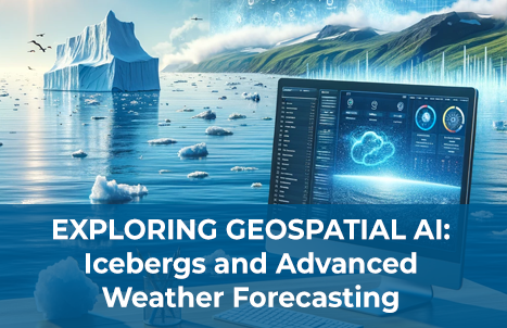
In a world of warming oceans and rapidly changing environmental conditions, it is important to understand icebergs and the impacts they are having on their surroundings. Icebergs affect many aspects of ocean life, from physics, chemistry, and biology to the more human-focused domain of maritime operations. As researcher Anne Braakmann-Folgmann states, “[This is why] it is crucial to locate icebergs and monitor their extent, to quantify how much meltwater [icebergs] release into the ocean.” And while this may seem straightforward in practice, it is easier said than done. Identifying icebergs in satellite images as separate from other objects such as sea ice and clouds, can prove quite difficult, as they all appear white. Even in radar images such as those from Sentinel-1, icebergs return as a bright object against a darker backdrop, but so does sea ice, and windy ocean conditions can often complicate the picture.

That is why researchers at the University of Leeds turned to AI, in hopes that it could relieve some of the challenges faced in identifying icebergs. Basing their system on the renowned U-net design, the neural network has shown great promise in the development stages. Training data was compiled of somewhere between 15 and 46 images for each of the seven icebergs, collected over various seasons from 2014-2020. The “seven icebergs, ranging in size from 54 sq km to 1052 sq km, roughly equivalent to the areas of the city of Bern in Switzerland and Hong Kong” have been identified with an accuracy of 99% and in a fraction of a second (0.01 to be precise).
It is all very impressive and frees up time for the team to work on more human-centric tasks, showing the incredible power that Geospatial AI has over changing the way we work, allowing the machines to handle what would otherwise be “manual and labour-intensive [tasks], locating and reporting iceberg [extents].” We look forward to future developments in what is already an exciting demonstration of the powers of AI.
Weather
We have all heard the age-old trope that says “I wish I could have the weatherman’s job, they never have to be right and yet they get to keep their job.” Weather systems are incredibly complex, which is why we often see changing forecasts, especially as we go further into the future. We all depend on an understanding of the weather to help plan everything from our daily lives and activities such as a hike on an upcoming sunny Saturday, to much more important decisions. Most of these forecasts come from what has been the standard in weather predictions, Numerical Weather Predictions (NWP), where precise physics equations are fed into supercomputers that run models and help meteorologists make their forecasts.
However, the team at Google’s DeepMind has recently unveiled a new AI model, GraphCast, that is proving to be more accurate for medium-term predictions than many of the gold-standard weather simulation systems. It offers faster and more efficient calculations of upcoming weather for localities with what the team calls “unprecedented accuracy.” Using Graph Neural Networks, which are specifically useful for spatially structured data, the system only needs 2 inputs of data to run: the current weather at a location and the weather from six hours before. GraphCast incorporates the data and can then step out weather predictions in six-hour increments to 10 days in the future.

Understanding the coming weather in such improved ways is critical for all sorts of event planning. However, GraphCast proved more useful in identifying extreme weather events on the horizon as well, without being trained to look for them. In the event of cyclones (hurricanes) and high precipitation events such as atmospheric rivers, GraphCast identifies these upcoming dangers earlier than traditional methods such as the High Resolution Forecast (HRES) from the European Centre for Medium-Range Weather Forecasts (ECMWF). The team even found that when a cyclone tracker was applied to the GraphCast model, it predicted the future movements of the storms with greater accuracy than the HRES model.

This sort of advanced warning for extreme weather events is critical when it comes to planning response and evacuation efforts. The GraphCast model provides insight on how these weather systems will evolve, such as refined flood predictions in atmospheric river events, and can provide critical knowledge to emergency response officials. Temperature predictions as a part of GraphCast can also enable officials to anticipate and plan for extreme heat events and the dangers they pose to vulnerable populations. The team hopes that these incredible leaps forward, thanks to geospatial AI, in weather prediction and forecasting will not only enhance our understanding of the weather but ultimately save lives through the increased response time their early prediction of extreme events enable for emergency response officials.
Further Reading
[1] https://www.techtimes.com/articles/300093/20231227/craziest-ai-breakthroughs-2023.htm
[2] https://tech.co/news/a-year-ai
[3] https://trends.google.com/trends/explore?date=today%205-y&q=ChatGPT&hl=en
[4] https://www.esa.int/Applications/Observing_the_Earth/Copernicus/Sentinel-1/AI_maps_icebergs_10_000_times_faster_than_humans
[5] https://deepmind.google/discover/blog/graphcast-ai-model-for-faster-and-more-accurate-global-weather-forecasting/?utm_source=twitter&utm_medium=social&utm_content=DH
[6] https://storage.googleapis.com/deepmind-media/DeepMind.com/Blog/graphcast-ai-model-for-faster-and-more-accurate-global-weather-forecasting/Learning_skillful_medium-range_global_weather_forecasting.pdf


