Canadian Geospatial Digest for July 29th, 2024
- Map of Destruction in Jasper
- Digital map making Toronto art more accessible
- Map shows hot spots for thefts in Ottawa
- Scientists creating first detailed maps of Metro Vancouver’s earthquake hazards
- Mapping the Trans Canada Trail
- Team Canada Athletes Map
Jasper Wildfire: Over a Third of Town’s Structures Destroyed
See the map here
Advocates hope digital map makes Toronto art more accessible
Advocates are working on a new mapping project called Artmap that will help provide information on the accessibility of different art installations for those with disabilities. AccessArt is currently three years into the project, ranking the accessibility of public art installations for every city in the country. They looked at many accessibility factors, such as visibility, height, texture, and whether the installation was easy to navigate around. Art’s accessibility is often overlooked by those who create it. This project aims to raise awareness so that more people can access and appreciate these art pieces.

The team at AccessArt reviewing an installation for accessibility. Source: AccessArt
The article can be viewed here
900 vehicles stolen in Ottawa so far in 2024: Here are the hot spots for thefts
Due to the ongoing issue of vehicle thefts in Ottawa, an interactive map can provide a better understanding of the location and volume of these thefts. The Ottawa Police Service’s crime map displays the location of more than 900 vehicle thefts that have occurred so far in 2024. These maps are valuable to the public because they can take precautions if they plan to park in a vehicle theft hotspot.
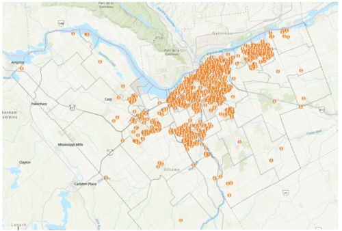
Ottawa Police Service’s crime map showing vehicle thefts in 2024. Source: CTV News
The article can be viewed here
How much will the ground shake? Scientists creating first detailed maps of Metro Vancouver’s earthquake hazards
A team at Western University, led by associate professor Sheri Molnar, is currently collecting data to create Canada’s first high-quality and comprehensive earthquake hazard map. Molnar says that previous earthquake maps only showed where the soil is likely to shake but not by how much. This new map will show how the ground will shake in each region and which regions are more susceptible to liquefaction and landslides. This new data will help with emergency preparedness, seismic risk, changes to building codes in specific regions and land use planning.
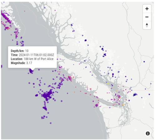
Map showing nearly 2,700 earthquake that have occurred in BC this year. Source: Natural Resources Canada
The article can be viewed here
Mapping the great outdoors
Lesley Johnson manages GIS mapping for the Trans Canada Trail and leads a team that advises on maintaining, improving, and creating new trails. Lesley talks about looking for ways to make the trail more enjoyable such as adding cultural information about the area or placing decision-makers showing which areas of the trail are more accessible for those with disabilities. Lesley says that she and her team use both local knowledge and open GIS data to ensure the accuracy of information for trail maintenance.

Lesley Johnson and her team at Trans Canada Trail. Source: Canada’s National Observer
The article can be viewed here
Team Canada Athletes Map
The 2024 Olympic Games in Paris are well underway, and if you are curious about which part of the country your favourite athletes are from, there’s an interactive map to help you out. This dashboard-style interactive map lets you filter by sport, gender, home province, hometown, age, previous Olympic experience, and Olympic medallists before Paris.
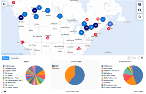
Team Canada Map. Source: Team Canada
The article can be viewed here


