
Canadian Geospatial Digest for September 9th, 2024
- McElhanney Wins 2023 Award of Excellence: A Big Win for Canada’s Geomatics Sector
- Mapping Montreal’s Bike Paths: GIS on Two Wheels!
- Toronto’s PATH Map Update: Good Intentions, But Needs Improvement
- Put Your Geospatial Skills on Display: Canada’s Best Maps and Posters Wanted!
- Is Canada’s Construction Industry Falling Behind? A National BIM Mandate Could Be the Key

Canada is Powering up for the National Geomatics Expo in Calgary October 28th-30th.

McElhanney Wins 2023 Award of Excellence: A Big Win for Canada’s Geomatics Sector
McElhanney winning the 2023 Canada Award of Excellence from BSI is great news for the Canadian geomatics community. We think it shows how a strong focus on quality, safety, and continual improvement can lead to great things. This award is an example of what’s possible when companies in our sector push the envelope on standards and best practices. It also shines a light on the importance of building robust systems to manage data, projects, and risks—helping us all raise the bar in our own work. Great job McElhanney.
Mapping Montreal’s Bike Paths: GIS on Two Wheels!
The City of Montreal is using GIS technology to map its entire bike path network, a project led by a city intern. This effort will provide updated geospatial data on bike path conditions and connectivity across the island. The mapping will aid urban planners, improve safety, and promote sustainable transportation by ensuring cyclists have the latest route information. It’s an exciting example of how GIS can be applied to enhance urban infrastructure.
Read more about the project here.
Q: Why did the intern bring a GPS to the bike path?
A: Because getting lost on the way to map the city’s bike lanes would be wheel-y embarrassing!
Toronto’s PATH Map Update: Good Intentions, But Needs Improvement
Toronto’s PATH network just got a new interactive map, but some users are finding it cumbersome and not entirely intuitive. While it’s a step up in helping residents and tourists navigate the vast underground network, critics argue that it still lacks real-time updates and better integration with street-level landmarks. For such a complex system, users might expect more precision and connectivity between above-ground and below-ground navigation. Though it’s a good start, there’s room for improvement in its user interface and functionality.
Currently PATH system’s letters each represent cardinal directions on a map, with P meaning south, A for west, T for north, and H for east. WTF?
You can read more here.
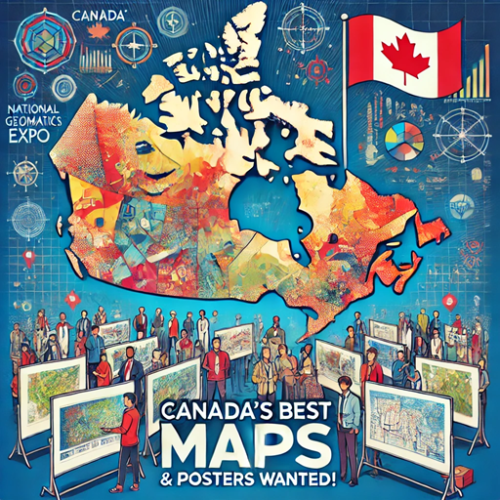
Put Your Geospatial Skills on Display: Canada’s Best Maps and Posters Wanted!
The Canada Maps & Posters Program is calling for top-tier geospatial work to be showcased at the 2024 National Geomatics Expo. This is an exciting opportunity for professionals and students alike to demonstrate their talents in cartography and geospatial analysis on a national stage. Whether you’re in academia or industry, this event is your chance to make a mark in Canada’s geomatics landscape. It is a free program. Just mail your maps and posters.
For more details, check out the full article here.
Is Canada’s Construction Industry Falling Behind? A National BIM Mandate Could Be the Key
Canada’s construction industry is lagging in digital transformation compared to global counterparts, and the question of whether a national BIM (Building Information Modeling) mandate is needed is gaining attention. This interview delves into how BIM can modernize the sector, improve efficiency, and potentially close the gap with leading countries. Is it time for Canada to enforce a national BIM standard to stay competitive?
Read more about the discussion here.