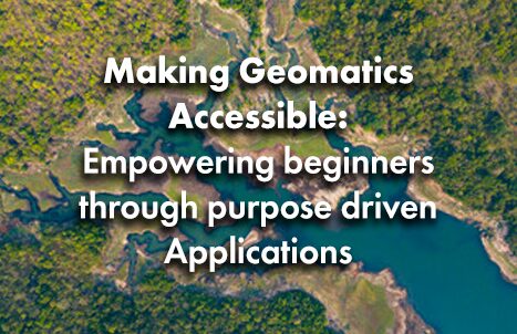

Making Geomatics Accessible: Empowering beginners through purpose driven Applications
My introduction to geomatics came through a required introductory GIS course during my undergrad. This course taught the basics of projections, ArcGIS, and the history of mapping and introduced me to our friends: points, lines and polygons. We learned about the power that cartographers hold over the public’s perception of the world around them through stories like the Vinland Map and Christopher Columbus, and completed introductory assignments that taught us
how to use certain features of ArcGIS Pro.
Interesting stuff, but it was not until I took more advanced courses and got involved in the GIS community at my university (thanks to my GIS-obsessed friends) that I was inspired by the powerful applications of GIS and remote sensing and decided to pursue a career in geomatics.
Many other students in the introductory GIS course took the information they learned and moved on from GIS without really looking back. Maybe if they gave GIS another chance like I did, they would have eventually been inspired to pursue a career in GIS or remote sensing. But first impressions matter, and the first impression we had just was not enough for some people.
The most successful introduction a person can have to any activity involves receiving information that they find both interesting and inspiring while allowing them to immediately find some kind of introductory success or encouragement. I believe that application-based and purpose-driven experiences are the key to being inspired by something and they should be emphasized when a subject or skill is introduced to a beginner. Let me show you what I mean through experiences I have had that have inspired me to pursue a career in geomatics:
Humanitarian Mapping as a GIS-Introduction for Beginners
During my undergrad, I participated in events hosted by the Open Mapping Group at McGill University. The most popular of these events was the Humanitarian Mapathon, where members would get together, eat pizza and use Humanitarian OpenStreetMaps (HOTOSM) to assist in projects relating to disaster relief. The goal was to use satellite imagery to update the map data of places that have recently experienced a disaster so that first responders could have more accurate maps when trying to save lives.
Whoever mapped the most features during the 2-3 hours we were mapping would receive a small prize and everyone would have a good time. Simple points, lines and polygons outlining roads, houses and buildings, but the importance of what we were doing was evident. Those new to GIS were able to learn and apply the basic skills while contributing to important humanitarian projects.
This gave them the skills they needed to pursue more advanced topics in GIS, but more importantly, it would sometimes inspire them to take classes in GIS or remote sensing when they otherwise would not have.

(Source: Humanitarian OpenStreetMaps Project #16207: DRC Congo River Floods Response)
Above is a visual from a high-priority HOTOSM mapping task for the flood-prone regions of the Democratic Republic of Congo. As few previous mapping efforts have been made for this region, this project will assist other humanitarian organizations with their response to the recent flooding in the region. In this image, we see a residential area has been delineated as well as a road and a nearby river. Knowing the number of houses and buildings near a flood-prone river
will allow first responders to devote an appropriate amount of resources to disaster relief.
Another Accessible Resource: NASA’s Applied Remote Sensing Training Program
Developing an interest and skill set in geomatics is not limited to those who are able to study it at a post-secondary level. There are several resources freely available for all remote sensing and GIS skill levels that allow for a purpose-driven application of the skills they learn.
One such resource I stumbled upon not too long ago was the NASA Applied Remote Sensing Training Program. This free online training course is hosted by current NASA employees and provides instructive lessons involving guided tutorials of different remote sensing software. The courses offered span a wide range of environmental topics including detecting large methane emissions and calculating blue carbon stocks in tropical ecosystems using satellites and remote sensing software such as Google Earth Engine.
Not only will beginners be able to learn and apply useful skills, but they can receive a certification from NASA upon completion of the course that can
help boost their career.

(Source: NASA ARSET – Methane Observations for Large Emission Event Detection and Monitoring)
This image is an excerpt from a presentation from the NASA ARSET course on detecting large methane emissions. This visual shows the distribution of a large methane emission in Kansas, USA from 2022 and 2023, measured by the NASA Earth Surface Mineral Dust Source Investigation sensor (EMIT). This example was used to discuss important sources for methane visualization and to show how analysts can use their data to mitigate environmental problems.
Concluding Thoughts
Resources like HOTOSM or the NASA ARSET program are important for beginners in GIS and remote sensing because they immediately outline global problems and demonstrate why and how geomatics is used to solve them while allowing the learner to practice their skills in a meaningful way. Not everybody will be able to enjoy GIS like you or I do, but showing the best of geomatics from the very first introduction ensures that everybody can at least make a fully
informed decision.
References:
Earth Observation for Sustainable Development (EO4SD), offered by the European Space Agency : https://eo4sd.esa.int/
Humanitarian OpenStreetMaps (https://www.hotosm.org/)
NASA Applied Remote Sensing Training Program (https://appliedsciences.nasa.gov/what-we-do/capacity-building/arset)
GISCorps Volunteering: https://www.giscorps.org/become-a-volunteer/
https://news.yale.edu/2021/09/01/analysis-unlocks-secret-vinland-map-its-fake