Robert Maher

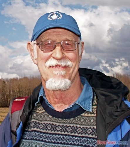
Bob Maher obtained his Ph.D in Geography from the University of Western Ontario. He subsequently went to teach at Memorial University of Newfoundland, Department of Geography – Quantitative Methods, Computer Mapping and Biogeography. In 1980, he joined the faculty at the Nova Scotia Land Survey Institute and was instrumental in its transformation into the College of Geographic Sciences (COGS). Between 1988 – 1999, he was a GIS consultant in Indonesia, and worked for ESRI in the United States, and across Canada with universities and government agencies. He returned to COGS in 2000 taking up the position of Senior Research Scientist in the Applied Geomatics Research Group (AGRG). He retired from AGRG in 2011.

Articles by Robert Maher

Putting Map Making Back Into the Hands of the Community

On April 7th, I attended the community mapping showcase at the NSCC Centre of Geographic Sciences (COGS). This project is…

A Shared Vision

Every year, a small team of Esri staff come to COGS to recruit new talent. As part of the interview…

Remembering Roger Tomlinson & Early History of GIS in Canada

It’s two years now since Roger Tomlinson passed away.  Roger’s and my career path have crossed several times over the…

The Real Thing: Robert Maher Examines the Book “The Real Thing” by Briony Penn

Over Christmas, I had the opportunity to go ‘off island’. One of the pleasures of visiting Victoria, British Columbia is…

Local Action & Geomatics: the Gowgaia Institute on Haida Gwaii

This blog is a sequel to last month’s discussion on ‘think global, act local‘. It looks at the the Gowgaia…

Dr Robert Maher on Geoliteracy: ‘Think global, act local’

This month (October) Digital Earth 2015 (DE2015) was held in Halifax. There were a number of keynote presentations, including those…

Beyond the Outer Shores

For over fifty years, the islands off the coast of British Columbia and Alaska have been called ‘the outer shores’.…

Finding Common Ground: CGCRT & GeoAlliance Canada

The full title of Ted Chamberlin’s 2003 book is ‘If this is your land, where are your stories ? Finding…

Ground Truthing

In the world of Remote Sensing, one of the key concepts is ground truthing. This has both a positional component,…

Story Mapping: Haida Gwaii

In my previous blog “Storytelling: Haida Gwaii,” I referenced the Geomatics Association of Nova Scotia’s (GANS) mentoring program between myself…

Storytelling: Haida Gwaii

Haida Gwaii is a rich source for stories. There are many perspectives and many different formats. In the Haida culture…

Landscape and Language: Haida Gwaii

Over the Easter break, I was walking along the North shore of Graham Island towards Tow Hill (pictured below). At…