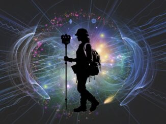
Gavin Schrock

Gavin Schrock, PLS is a surveyor, technology writer, consulting editor for GoGeomatics, and operator of a cooperative GNSS network (RTN). He has worked in surveying, mapping, data management, GNSS, and GIS for more than three decades in the civil, utility, defense, and mapping disciplines. He has published in these fields and has taught these subjects at local, state, national, and international conferences

Articles by Gavin Schrock

AirWorks CAD View

Easing the Aerial-to-CAD Bottleneck

Data capture is getting easier and faster, but the subsequent step of CAD linework generation is a bottleneck, and even…

The Canadian Firm Accelerating the Creation and Use of 3D Reality Models

Traditional pathways for creating, using, and sharing modeled 3D reality data presents challenges to broader adoption. Montreal-based Prevu3D provides a…

Meet the Stats Guy

Geographer Simon Kuestenmacher is a researcher, writer, and presenter on matters of demographics, economics, and curator of fascinating maps… There…

AutoPole – Tilt, Height, and Target Identification

An innovative prism pole, the first of its kind, addresses three troublesome sources of error for robotic total station operation.…

Hexagon CEO Ola Rollén

Conversation with Hexagon CEO Ola Rollén: “We Can Have Both”

A conversation with Hexagon CEO Ola Rollén on pursuing dual goals of prosperity and sustainability Hexagon is not strictly a…

Renewed Interest in Manned Aerial Mapping

Despite a boom in the use of small unmanned aerial systems for surveying and mapping, manned systems have seen growth.…

Low Earth Orbit Satellites for Resilient Positioning, Navigation, and Timing

Xona Space Systems is on track for a dedicated constellation of LEO satellites to provide resilient positioning, navigation, and timing…

Alternate GPS/GNSS/PNT – Orolia

Positional continuity, precise and traceable time, testing and simulation—key elements of multi-layered alternate PNT solutions. What is Alt PNT? What…

Modernizing the Grid with Digital Twins

Transmission network modernization features prominently in infrastructure expansion and upgrade funding packages. Two geospatial leaders in grid design and management…

Women in Geospatial+ Writing Competition 2021 Winner Announced

The Women in Geospatial+ Writing Workshop, held online in September of 2021, included a practical exercise: a writing competition for…

Pay-As-You-Go High Precision GNSS

A unique GNSS hardware and software-as-a-service (SaaS) combination provides very affordable high-precision—on an as-needed basis The Trimble DA2 + Catalyst…

Surveying Instruments – Building Trust Through Verification

Surveying instruments have evolved to provide reliable and repeatable precision and accuracy, but you cannot afford to eschew putting this…