
- Minerva Intelligence launches Canada’s first wildfire risk map using AI and ML
- Alberta grain elevators preserved in virtual reality
- W5, CTV creates a map of asbestos cement pipes delivering drinking water in Canada
- University of Toronto geospatial data visualization challenge for students
- Mapping the Way to Saving Endangered Killer Whales: Raincoast Foundation’s Conservation Efforts
Minerva Intelligence launches Canada’s first wildfire risk map using AI and ML
Minerva Intelligence has launched Canada’s first comprehensive wildfire risk map using artificial intelligence and machine learning algorithms to predict wildfire risk. The tool provides insights for insurers, emergency responders, and communities to better understand the risk of wildfire in their area, which could help them prepare for potential disasters and reduce the impact of wildfires on people and properties. The map covers over 2.2 million square kilometers and could be expanded to other countries. Click here to learn more.
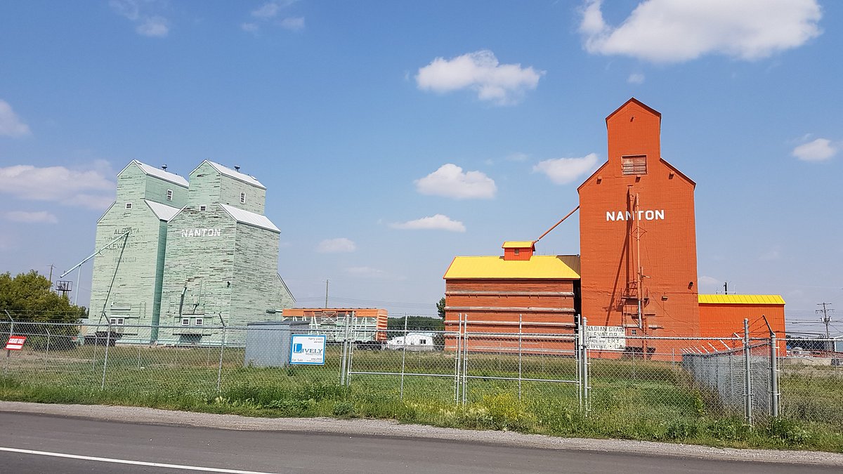
Alberta grain elevators preserved in virtual reality
The Grain Elevator Society of Nanton, Alberta, is preserving the history of Canadian rural life by creating virtual reality (VR) experiences of grain elevators. The VR simulations will help preserve the elevators’ history and educate future generations about their significance. The project highlights how VR technology can be used to preserve historical artifacts and educate people about the past. To learn more, click here.
W5, CTV creates a map of asbestos cement pipes delivering drinking water in Canada
W5, an investigative team from CTV, has created a map of asbestos cement pipes delivering drinking water in Canada. The map shows that millions of Canadians still rely on these pipes for their drinking water, even though they are known to pose a health risk due to asbestos fibers breaking down into the water. The map aims to raise awareness about the issue and encourage municipalities to take action to protect their residents’ health. To learn more and see what municipalities are most affected, click here.
University of Toronto geospatial data visualization challenge for students
The University of Toronto hosted a geospatial data visualization challenge for undergraduate and graduate students. The challenge required students to create a map or visualization that highlights a societal issue or trend using geospatial data. The competition showcased the potential of geospatial data to solve real-world problems and highlighted the importance of data visualization skills in communicating complex information. To check out some of the top projects from the competition, click here.
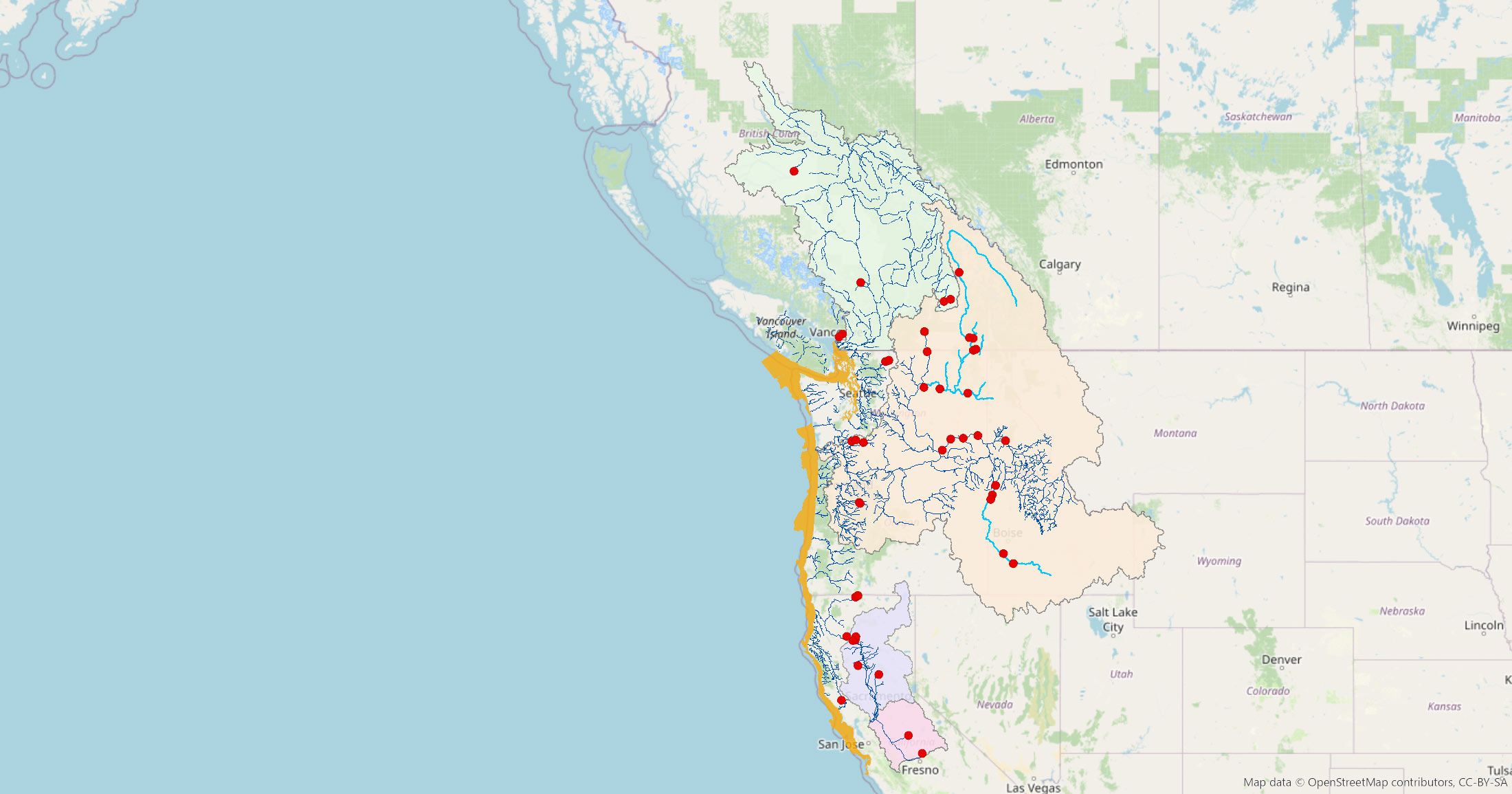
Mapping the Way to Saving Endangered Killer Whales: Raincoast Foundation’s Conservation Efforts
The Raincoast Conservation Foundation is mapping the watersheds feeding into the critical habitat of Southern Resident killer whales to prioritize conservation efforts in Chinook salmon habitat. The project aims to support the recovery of endangered orcas by using scientific data, traditional ecological knowledge, and geospatial analysis. The mapping project will inform policy decisions and conservation efforts to protect the whales’ habitat and the salmon they depend on. This effort is an important step towards protecting the endangered Southern Resident killer whales and the coastal ecosystems that sustain them. Check out the interactive map here.


Be the first to comment