
![]()
![]()
GeoTech Training offers a wide variety of training opportunities built on current standards and professionally led by leading industry experts who strive to empower their students. GeoTech training specializes in all aspects of geospatial tech. Upgrade your knowledge and skill set with courses like the following: 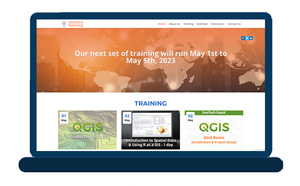
GeoTech Intermediate QGIS: Ottawa River, Watershed Analysis
On May 3, 2023, from 1 pm to 2 pm, join EBP Geospatial Consulting Inc., Teaching Assistant, Eric Purdie as he guides you through learning how to perform a Ottawa River Watershed Analysis using an SRTM DEM, Whitebox Tools, Raster Calculator and QGIS 3D Map Viewer. Datasets involved in this course are the Canvec series, Landsat, Orthoimages of Canada, 2005 – 2010, and SRTM DEM datasets.
Participants will need the following software and plugins: QGIS, SAGAGIS / Whitebox Tools
GeoTech Advanced QGIS: Ground Subsidence Analysis (Study area to be determined)
Eric Purdie, EBP Geospatial Consulting Inc.,Teaching Assistant, will once again provide guidance for a learning experience in QGIS: Ground Subsidence Analysis on May 4, 2023, from 11am -12pm. During this program, you will learn to determine impacts on residential areas by performing a ground subsidence analysis of abandoned mining tunnels in BC. Datasets involved are: Canvec series, BC open data, and RADARSAT – 1 / Sentinel 1 datasets.
Participants will need the following software and plugins: QGIS and ESA SNAP
GeoTech Advanced QGIS: St. Lawrence, River and Flood Analysis
Looking to further your knowledge of QGIS? On May 4, 2023, from 1 pm to 2pm, Eric Purdie, EBP Geospatial Consulting Inc., Teacher Assistant, will be training participants to determine residential areas affected by flooding by performing a River and Flood Analysis of the Montreal, St. Lawrence River using SAGAGIS and QGIS tool sets.
Canvec series, Landsat, DTM, DSM datasets will be involved and participants will need the following software and plugins: QGIS / Whitebox Tools
GeoTech Advanced QGIS: Notre Dame Bay Shipwreck Detection Analysis
May 4, 2023, from 3 pm to 4 pm,will find Eric Purdie, EBP Geospatial Consulting Inc., Teacher Assistant, training participants to successfully analyze bathymetry datasets of Notre Dame Bay, Newfoundland to detect and display underwater shipwrecks using QGIS.
Canvec series, Bathymetry BAG, and Sentinel 2 data sets will be involved in this session, and participants will need the following Software and plugins needed: QGIS, ESA SNAP / Whitebox Tools
For more information on these courses and other available programs, click here.


Be the first to comment