- The Arctic Observing Mission: Monitoring the Arctic in new and profound ways
- First Nations have new weapon in traditional land disputes with Sask. government — maps
- Canada’s renowned Marine Institute joins global endeavour to map entire ocean floor
- Canadian cities publish interactive maps to enhance lives residents
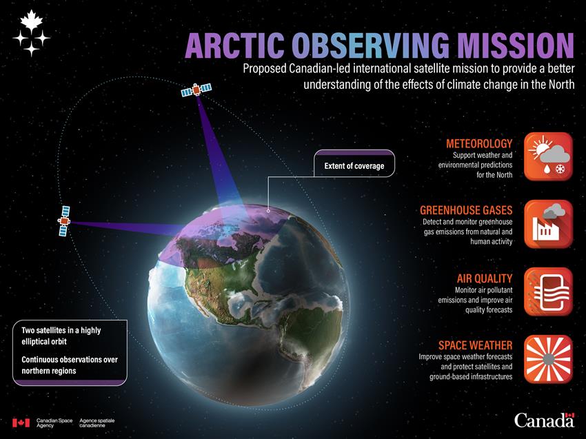
The Arctic Observing Mission: Monitoring the Arctic in new and profound ways
The Arctic is experiencing rapid warming, and its environmental changes are impacting ecosystems and the global climate. To better understand these shifts and inform climate change decisions, the Canadian Space Agency (CSA) is leading the Arctic Observing Mission in collaboration with Environment and Climate Change Canada (ECCC). This international Earth observation mission aims to deploy two satellites that will provide unprecedented views of weather and climate patterns in the Arctic. The satellites would carry four key instruments: an advanced meteorological imager for improved weather forecasting, a greenhouse gas imaging Fourier transform spectrometer to monitor greenhouse gases and pollutants, a dispersive spectrometer for air quality observations, and a collection of space weather instruments for better space weather forecasting to protect satellites and infrastructures. The mission would also help monitor permafrost to understand and address its thawing.
Full article here.

First Nations have new weapon in traditional land disputes with Sask. government — maps
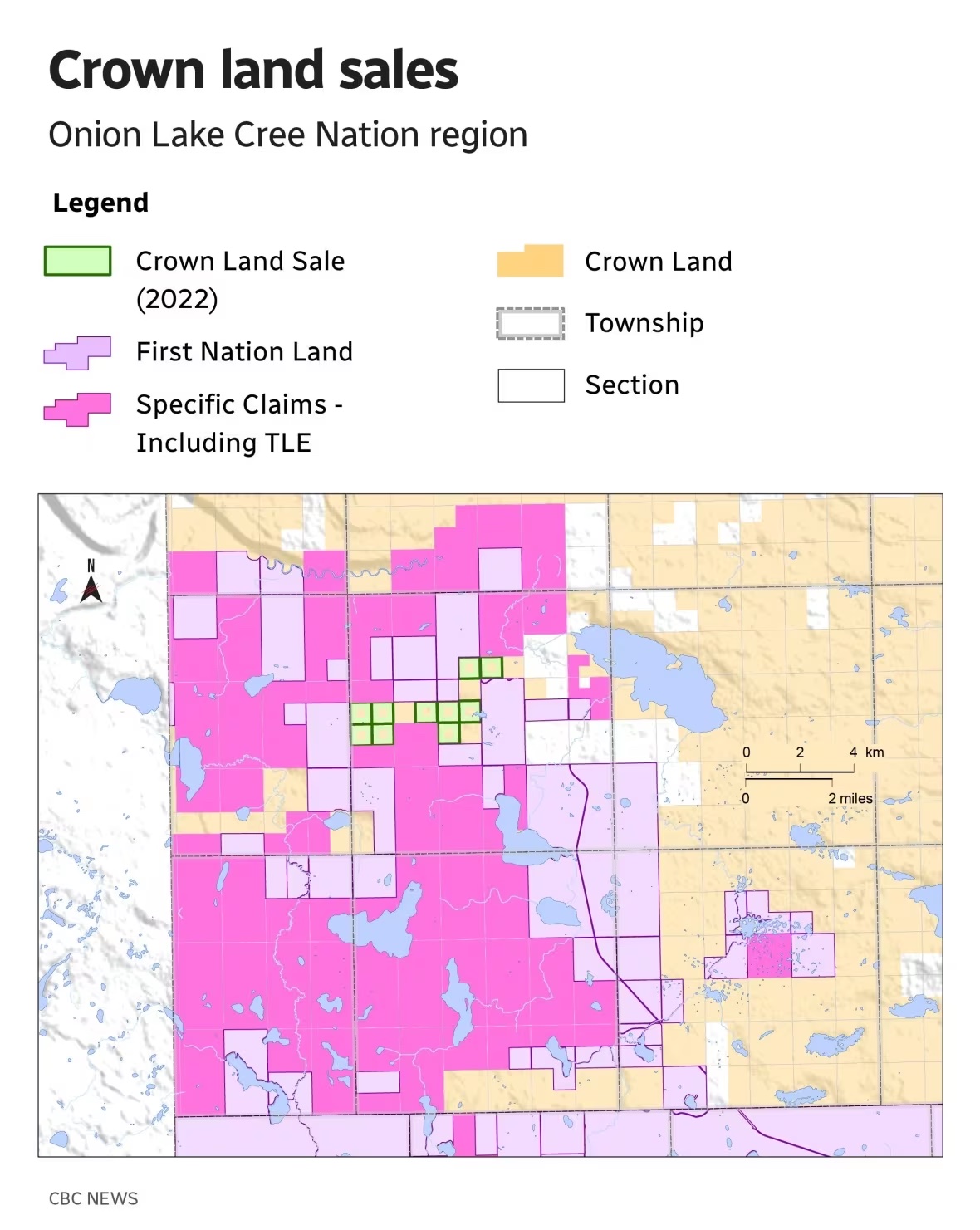
First Nations in Saskatchewan say the provincial government has been privatizing land within their traditional territories without proper consultation. However, the First Nations now have a powerful tool in their fight against this issue—a comprehensive series of maps created by the Saskatchewan First Nations Natural Resources Centre of Excellence. The maps reveal the location and size of Crown land sales, showing that at least $84 million worth of land has been sold to private interests in the past decade without adequate consultation. This is a violation of their treaty and constitutional rights to be consulted and accommodated. First Nations leaders argue that this land privatization prevents them from practicing traditional lifestyles and hampers their ability to reclaim promised land for their reserves and are ready to protect their rights, armed with the evidence from these maps.
Full article here 
Canada’s renowned Marine Institute joins global endeavour to map entire ocean floor
The Nippon Foundation-GEBCO Seabed 2030 Project has formed a new partnership with Memorial University of Newfoundland’s Fisheries and Marine Institute, known for its marine research and education excellence. Seabed 2030 aims to collaboratively map the world’s ocean by 2030 and create the freely accessible GEBCO Ocean Map, endorsed by the UN Ocean Decade. Memorial University, a top Canadian research institution with a strong focus on ocean-related studies, brings valuable expertise to support Seabed 2030’s mission. The Marine Institute, a comprehensive center for ocean industries education, research, and support, will contribute to a deeper understanding of the ocean floor for sustainable use and management. All data collected will be publicly available through the GEBCO global grid.
Full article here
Canadian cities publish interactive maps to enhance lives of residents
Canadian cities like Norfolk County and New Westminster are utilizing a wide range of maps and geospatial information to share information with residents, and to enhance their urban planning and infrastructure development. By integrating detailed data such as parcel outlines, sewer lines, water lines, biking routes and parks into their mapping systems, these cities are able to make informed decisions to improve the lives of their residents. This data-driven approach not only fosters efficient urban development but also ensures a higher quality of life for citizens, as they can easily located and enjoy public spaces and amenities. By harnessing the power of geospatial data, Norfolk County and New Westminster set a stellar example for other cities aiming to create smart, livable, and environmentally-conscious communities.
Norfolk County maps
New Westminster maps


Be the first to comment