
- Canada launches first defence industrial strategy
- Quebec’s plan for digital sovereignty
- Dynamic Map Platform’s coast-to-coast coverage of Canadian roads
- Natural Resources Canada adds to existing flood event datasets
- NRCan-TAP: A partnership for building sustainable communities
- Canadian educational institute NASI looks to expand into the US
Canada launches first defence industrial strategy
Last week, the Government of Canada announced the launch of its first defence industrial strategy. Through this strategy, the Government of Canada aims to support the development and expansion of the country’s defence and defence-adjacent industries, aiming to eventually position Canada as a leader in the defence space.
Over the next 10 years, the Government of Canada will spend nearly $500 billion in defence procurement and defence capital expenditure, which is estimated to created 125000 jobs. The Government’s defence industrial strategy also aim to support dual-use technologies, such as those found in aerospace and drone development.
Learn more here
Quebec’s plan for digital sovereignty
The Government of Quebec has released a policy document outlining the province’s vision of digital sovereignty. In Policy Statement on Digital Sovereignty and Information Technology Procurement, the Government of Quebec highlights its desire to exercise greater control over government digital infrastructure, software and other assets.
The Government of Quebec plans to take concrete steps such as hosting assets in data centres located in Quebec and other parts of Canada, taking advantage of open-source software when possible, and learning best practices from other jurisdictions. The Ministry of Cyber Security and Digital Technology will make $1.4 billion in funding available for Quebec and Canadian firms to help meet this vision.
Learn more here
Dynamic Map Platform’s coast-to-coast coverage of Canadian roads
The geospatial mapping firm Dynamic Map Platform (DMP) has recently completed coast-to-coast LiDAR mapping for major Canadian road systems. Altogether, DMP has mapped more than 120000 miles of Canadian roads, bringing the firm’s total North American coverage to more than 970000 miles of road. This highly detailed data captures road feature such as lane dividers, road signs and crosswalks. This data is useful for applications including infrastructure planning and traffic simulation, as well as for use in driver-assistance systems and autonomous vehicles.
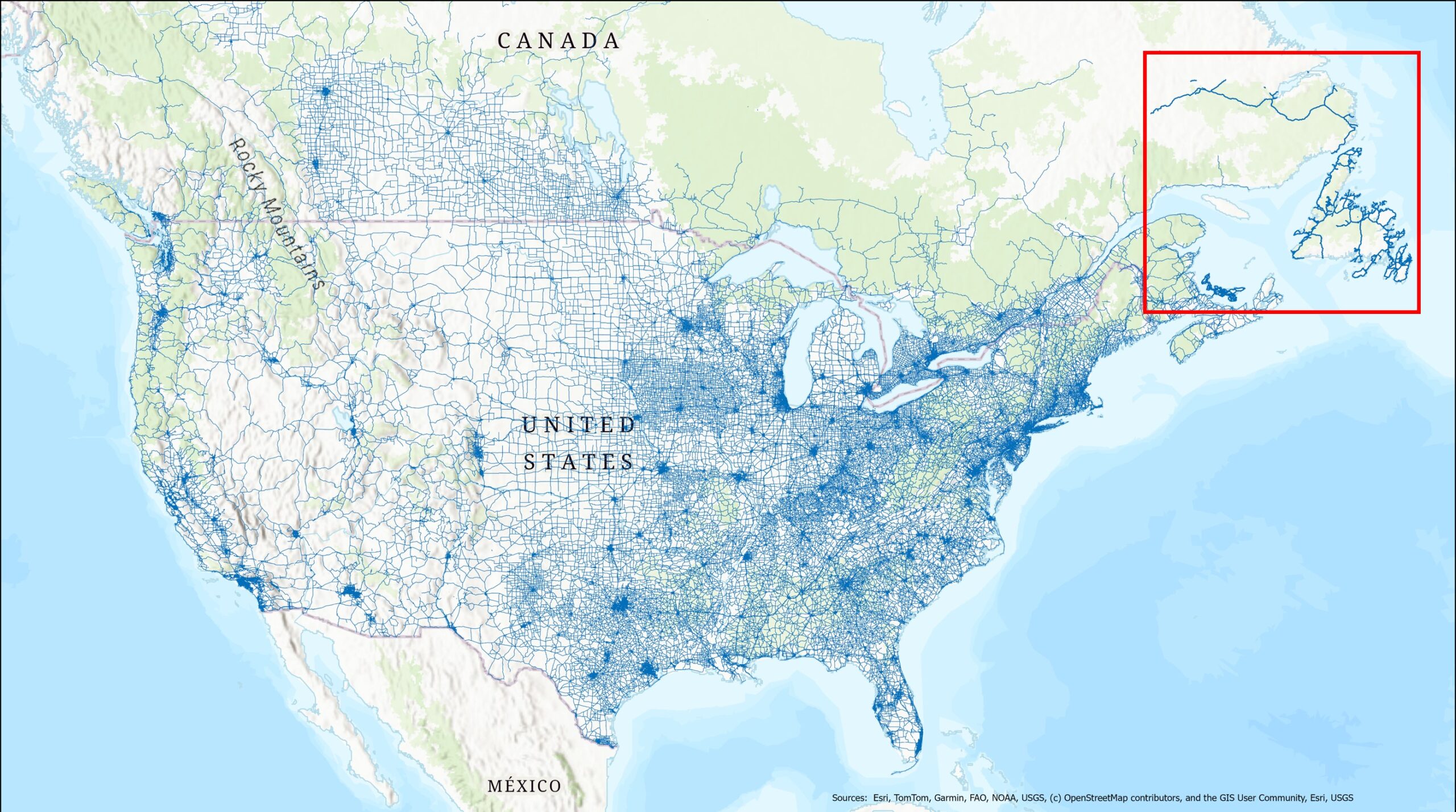
Learn more here
Natural Resources Canada adds to existing flood event datasets
Natural Resources Canada (NRCan) has added more than 300 new flood events to their Historical Flood Event (HFE) layer. The HFE layer provides data on more than 7000 documented flood events occurring between 1696 and 2025. 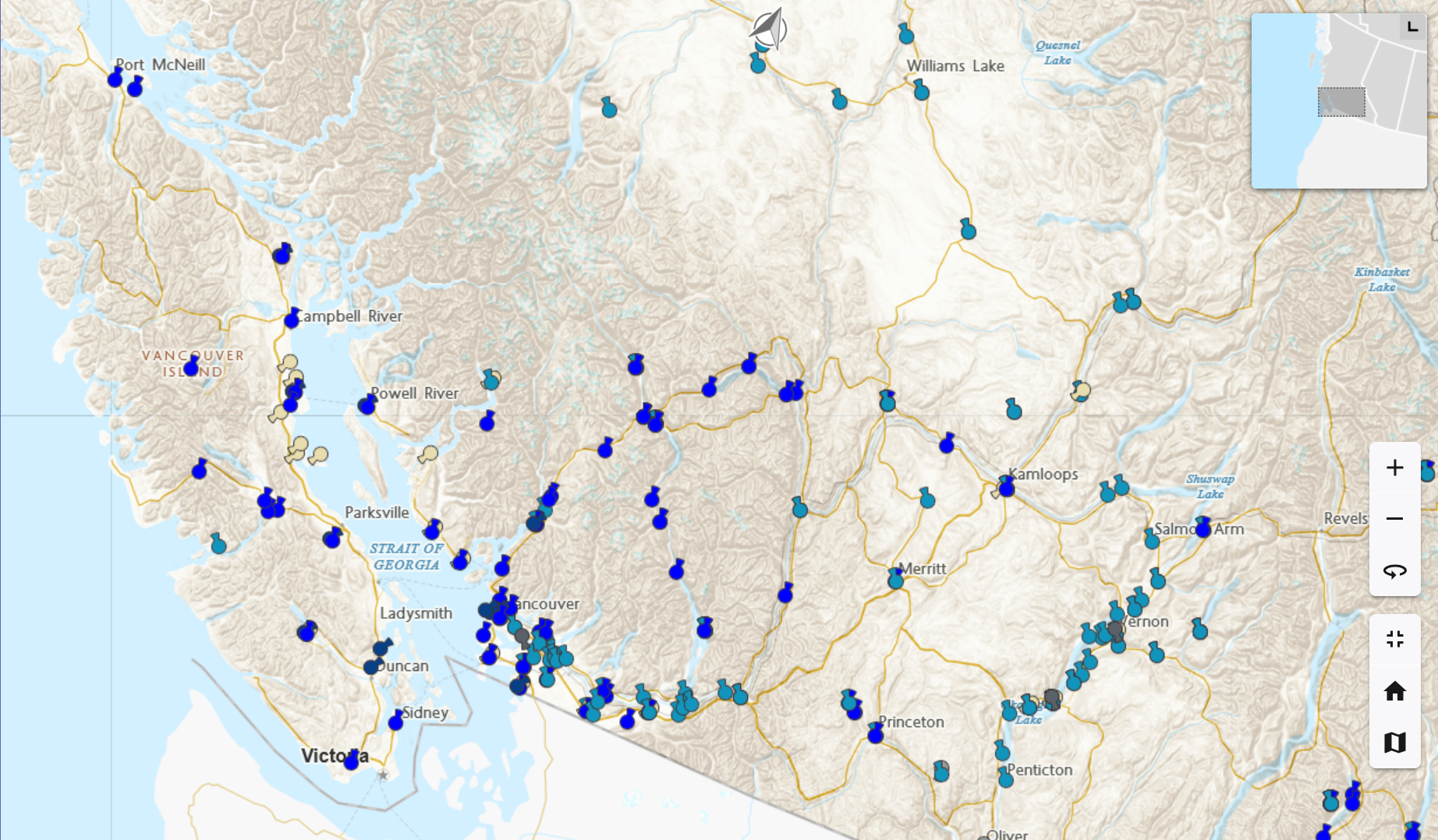
A screenshot of the Historic Flood Event layer showing southern British Columbia
For more recent flood events, the HFE layer contains information from satellite imagery gathered by NRCan’s Emergency Geomatics Service, along with historical precipitation data. Together, this data provides a detailed picture of landscape and precipitation conditions around flood events.
Learn more here
NRCan-TAP: A partnership for building sustainable communities
In celebration of International Development Week, Natural Resources Canada (NRCan) is highlighting the NRCan Technical Assistance Partnership Program (NRCan-TAP). Launched in 2024, NRCan-TAP supports partner nations by sending scientists, engineers and other technical staff to share knowledge in support of initiatives around community health, economic security and sustainable development.

Already, NRCan-TAP is supporting, or preparing to support, initiatives in the Caribbean, Europe, Africa and Asia. These efforts include developing disaster relief, reduction and recovery practices, supporting energy efficiency projects, building geospatial capacity and the creation of long-term water planning capabilities.
Learn more here
Canadian educational institute NASI looks to expand into the US
The North American Space Institute (NASI) has partnered with American firms Learning Exchange Inc. (LEXX) and Alliance Cyber to standardize space-related technical training across Canada and the United States. NASI is an educational institute created by a former technician from the Canadian Space Agency. The goal of NASI is to provide technical training for those interested in the space industry.
NASI aims to align Canadian teaching standards with current American standards, allowing technicians trained in either country to work in Canadian or American industries. There is currently a shortage of 58000 qualified technicians throughout North America.
Learn more here


Be the first to comment