
- MDA Secures Future of Canada’s Only Commercial Satellite Test Facility
- Drones Take Root in Quebec’s Burned Forests
- Vaughan’s Real-Time Construction Map Wins Provincial Award
- CSA Launches $5.5M Call for University Space Research Proposals
- New Drone Partnership Targets Faster Wildfire Response in Canada
- Water Mapping Projects in Slocan Valley Aim to Boost Wildfire Response
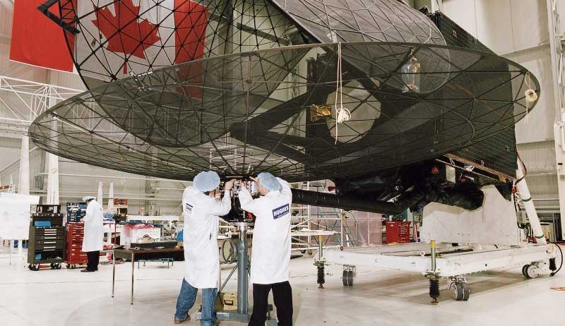
MDA Secures Future of Canada’s Only Commercial Satellite Test Facility
MDA Space has officially taken over operations of the David Florida Laboratory (DFL) in Ottawa, keeping the country’s only commercially available satellite testing facility under Canadian control. DFL has been a vital part of Canada’s space ecosystem since the 1970s, supporting historic missions like the James Webb Space Telescope and the RADARSAT series. The site provides full spacecraft assembly, integration, and testing services in one location, and is critical to the health of Canada’s sovereign space capabilities. Under MDA’s leadership, the lab will remain open to all Canadian industry players, supporting innovation through fair access to electromagnetic compatibility, thermal vacuum, and vibration testing services. This move strengthens Canada’s position in the global space industry and ensures that homegrown technologies continue to have a place to launch.
Learn more here
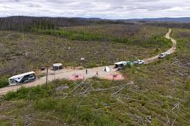
Drones Take Root in Quebec’s Burned Forests
After Canada’s record-breaking wildfire season in 2023, replanting millions of lost trees has become urgent. In northern Quebec, the company Flash Forest is using drones to lead a new reforestation effort, dropping seed capsules filled with water, nutrients, and fungi to help black spruces and jack pines grow in the charred soil. With AI-guided mapping and data-driven site selection, each drone can plant up to 50,000 seeds a day. The project is not only speeding up reforestation but also working closely with Indigenous Cree communities affected by the fires. While some seeds don’t survive and Canada still faces a national seed shortage, the effort signals a shift toward tech-driven reforestation in remote and fragile landscapes.
Read the full story here
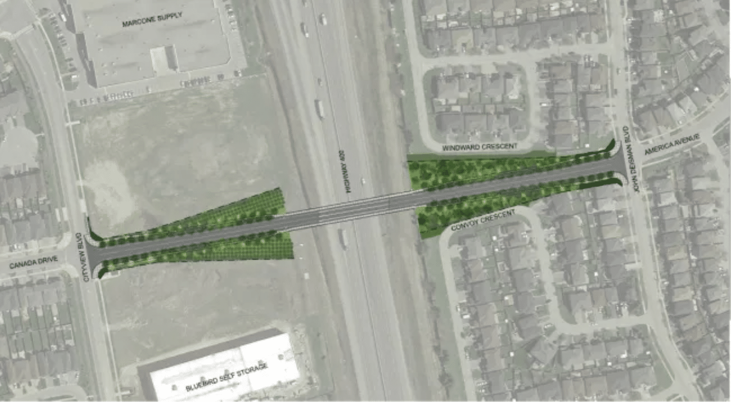
Vaughan’s Real-Time Construction Map Wins Provincial Award
The City of Vaughan is getting recognition from BeSpatial Ontario for its innovative online tool that tracks nearly 400 infrastructure projects in real time. Designed for internal city staff, the map brings project data into one platform, helping teams stay on top of locations, timelines, and progress updates, reducing delays and avoiding scheduling conflicts. Vaughan is the first city in York Region to roll out this level of GIS coordination under the regional “All Construction” initiative. A public version of the tool is also available, allowing residents to view ongoing and upcoming construction by address, ward, or year. The city says the new map improves transparency and streamlines communication both internally and with the public.
Explore the full story here
CSA Launches $5.5M Call for University Space Research Proposals
The Canadian Space Agency has opened its 2025 FAST (Flights and Fieldwork for the Advancement of Science and Technology) program, offering up to $5.5 million in grants to support space-related research and student training across Canada. The program funds projects in areas like space health, planetary science, Earth system monitoring, solar-terrestrial science, and innovative space tech. FAST is designed for universities and post-secondary institutions, with different funding categories based on the scale and platform access of each project. This initiative not only supports scientific advancement but also gives students the chance to get hands-on experience designing payloads or working in space-like conditions. Applications are due by October 6, 2025, and selected projects are expected to start in early 2026.
Full details available here
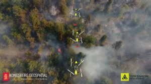
New Drone Partnership Targets Faster Wildfire Response in Canada
Kongsberg Geospatial and FireSwarm Solutions have joined forces to tackle the growing threat of wildfires through advanced drone swarm technology and real-time mapping. A new Memorandum of Understanding outlines how the two Canadian-based companies will combine FireSwarm’s autonomous suppression drones with Kongsberg’s IRIS Terminal, a situational awareness platform used in emergency response and defense. Together, they aim to speed up wildfire detection and response while also expanding into defense logistics and international disaster readiness. The partnership is a timely move as wildfires continue to stretch Canada’s emergency resources. With drone swarms ready to deploy and AI mapping on hand, this joint effort could set a new benchmark for early wildfire suppression and safe crisis response.
Find out more here. here
Details here


Be the first to comment