
In the weeks leading up to GeoIgnite 2025, the Canada Centre for Mapping and Earth Observation (CCMEO) joined with GoGeomatics to host the CCMEO Hackathon on Building Reslience with GEO.ca. The Hackathon provided an opportunity for students from around Canada to solve real-world problems using data from GEO.ca and open-source software. With the theme of emergency response and readiness, students worked individually or in pairs to produce a product and video demonstration within a one-month period. On May 12, the results of the Hackathon were announced at GeoIgnite 2025 being held in Ottawa, with the first, second, and the third place winners having the opportunity to share their projects and answer questions.

1st Place Winners
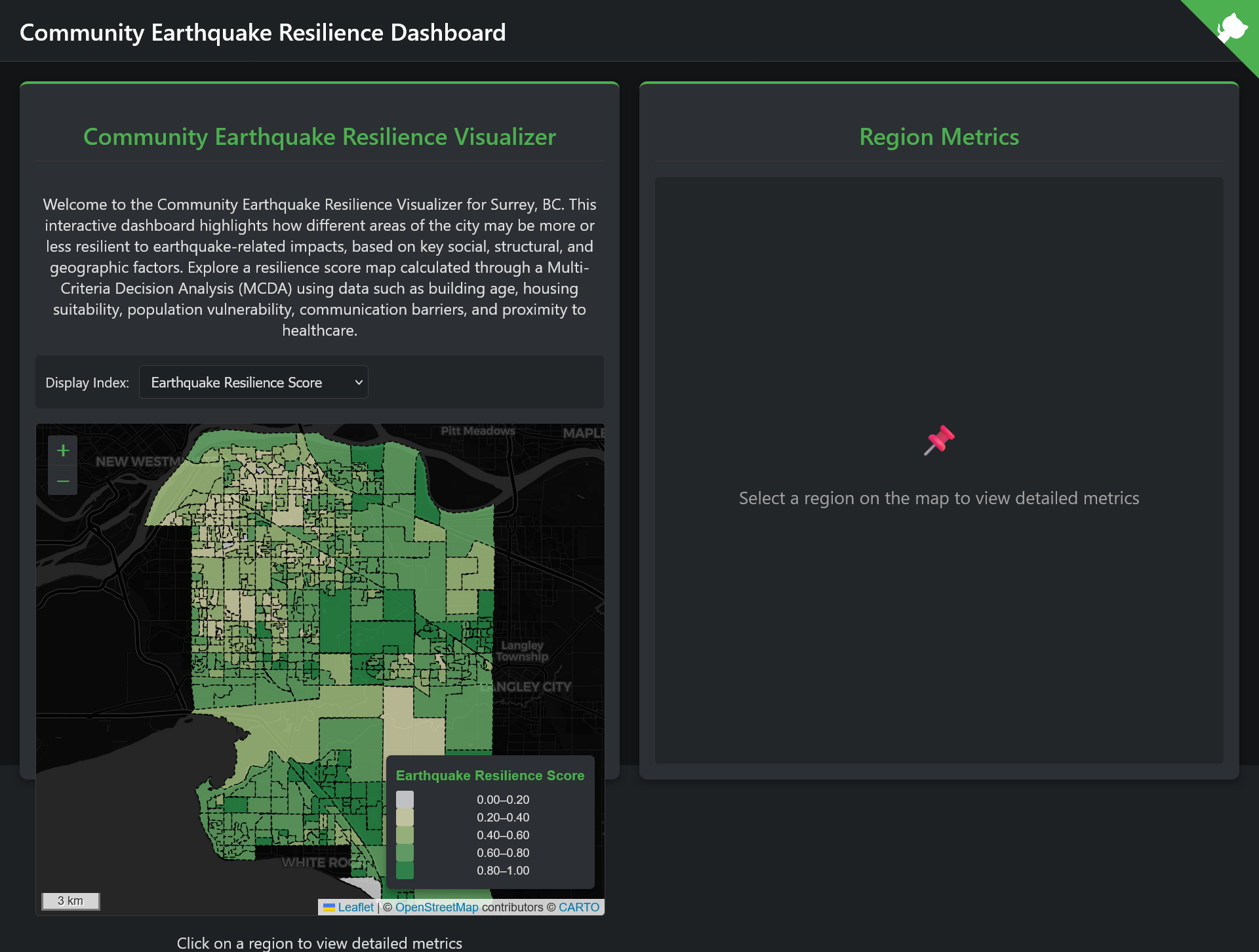
Pierre Koelich and Kyle Vu from the British Columbia Institute of Technology came in 1st place with their Community Earthquake Resilience Visualizer, which highlights earthquake vulnerability in Surrey, British Columbia. This application presents a variety of data, placing an emphasis on socioeconomic factors such as building history and population age. The application exists as a one page dashboard, making it easy for users to access the data.
2nd Place Winner
Abdul Mutakabbir from Carleton University came in second place with his application titled Heuristics for Forest Fires, which displays changes in land cover due to forest fires. Presented as an easy-to-use dashboard, Abdul’s application allows users to examine land cover in different parts of Canada to help better understand the risks and impacts of forest fires.
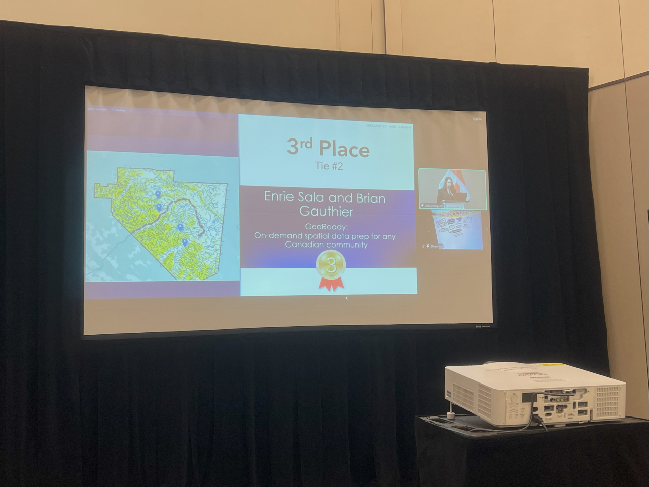
3rd Place Winners
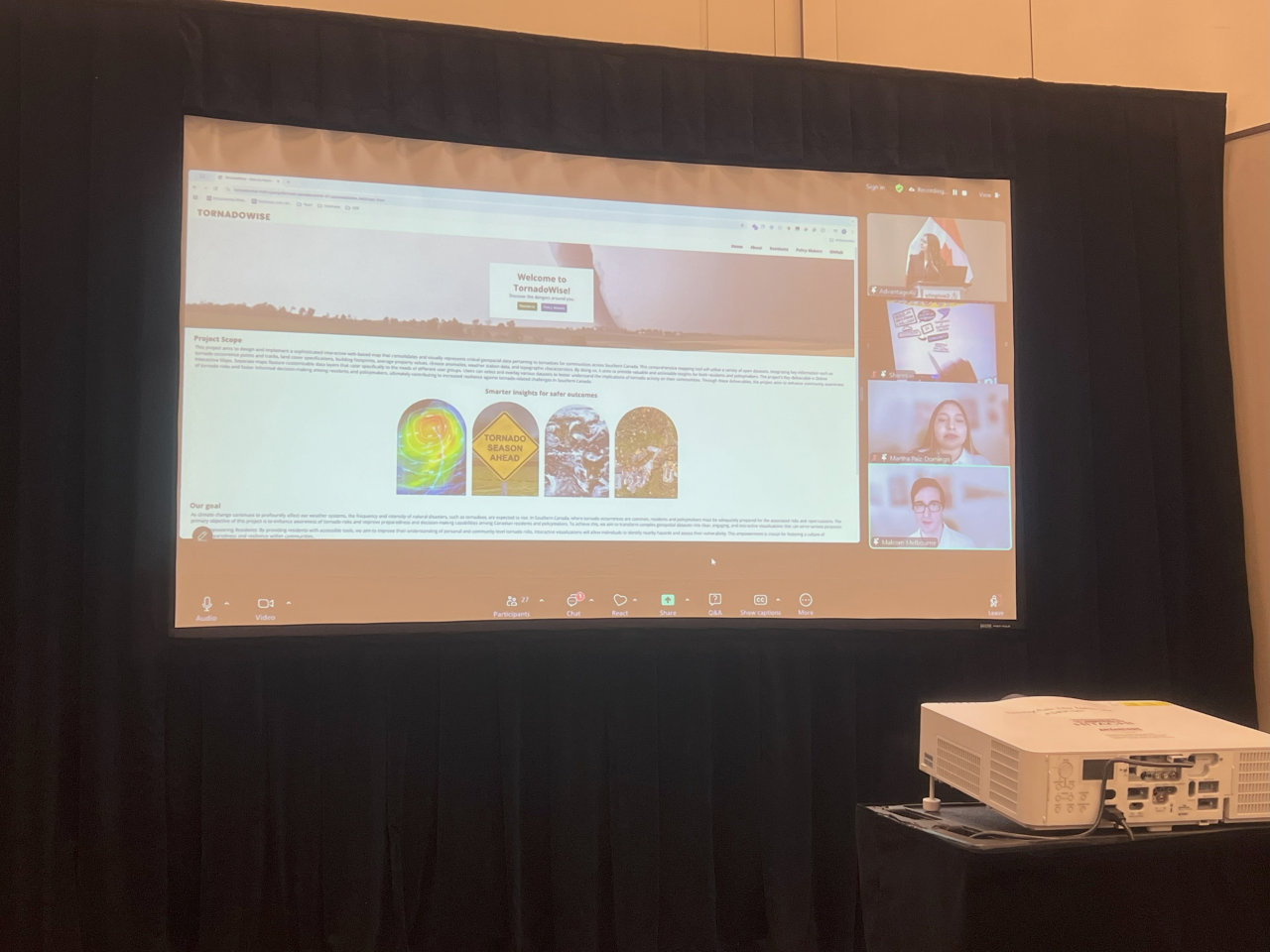
There were two groups that tied for 3rd place. Martha Paiz-Domingo and Malcolm Melbourne from Fanshawe College created an interactive tornado map titled TornadoWise. This application allows users to find information about tornadoes in Canada, including weather alerts and monitoring stations. An interesting feature of TornadoWise is that it provides separate information portals tailored to both residents and policy makers.
Enrie Sala and Brian Gauthier from Nova Scotia Community College created the application GeoReady: On-Demand Spatial Data Prep for any Canadian Community, helping users determine flow paths of potential hazardous material spills in Canada. Once a user selects a city, a terrain product is created for the area, highlighting information such as rail lines and potential spills sites. This application is useful for risk assessment of properties and spill response management.


Be the first to comment