It’s that time of the year – back to school! This used to mean physically entering the classroom for most students, but 2020 has proven to be THE year for online learning. We are still in a pandemic, and many of us are choosing to use this time to strengthen our skills, whether for the purpose of furthering our careers or just to curb boredom (rather than bake another loaf of bread or start yet another 1000+ piece puzzle).
There are many, great, free (or low-cost) courses that fall under the geomatics umbrella — almost too many to grasp. You may have heard that several Canadian organizations, like the Canadian Space Agency, Environment Canada and Natural Resources Canada, have recently announced that they are developing online remote sensing courses. Until those are available, here is a round-up of courses that you can start immediately (or very soon) and are offered by Canadian Institutions. Also listed are a few international courses worth considering too.
This list is a snap shot of what is available. Hope you enjoy furthering your geospatial education by enrolling in one or all!
Courses from Canadian Institutions
Specialization: GIS, Mapping and Spatial Analysis

Length of Program: Approximately 6 months to complete (at 3 hours/week)
Organization: University of Toronto
Program URL: https://www.coursera.org/specializations/gis-mapping-spatial-analysis
Free or Paid: Paid (free 7-day trial)
Description: Offered through Coursera, you can start any of the four courses included in this specialization for a free 7-day trial. Following the trial, pay $66 per month to complete any or all of the specialization requirements as you work at your pace. Courses are taught by Professor Don Boyes (his GIS how-to YouTube videos have certainly helped me in the past!)

- Course 1: Introduction to GIS Mapping
- Course 2: GIS Data Acquisition and Map Design
- Course 3: Spatial Analysis and Satellite Imagery in a GIS
- Course 4: GIS, Mapping and Spatial Analysis Capstone
Ecodesign for Cities and Suburbs

Length of Program: 6 weeks
Organization: University of British Columbia
Program URL: https://www.edx.org/course/ecodesign-for-cities-and-suburbs
Free or Paid: Free
Description: Offered by edX, Professors Jonathan Barnett and Larry Beasely use real examples to explain how ecology can guide urban design to avert environmental disasters and improve people’s lives.
Introduction to the Arctic: Climate

Length of Program: Approximately 9 hours
Organization: University of Alberta
Program URL: https://www.coursera.org/learn/arctic-introduction-climate
Free or Paid: Free
Description: In collaboration with the University of Tromso in Norway and the University of the Arctic in Finland, join the University of Alberta in this course that examines the environment and climate of the Arctic. Expect a thorough review of the region’s geography, the impact of cold and ice on its ecosystem and the evidence of present day climate change.
Watershed Systems and Their Influence on Water Movement and Quality

Length of Program: Approximately 4 weeks
Organization: Queen’s University
Program URL: https://www.edx.org/course/watershed-systems-and-their-influence-on-water-movement-and-quality
Free or Paid: Free
Description: Offered by edX, this course focuses on watershed systems and how land use and land cover impacts water.

Courses from International Sources
AI for Everyone

Length of Program: Approximately 6 hours
Organization: deeplearning.ai
Program URL: https://www.coursera.org/learn/ai-for-everyone
Free or Paid: Free
Description: This course is literally for everyone – largely non-technical, expect to gain a beginner understanding of Artificial Intelligence (AI)
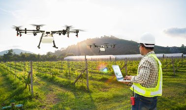
Drones for Agriculture: Prepare and Design Your Drone (UAV) Mission

Length of Program: Approximately 3 weeks
Organization: Wageningen University & Research, Netherlands
Program URL: https://www.edx.org/course/drones-for-agriculture-prepare-and-design-your-dro
Free or Paid: Free
Description: This course teaches how to prepare and execute a flight mission with an Unmanned Aerial Vehicle (UAV), otherwise known as a drone. You will learn how to process and understand the data collected by drones and upon completion, be well versed on aerial mapping and how to implement it in a programmable small drone. Note: you do not need to own your own drone for this course!

Introduction to Satellite Communications


Length of Program: Approximately 33 hours
Organization: Institut Mines-Télécom
Program URL: https://www.coursera.org/learn/satellite-communications
Free or Paid: Free
Description: Offered through Coursera by three schools associated with the Institut Mines-Télécom, this course will explain how satellites are built, fly and communicate. It is taught by a combination of scientists and space professionals
Oceanography: a key to better understand our world


Length of Program: Approximately 29 hours
Organization: University of Barcelona & Fundació Navegació Oceànica Barcelona
Program URL: https://www.coursera.org/learn/oceanography
Free or Paid: Free
Description: Channel your inner ocean explorer with this course that will lead you through the Mediterranean, Atlantic and Southern Indian and South Pacific Oceans, learning about the science of oceanography. We geospatialists will most appreciate learning about how current sea satellite analysis systems work.
Multiple Courses Offered through OPEN.ED

Length of Program: Vaires
Organization: OPEN.ED, Penn State, USA
Program URL: https://open.ems.psu.edu/
Free or Paid: Free
Description: OPEN.ED offers a catalogue of over 50 geospatial courses ranging from beginner to advanced. It seems that these free courses are integrated into the requirements of regular, paying students, but most of the content is available for free. You will not be evaluated or receive a grade, but you definitely have access to a lot of valuable and useful content.
Have you completed any these courses? Know of any other courses that those in the geospatial community should take? Let us know!


Be the first to comment