
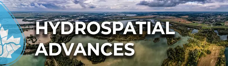
As the inaugural Chair of the Hydrospatial program at this year’s GoGeomatics Expo, I invite you to join us for talks and panels devoted to the Future of Water Management with Geospatial Technologies. This year, we are pushing the boundaries of how we use technology to address critical water issues, from watershed conservation to flood risk and drought monitoring.
Why Hydrospatial?
Water management is no longer just a local or regional challenge—it is a global priority. With climate change impacting water availability and quality, it has become essential for governments, industries, and communities to adopt smarter strategies. This is where Hydrospatial comes in. By harnessing the power of geospatial technologies, we are unlocking new ways to predict, monitor, and manage water resources more effectively.
Program Highlights
Our Hydrospatial program offers something for everyone. Here are some of the key sessions you won’t want to miss:
- Day 1 Keynote: Dr. Zahidul Islam and Tachara Larocque will present Alberta’s groundbreaking flood and fluvial hazard initiatives. Their work is critical in addressing the ever-increasing risk of flooding in our region and showcases how geospatial technologies are making a real-world impact.
- Day 2 Keynote: Dr. Chris Hopkinson will take us through his innovative use of LiDAR to model mountain snow water, providing critical data for drought monitoring. As climate change alters snowpack levels, this work is vital for understanding and mitigating drought risk.
- FREE Workshop on ArcHydro: Thanks to Esri, we are offering a hands-on workshop on watershed modeling using ArcHydro. This is an invaluable opportunity to learn from experts and gain practical experience with one of the leading tools in water resource management.
- Riparian Web Map Portal: Learn how an award-winning web map portal is making a difference in watershed conservation across Alberta. This session will show how open-access geospatial tools can empower conservation efforts.
- Special Panel Discussion: I’m particularly excited about our panel on geospatial-driven water policy. We will hear from a diverse group of experts about how technology is shaping smarter decision-making. Water policy is one of the most critical areas where geomatics can have a profound impact, and this discussion is sure to offer new perspectives and solutions.

Calling Hydrospatial Industry Specialists
One of the unique aspects of the Hydrospatial program is the opportunity to share your expertise. We are still looking for panelists who are passionate about how geomatics is shaping the future of water management. If you work in the Hydrospatial sector and are interested in contributing to our panel discussion, I encourage you to reach out to me at [email protected].
Join Us
I look forward to seeing you in Calgary this October for an engaging and impactful event!
Mark Empey
Chair, Hydrospatial Program
GoGeomatics Expo 2024
Thank you to our sponsors!
Platinum

Silver
![]()
![]()


Be the first to comment