Present day technology has the ability to facilitate so many things that it’s sometimes hard to comprehend how fast it moves along. This is one of the reasons that professional associations across Canada and the globe have started to move towards Mandatory Professional Development, but the challenge they face today is how to provide learning opportunities to their members who are often far-flung and busy.
GeoEd is our solution! GeoEd is a collaborative program that seeks to include all provincial and federal surveying associations in Canada to promote accessible continuing professional development (CPD). The initiative was conceived and developed by the Association of Canada Lands Surveyors (ACLS) 1 and Professional Surveyors Canada (PSC) 2 when the need for a national forum for CPD was recognized. ACLS continues to maintain the portal in what will hopefully become a cooperative effort to share resources and expertise towards the development of national learning.
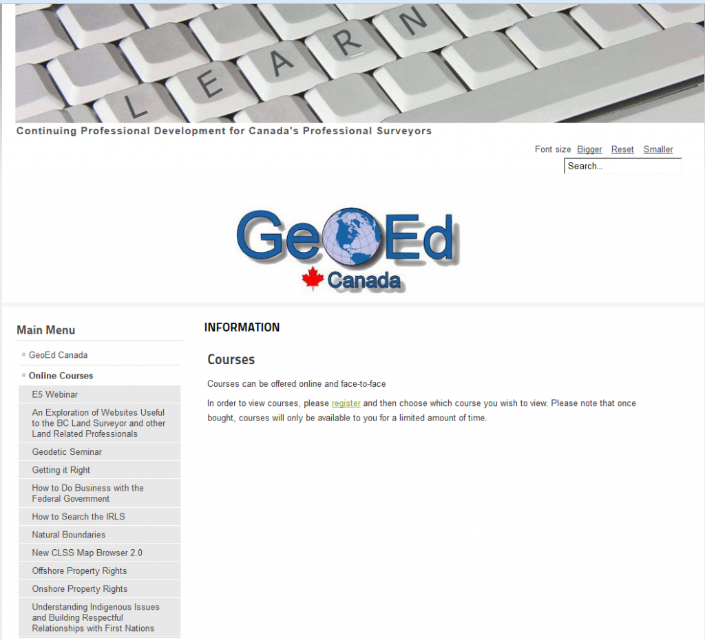
GeoEd exists to help surveyors succeed. It is mainly used as an online system for course delivery for surveyors wherever they may be. Courses on a wide variety of topics are available at your fingertips! These courses can consist of live interactive webinars, or be self-study with recorded video and other digital materials. Surveyors are able to sign up for any course and complete it at their leisure.
GeoEd can be used by surveyors to keep up to date on the subjects that are most relevant to them. One recent addition is an Expert Witness course! Developed in collaboration with Four Point Learning, this e-learning course explores all aspects surrounding the preparation of the professional land surveyor in Canada to assist the decision maker in a legal proceeding. This course is of particular interest to land surveyors or other professionals who want to be better prepared in their role of expert witness or any other type of event where a professional is asked to issue an opinion in a public forum.
Another course to look forward to is Understanding Indigenous Issues and Building Respectful Relationships with First Nations (How to Approach First Nations for Research and Business). This course currently being presented live and will be available as videos at a later date on GeoEd. It covers topics such as:
- How we know what we know about Indigenous Issues: Media representations past and present
- Cross cultural issues & building mutual respect with Indigenous peoples & nations: General principles
- Employment, hiring and retention, human resources, and building a supportive environment for Indigenous employees
GeoEd does not only advocate online course, part of this is initiative is a forum where surveyors can search by jurisdiction to find face-to-face seminars that are happening near them, as well as post upcoming ones for others to find. Surveyors across Canada can chat about seminars they have attended and what sort of seminars they would like to see in the future. Using the forum ensures that every person can have a voice in how future CPD opportunities develop.
GeoEd is the tool that surveyors will use to make educational opportunities as easy, accessible, and relevant as possible.
1 The Association of Canada Lands Surveyors (ACLS) is the national licensing body for professionals surveying in the three Canadian territories, in the Federal parks, on Aboriginal reserves, as well as on and under the surface of Canada’s oceans. It is a self-governing, non-profit, non-governmental organization that manages the activities of its members across Canada in the field of cadastral (boundary or legal) surveying.
2 Conceived, developed, and run by Canadian surveyors, Professional Surveyors Canada is dedicated to building and enabling a strong multi-faceted community of surveying professionals committed to exceeding expectations.


Be the first to comment