
Natural Resources Canada (NRCan) is increasing the HRDEM product coverage by 30,000 km2 by publishing 21 new datasets in six provinces (BC, SK, MB, ON, QC, NB). This new publication of the HRDEM product adds 24,000 km2 in western New Brunswick, 5,500 km2 in southern Manitoba, the City of Nanaimo (BC), and some other areas of interest in the south of the country. Stay tuned as other HRDEMs derived from LiDAR will be released in June 2019!
You can download HRDEM data from the Open Government Portal.
For northern Canada, NRCan recently started the process of integrating an improved version of the ArcticDEM project final product at 2m resolution (release 7) into HRDEM. Thus this new 2m product, will replace the current 5m version and cover almost all of northern Canada.
Deep Learning (Artificial Intelligence) techniques for mapping
Deep Learning (AI) techniques are key to facilitate feature extraction automation in voluminous geospatial datasets. For almost a year now, NRCan’s Canada Center for Mapping and Earth Observation (CCMEO) has been developing Geo-Deep-Learning, an open source software package based on Convolutional Neural Networks (CNN) to simplify and accelerate automatic extraction of cartographic features.
To demonstrate Deep Learning capacity for automatic topographic feature extraction, the team has been working on extracting eskers from HRDEM data. Fourteen (14) HRDEM tiles where eskers can be found were selected to train a model and assess automatic delineation of eskers on sections of untrained tiles. Preliminary results are promising and will be revealed in May at the Geoconvention in Calgary.
Simplified access to HRDEM product using Big Data technologies

Big data is a field that treats of ways to analyze, systematically extract information from, or otherwise deal with data sets that are too large or complex to be dealt with by traditional data-processing application software. For an organization such as Canada Center for Mapping and Earth Observation (CCMEO), leveraging Big Data technologies is critical to our mission. Given the size of our country (10 million km²), the amount of geospatial data we manage – satellite imagery, aerial photography, national scale vector data, and most recently point clouds from LiDAR – has increased exponentially.
With this challenge clearly laid-out, CCMEO is developing a datacube platform for Earth Observation (EO) and 3D data based on an open source Big Data framework (Apache Spark and GeoTrellis).
This infrastructure will provide visualization of and access to both EO and 3D geospatial data through standardized services such as WMS, WMTS and WCS. In the coming months, our datacube platform should allow us to offer visualization of our HRDEM product, through existing viewers such as the open maps viewer.
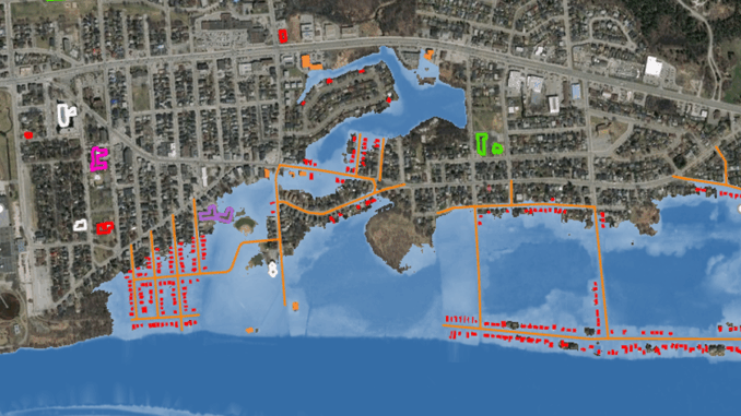
The team is also working on the development of dynamic analysis capacities on top of geospatial data to address different issues such as floods and coastal erosion. We are investigating the use of standardized Web Processing Services to facilitate analysis that harness EO and 3D data.
In our view, providing visualization and analysis services that highlight these data holdings will allow us to unlock their value to new and unforeseen uses.
Contact Us:
Comments and suggestions are always welcome. Please contact us at: [email protected]
The authors of the articles are: David Bélanger, Pierre Gravel, Josée-Anne Langlois, Mike Major, Charles Papasodoro, Daniel Pilon


Be the first to comment