
- Russia Signals Threat to Satellites Backing Ukraine
- NISAR Satellite to Deliver Global Radar Data at Unmatched Scale
- Planet Releases Tanager Hyperspectral Data for Public Exploration
- NASA Demonstrates Modular Satellite Design to Speed Up Sensor Launches
- Floodbase Rolls Out AI-Driven Flood Mapping Across the U.S.
- Tampa Bay Turns to AR to Engage Communities in Climate Planning
Russia Signals Threat to Satellites Backing Ukraine
Russia has formally warned that it may target satellites supporting Ukraine’s military efforts. In documents shared with the International Telecommunication Union, Russian officials argued that countries using commercial satellites for defense purposes have no grounds to protest signal interference. This comes amid growing concern over GPS jamming and signal disruptions across Europe. The move reflects a hardening stance from Moscow, which now openly frames dual-use satellites as military assets and justifies interference as a wartime measure.
Read more here
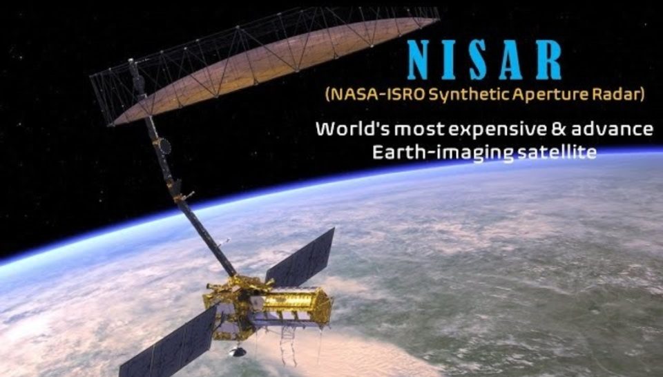
NISAR Satellite to Deliver Global Radar Data at Unmatched Scale
The upcoming launch of NISAR, a collaborative satellite mission by NASA and ISRO, will provide high-resolution radar data on land, vegetation, and ice across the planet. Designed to scan the Earth’s surface every 12 days, the satellite will help track everything from glacier retreat to crop health and volcanic activity. Its dual radar system, combining NASA’s L-band and ISRO’s S-band technology, makes it one of the most capable Earth observation missions to date. Data will be freely available to support scientific research and disaster preparedness worldwide.
Read more here
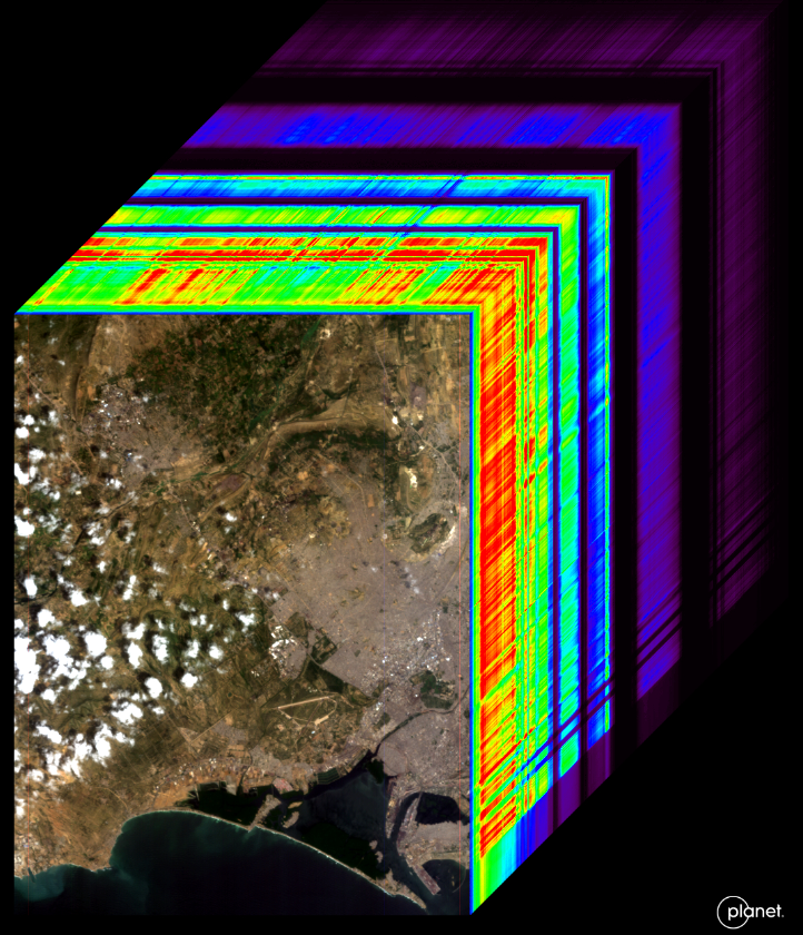
Planet Releases Tanager Hyperspectral Data for Public Exploration
Planet has made over 50 Tanager-1 hyperspectral radiance datasets openly available through its Open Data STAC platform. Tanager’s Dyson imaging spectrometer captures detailed surface information across the visible to shortwave infrared spectrum, revealing insights not visible in standard imagery. The datasets cover diverse environments such as farmlands, mining zones, glaciers, cities, and coastlines. They are already being used to monitor plant health, detect mineral signatures, assess water quality, and more. With plans to expand the collection and add surface reflectance products, this marks a big step toward broader access to high-resolution hyperspectral Earth data.
Read more here
NASA Demonstrates Modular Satellite Design to Speed Up Sensor Launches
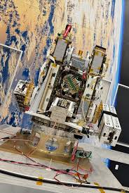
NASA is testing a new satellite architecture called Athena EPIC that promises to lower costs and shorten the time it takes to launch Earth observation instruments. Instead of building full satellites from scratch, Athena EPIC uses small modular units called HISats that share basic functions like power and processing. This setup allows sensor payloads to focus only on core measurements, making them smaller, cheaper, and easier to deploy. Built using spare parts from earlier missions, Athena EPIC is set to launch as a rideshare on a Falcon 9 rocket, potentially setting a new model for scalable satellite missions.
Read more here
Floodbase Rolls Out AI-Driven Flood Mapping Across the U.S.
Floodbase has launched a real-time flood mapping platform covering the entire continental U.S., delivering continuous flood insights powered by AI and satellite data. The system tracks both widespread events and local flash floods in near real time, helping emergency agencies, insurers, and news outlets make faster, more informed decisions. It builds on Floodbase’s earlier work with FEMA during Hurricane Helene, where it helped monitor over 500,000 square miles. The data is now available per event, allowing users to access detailed flood extents just days after impact.
Read more here
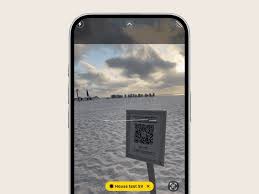
Tampa Bay Turns to AR to Engage Communities in Climate Planning
The Tampa Bay Regional Planning Council is using augmented reality to help residents visualize climate-resilient infrastructure before it’s built. Partnering with startup InCitu, the council showcased lifelike AR models of projects like elevated homes, bioswales, and living shorelines during its annual resiliency summit. Using just a smartphone, users can scan a QR code to explore full-scale 3D models on site. The approach is helping bridge the gap between complex planning documents and public understanding. Planners say AR is becoming a vital tool for outreach, education, and early engagement as cities prepare for future flood risks.
Read more here


Be the first to comment