• facebook
  • Twitter
  • Linkedin
  • Youtube
  • Linkedin Group
  • Post a Job
  • Post an Ad
  • Post an Event
  • Post a Directory Listing
  • Post a Press Release
  • Media Kit
  • My Account
  • Shopping Cart
  • Login
GoGeomatics
  • MAGAZINE
    • BIM & GIS
    • Community
    • Conference news
    • Earth Observation
    • Education & Careers
    • GEOAI
    • Announcements
    • Reality Capture & Lidar
    • Science
    • Technology
    • Between the Poles
  • Directories
    • ASSOCIATION
    • INDUSTRY
    • EDUCATION
    • Open Data
  • EVENTS
    • GeoIgnite Events
    • Events Calendar
    • GoGeomatics Meetups
  • Services
    • Advertising
    • Marketing
    • Post a Job
    • Post an Ad
    • Post an Event
    • Post a Press Release
    • Post a Directory Listing
    • Media Kit
    • Web Design
  • Find a Job
  • Volunteer
    • Start a GoGeomatics Group
    • Editors & Writers Group
  • About Us
    • About Us
    • Contact Us
    • Frequently Asked Questions
  • Videos
HomeEarth Observation

Earth Observation

BIM & GIS

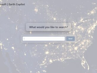
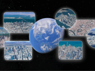
Cross-Modal Reasoning at Planetary Scale: The Rise of Google Earth AI

7 November 2025 Alefiya Dungrawala | BigQuery

As the planet’s challenges intensify, human innovation rises to meet them. However, unlocking timely and actionable insights from the vast volumes of Earth observation data demands more than traditional GIS platforms, which often face limitations […]

Earth Observation

Earth Copilot 2.0: NASA and Microsoft Harness AI to Unlock the Power of Planetary Data

7 November 2025 Alefiya Dungrawala | democratizing aerial data

Every minute, satellites orbiting Earth collect an extraordinary stream of information, more than 100 petabytes of Earth science data to date. These orbiting observers track everything from raging wildfires and shifting climate patterns to agricultural […]

BIM & GIS

International Geospatial Digest – November 3rd, 2025

3 November 2025 Volunteer Editors and Group Writers | aerospace collaboration

NASA’s SWOT Satellite Reveals the Most Detailed Maps of Earth’s Seafloor Yet Pakistan Enters a New Space Era with the Launch of Its First Hyperspectral Satellite Human Judgment Remains Central in the Era of Geospatial […]

Education survey results
BIM & GIS

Survey Reveals Deep Concern Over Canada’s Geomatics Education and Workforce Readiness

2 November 2025 GoGeomatics Canada | business

A new GoGeomatics survey on the State of Geomatics Education and Workforce Development in Canada reveals a sector deeply worried about the health of its education pipeline. With several college and university geomatics programs already […]

Geomatics, Procurement, and the New Canadian Economy
BIM & GIS

Survey Shows Strong Support for Procurement Reform Across Canada’s Geomatics Sector

31 October 2025 GoGeomatics Canada | business

A new GoGeomatics survey of professionals across Canada’s geomatics and geospatial community reinforces what we, and many across the sector, have been saying for some time: Canada’s procurement system is out of step with national […]

Vernon Singhroy Book
Earth Observation

A Conversation with Dr. Vernon Singhroy on Radar’s Future and His Book

29 October 2025 Farzaneh Farshad | #RemoteSensing

Radar technology has long been at the heart of how we observe, measure, and manage our planet. Few people have shaped that field as profoundly as Dr. Vernon Singhroy, President of EOSPATIAL Inc. and one […]

Earth Observation

Polar Paradigms 2045: Shaping the Future of Canada’s Arctic Defence

28 October 2025 GoGeomatics Canada | Arctic Defence

Ottawa, ON – The Department of National Defence (DND) is calling on visionary thinkers to participate in “Polar Paradigms 2045: Defending Canada’s Sovereignty” — a national contest inviting Canadians to craft hard science fiction essays […]

Earth Observation

Canadian Space Agency Awards $5.4 Million for HAWC Mission

28 October 2025 GoGeomatics Canada | Aerosol Limb Imager

Ottawa, ON, October 23, 2025 – The Canadian Space Agency (CSA) has awarded a $5.4 million contract to the Thin Ice Clouds and Far InfraRed Emissions (TICFIRE) instrument as part of Canada’s contribution to NASA’s […]

Posts pagination

« 1 … 4 5 6 … 25 »

Events

Notice
There are no upcoming events.

View All Events

Services

  • Post a Job
  • Post an Ad
  • Post an Event
  • Post a Directory Listing
  • Post a Press Release
  • Media Kit
  • My Account
  • Shopping Cart
  • Login

Jobs

Post a Job
  • Survey Technicians (Field and Office)
    Calgary, Alberta
  • Geospatial Analytical Technician / Technicien, analyses géospatiales; technicienne, analyses géospatiales
    Peterborough
  • Volunteer Editorial Contributor – Be Part of Canada’s Geomatics Story
    Remote
  • Jr. GIS Analyst
    Hamilton
View All Jobs
  • Directories
    • Associations Directory
    • Industry Directory
    • Education Programs
    • Open Data
  • Volunteer
    • Start a GoGeomatics Group
    • Editors & Writers Group
  • About Us
    • GoGeomatics Media Kit
    • Who We Are
    • Contact Us
    • FAQ’s
    • Advertising
    • Marketing
  • Subscribe
GoGeomatics
GoGeomatics is the largest and most popular communications hub promoting the Canadian geospatial community. The business was incorporated in 2011. GoGeomatics hosts over 100 fun, free, location technology networking events each year in cities across Canada.

© 2026 GoGeomatics

  • facebook
  • Twitter
  • Linkedin
  • Youtube
  • Linkedin Group