Conference news
The Canadian Hydrospatial Network: A Living System for Surface Water Intelligence
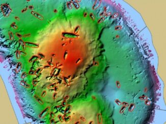
The Canadian Hydrospatial Network isn’t just a technical upgrade — it’s a reimagining of how Canada models, manages, and mobilizes its water data. In her GeoIgnite 2025 presentation, Colleen Fuss, Physical Science Specialist (Geomatics) and […]