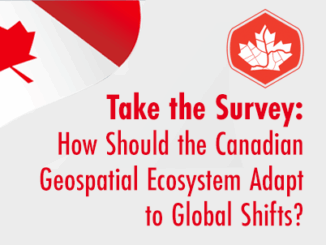
• facebook
  • Twitter
  • Linkedin
  • Youtube
  • Linkedin Group
  • Post a Job
  • Post an Ad
  • Post an Event
  • Post a Directory Listing
  • Post a Press Release
  • Media Kit
  • My Account
  • Login
GoGeomatics
  • MAGAZINE
    • BIM & GIS
    • Community
    • Conference news
    • Earth Observation
    • Education & Careers
    • GEOAI
    • Announcements
    • Reality Capture & Lidar
    • Science
    • Technology
  • Directories
    • ASSOCIATION
    • INDUSTRY
    • EDUCATION
    • Open Data
  • EVENTS
    • GeoIgnite Events
    • Events Calendar
    • GoGeomatics Meetups
  • Services
    • Advertising
    • Marketing
    • Post a Job
    • Post an Ad
    • Post an Event
    • Post a Press Release
    • Post a Directory Listing
    • Media Kit
    • Web Design
  • Find a Job
  • Volunteer
    • Start a GoGeomatics Group
    • Editors & Writers Group
  • About Us
    • About Us
    • Contact Us
    • Frequently Asked Questions
  • Videos
HomeReality Capture & Lidar

Reality Capture & Lidar

UAV Expo
Newsmakers & Press Releases

Commercial UAV Expo 2025 Call for Speakers is Open

25 February 2025 GoGeomatics Canada | Commercial UAV Expo 2025

PORTLAND, MAINE – USA, February 25, 2025 – Organizers of Commercial UAV Expo, have announced that the Call for Speakers is open, with a deadline of March 7 for all submissions. The Call for Speakers […]

International-Digest-Feb-24|||||||
BIM & GIS

International Geospatial Digest for February 24, 2025

24 February 2025 Volunteer Editors and Group Writers | drones

US Signals Potential Changes at NOAA UConn Researchers Tracking Change in Precious Ecosystems New UN Report Offers Insights into how Geospatial Technology can Advance Global Food Security Lost Cities of the Amazon: Science is Revealing […]

Lidar-Canex-2025-flood-mapping|Lidar-data-aquisition||||
Reality Capture & Lidar

Lidar Data Acquisitions in Support of Flood Mapping in Canada from LidarCANEX 2025

24 February 2025 Kruti Mehta | Climate Change

Flooding is Canada’s most financially devastating natural disaster, causing extensive damage to communities, infrastructure, and ecosystems. Despite the importance of flood hazard maps for understanding and mitigating risks, many areas in Canada lack up-to-date maps, […]

Keeping it CLASS(y) and Having a BLAST with NV5
Conference news

Lidar CANEX 2025: Keeping it CLASS(y) and Having a BLAST with NV5

21 February 2025 Benedicta Antwi Boasiako | Airborne Sensing Technology

At Lidar CANEX 2025, NV5 made waves with their newest Lidar developments, introducing two innovative solutions aimed at solving real-world mapping challenges. The premier B2B online forum held on January 29, 2025, brought together experts […]

GeoWeek photo|geoWeek
BIM & GIS

Geo Week Continues to Break Attendance Records; Sold Out Exhibit Hall Floor Largest in Event History

21 February 2025 GoGeomatics Canada | 3D

Leading geospatial event gathered 3200+ professionals and 215 solutions providers in Denver, CO Denver, CO, February 21, 2025: Thousands of geospatial and mapping professionals gathered for Geo Week, held February 10-12, 2025, at the Colorado […]

AI-driven-LidarMapping|||
Conference news

Lidar CANEX 2025: AI-driven Lidar Mapping

20 February 2025 Alefiya Dungrawala | AI classification

One of the highlights of Lidar CANEX 2025 was AI-driven Lidar mapping, along with a series of other intriguing topics. The premier B2B online forum held on January 29, 2025, brought together experts in Lidar […]

Community

A Huge Thank You to All Who Made LidarCANEX 2025 a Success!

7 February 2025 GoGeomatics Canada | 3D

  A big thank you to all the sponsors, speakers, and attendees who contributed to the success of LidarCANEX 2025! Over January 29-30, we had the opportunity to engage with experts across the Lidar and […]

Reality Capture & Lidar

Uncovering the Past: How LiDAR Technology is Revolutionizing Archaeology

31 January 2025 Alicia Schrader | 3D Mapping

Introduction Mapping and history have been entwined since the first came to be. Maps have allowed humans to expand and record their exploration. Pushing the boundaries of territories and countries and recording the expansion of […]

Posts pagination

« 1 … 7 8 9 10 »

Events

Notice
There are no upcoming events.

View All Events

Services

  • Post a Job
  • Post an Ad
  • Post an Event
  • Post a Directory Listing
  • Post a Press Release
  • Media Kit
  • My Account
  • Login

Jobs

Post a Job
  • Canada Maps and Poster Gallery Volunteer Leads — GeoIgnite 2026
    remote
  • GIS & Data Analytics Lead
    Beaumont, AB
  • Lead Surveyor, Projects/Arpenteur-géomètre principal, projets; arpenteuse-géomètre principale, projets
    North Bay, Thunder Bay
  • Senior GIS Developer
    Calgary, AB
View All Jobs
  • Directories
    • Associations Directory
    • Industry Directory
    • Education Programs
    • Open Data
  • Volunteer
    • Start a GoGeomatics Group
    • Editors & Writers Group
  • About Us
    • GoGeomatics Media Kit
    • Who We Are
    • Contact Us
    • FAQ’s
    • Advertising
    • Marketing
  • Subscribe
GoGeomatics
GoGeomatics is the largest and most popular communications hub promoting the Canadian geospatial community. The business was incorporated in 2011. GoGeomatics hosts over 100 fun, free, location technology networking events each year in cities across Canada.

© 2025 GoGeomatics

  • facebook
  • Twitter
  • Linkedin
  • Youtube
  • Linkedin Group