• facebook
  • Twitter
  • Linkedin
  • Youtube
  • Linkedin Group
  • Post a Job
  • Post an Ad
  • Post an Event
  • Post a Directory Listing
  • Post a Press Release
  • Media Kit
  • My Account
  • Shopping Cart
  • Login
GoGeomatics
  • MAGAZINE
    • BIM & GIS
    • Community
    • Conference news
    • Earth Observation
    • Education & Careers
    • GEOAI
    • Announcements
    • Reality Capture & Lidar
    • Science
    • Technology
    • Between the Poles
  • Directories
    • ASSOCIATION
    • INDUSTRY
    • EDUCATION
    • Open Data
  • EVENTS
    • GeoIgnite Events
    • Events Calendar
    • GoGeomatics Meetups
  • Services
    • Advertising
    • Marketing
    • Post a Job
    • Post an Ad
    • Post an Event
    • Post a Press Release
    • Post a Directory Listing
    • Media Kit
    • Web Design
  • Find a Job
  • Volunteer
    • Start a GoGeomatics Group
    • Editors & Writers Group
  • About Us
    • About Us
    • Contact Us
    • Frequently Asked Questions
  • Videos
HomeReality Capture & Lidar

Reality Capture & Lidar

Addressing-the-Growing|DIRT Report 2023|SUE|DIRT 2|SUE2
BIM & GIS

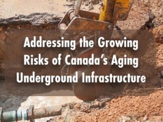
Addressing the Growing Risks of Canada’s Aging Underground Infrastructure

14 March 2025 Anusuya Datta | BIM

Did you know that in 2023 alone, almost 10,000 incidents of damage to buried facilities were reported from excavation activities in Canada? In nearly 80% of cases, these incidents affected essential utilities like natural gas […]

Early bird Expo tickets
BIM & GIS

Early Bird Tickets Available for Canada’s National Geomatics Expo 2025!

10 March 2025 GoGeomatics Canada | 3D modelling

Get ready for Canada’s National Geomatics Expo 2025, happening from November 3-5, 2025, at the Big Four Roadhouse in Calgary! Early bird tickets are available now for just $275 CAD (or $200 USD*). This exclusive […]

Take the survey
BIM & GIS

Take the Survey: How Should the Canadian Geospatial Ecosystem Adapt to Global Shifts?

27 February 2025 GoGeomatics Canada | business

The global alliances that have shaped international relations for decades are being redefined. A looming trade conflict with the USA, shifting supply chains, and the potential for new partnerships are presenting both challenges and opportunities […]

Lidar CANEX 2025 Panel:
Conference news

Lidar CANEX 2025 Panel: Exploring the Current and Future Landscape of Lidar Projects in Canada

26 February 2025 Alicia Schrader | Canada

A distinguished panel of experts from various sectors gathered at Lidar CANEX 2025, to discuss the evolving landscape of Lidar technology in Canada. The premier B2B online forum was held on January 29. LidarCANEX is Canada’s […]

Aviation-Safety-101||||
Conference news

Lidar CANEX 2025: Aviation Safety 101 – Aircraft Selection and Job Safety

25 February 2025 David Legris | Adverse Weather

LidarCANEX 2025 brought together industry professionals and experts to share the latest advancements in LiDAR technology. Held on January 29, 2025, the virtual event featured an exciting lineup of presentations, offering valuable insights into a […]

UAV Expo
Newsmakers & Press Releases

Commercial UAV Expo 2025 Call for Speakers is Open

25 February 2025 GoGeomatics Canada | Commercial UAV Expo 2025

PORTLAND, MAINE – USA, February 25, 2025 – Organizers of Commercial UAV Expo, have announced that the Call for Speakers is open, with a deadline of March 7 for all submissions. The Call for Speakers […]

International-Digest-Feb-24|||||||
BIM & GIS

International Geospatial Digest for February 24, 2025

24 February 2025 Volunteer Editors and Group Writers | drones

US Signals Potential Changes at NOAA UConn Researchers Tracking Change in Precious Ecosystems New UN Report Offers Insights into how Geospatial Technology can Advance Global Food Security Lost Cities of the Amazon: Science is Revealing […]

Lidar-Canex-2025-flood-mapping|Lidar-data-aquisition||||
Reality Capture & Lidar

Lidar Data Acquisitions in Support of Flood Mapping in Canada from LidarCANEX 2025

24 February 2025 Kruti Mehta | Climate Change

Flooding is Canada’s most financially devastating natural disaster, causing extensive damage to communities, infrastructure, and ecosystems. Despite the importance of flood hazard maps for understanding and mitigating risks, many areas in Canada lack up-to-date maps, […]

Posts pagination

« 1 … 7 8 9 10 »

Events

Notice
There are no upcoming events.

View All Events

Services

  • Post a Job
  • Post an Ad
  • Post an Event
  • Post a Directory Listing
  • Post a Press Release
  • Media Kit
  • My Account
  • Shopping Cart
  • Login

Jobs

Post a Job
  • GIS Technician
    Sudbury, Ontario
  • Asset/GIS Coordinator
    Edson, AB
  • Civic Operations GIS Technologist (Permanent, Full-Time) – 1953
    Kamloops, British Columbia
  • Senior Manager, Data Science – Geospatial
    Mississauga, Ontario
View All Jobs
  • Directories
    • Associations Directory
    • Industry Directory
    • Education Programs
    • Open Data
  • Volunteer
    • Start a GoGeomatics Group
    • Editors & Writers Group
  • About Us
    • GoGeomatics Media Kit
    • Who We Are
    • Contact Us
    • FAQ’s
    • Advertising
    • Marketing
  • Subscribe
GoGeomatics
GoGeomatics is the largest and most popular communications hub promoting the Canadian geospatial community. The business was incorporated in 2011. GoGeomatics hosts over 100 fun, free, location technology networking events each year in cities across Canada.

© 2026 GoGeomatics

  • facebook
  • Twitter
  • Linkedin
  • Youtube
  • Linkedin Group