
Geospatial Intelligence (GEOINT) is a cornerstone of modern decision-making, supporting defence, environmental resilience, and public safety. Canada, with its vast geography and unique challenges—from Arctic sovereignty to climate-driven disasters—relies heavily on GEOINT to address both strategic and operational needs.
In Canada, GEOINT is a critical component of national security, defence, and public service operations. Several government departments and agencies are actively involved in the collection, analysis, and dissemination of geospatial data.
Canada’s GEOINT framework is decentralized, with key government agencies, research institutions, and international partners contributing to its success. While this structure enables flexibility, it also presents opportunities to strengthen coordination and integration. This article maps Canada’s GEOINT landscape, highlighting its players, areas of strength, and pathways to address existing gaps.
GEOINT Players in Canada: A Collaborative Network
Canada’s GEOINT ecosystem is built on a foundation of collaboration among diverse organizations, each playing a distinct yet interconnected role. These players—ranging from direct generators and users of geospatial data to supporting stakeholders and research innovators—ensure that Canada can address its unique geographic and security challenges.
By combining defence capabilities, environmental monitoring, and technological innovation, this network supports critical national priorities, including Arctic sovereignty, disaster resilience, and sustainable resource management. The strength of Canada’s GEOINT landscape lies in its ability to harness expertise across government agencies, research institutions, and industry partnerships to provide actionable intelligence where it is needed most.
The following sections outline the three key pillars of Canada’s GEOINT network: Core Generators and Users, Supporting Stakeholders, and Research and Innovation Leaders—each contributing to a dynamic, multi-faceted framework.
Core GEOINT Generators and Users
At the heart of Canada’s GEOINT ecosystem are the organizations directly responsible for generating and leveraging geospatial data to fulfill mandates critical to national defence, environmental monitoring, and public safety. These agencies provide foundational intelligence that supports decision-making across government operations.
Their work spans the collection of raw data—using advanced tools like satellite imagery, unmanned aerial vehicles (UAVs), and sensors —to transforming it into actionable intelligence. This intelligence supports key government operations, such as monitoring border security, predicting climate-related hazards, and responding to national security threats.
- Canadian Armed Forces (CAF): A key user and generator of GEOINT, CAF focuses on Arctic surveillance, national security, and defence operations in collaboration with allies like NORAD and NATO.
- Canadian Forces Intelligence Command (CFINTCOM): Provides credible, timely, and integrated defence intelligence capabilities, products, and services to support Canada’s national security objectives. It is responsible for management of defence intelligence partnerships and policy oversight, and provision of geospatial intelligence to support military operations and decision-making.
- Mapping and Charting Establishment (MCE): A unit within the Canadian Forces Intelligence Command that provides geospatial information and geomatics support to the defence ream and other government departments. Relevant focus areas include production of topographic maps and geospatial data for military and civilian use, and support for operational planning and situational awareness through geospatial intelligence.
- Canadian Forces Joint Imagery Centre (CFJIC): Within CFINTCOM, the CFJIC, provides imagery and imagery intelligence support to the Canadian Armed Forces. Additionally, the Canadian Forces National Counter-Intelligence Unit addresses threats posed by foreign intelligence services and other entities.
- Canadian Forces Intelligence Command (CFINTCOM): Provides credible, timely, and integrated defence intelligence capabilities, products, and services to support Canada’s national security objectives. It is responsible for management of defence intelligence partnerships and policy oversight, and provision of geospatial intelligence to support military operations and decision-making.
- Natural Resources Canada (NRCan): Natural Resources Canada (NRCan) plays a vital role in ensuring the sustainable development and management of Canada’s natural resources, including energy, forests, minerals, and metals. Leveraging its expertise in Earth Sciences, NRCan also maintains a comprehensive and up-to-date knowledge base of Canada’s landmass and resource wealth.
- Canada Centre for Mapping and Earth Observation (CCMEO): A branch of NRCan, CCMEO is responsible for remote sensing and the development of geospatial data and applications, including the maintenance of the Atlas of Canada. Provides remotely sensed geographical information to decision-makers; constructs remote sensing technology and applications; collaborates on the Canadian Geospatial Data Infrastructure.
- Geological Survey of Canada (GSC): As part of NRCan, the GSC conducts research and provides geospatial data on geology, including mapping natural resources, geological hazards, and environmental conditions. Monitors mineral and energy resources; maps geological risks and hazards, including seismic activity and land erosion.
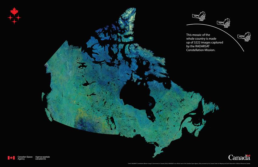
- Canadian Space Agency (CSA): The Canadian Space Agency (CSA) is dedicated to advancing the peaceful use and development of space, fostering scientific exploration, and ensuring that space science and technology contribute to the social and economic well-being of Canadians. Through a range of initiatives, the CSA drives innovation in space exploration, satellite technology, and space-based research, providing valuable insights into Earth’s environment, natural resources, and global security. By collaborating with international space agencies and industry partners, the CSA plays a pivotal role in enhancing Canada’s leadership in space and ensuring its strategic role in global space activities.
- Public Safety Canada: The federal department responsible for national security, emergency management, and public safety, Public Safety Canada relies on GEOINT to coordinate emergency response efforts, including monitoring and managing wildfires, floods, and other climate-related disasters. It utilizes geospatial data for real-time situational awareness, disaster planning, and resource allocation, and collaborates with agencies such as Environment and Climate Change Canada (ECCC) and Natural Resources Canada (NRCan) to integrate GEOINT into disaster resilience and recovery strategies.
- Royal Canadian Mounted Police (RCMP): The RCMP is a federal law enforcement agency under the jurisdiction of Public Safety Canada. It leverages GEOINT to support crime mapping, intelligence-led policing, and the monitoring of critical areas. Utilizes geospatial data to identify crime patterns, enhance public safety, and assist in tactical decision-making. Collaborates with other agencies to integrate GEOINT into national and local law enforcement strategies.
- Canada Border Services Agency (CBSA): Also under the jurisdiction of Public Safety Canada, CBSA employs GEOINT for risk assessment, border security, and the monitoring of goods and travelers. It uses GEOINT to identify high-risk areas, track illicit activities, and improve situational awareness at borders, and collaborates with allied organizations, such as RCMP and international partners, to share geospatial data and strengthen border management efforts.
- Canadian Security Intelligence Service (CSIS): As Canada’s primary national intelligence agency, CSIS integrates geospatial intelligence (GEOINT) into its operations to collect, analyze, and interpret critical information for protecting national security. It utilizes GEOINT to monitor threats to critical infrastructure, assess foreign interference, and address emerging security challenges, including in the Arctic regions, and collaborates with allied intelligence agencies and other federal departments to enhance intelligence-sharing and geospatial data utilization for national defence and security strategies.
These agencies not only generate foundational datasets but also integrate cutting-edge technologies like artificial intelligence (AI) and big data analytics to enhance the precision, speed, and usability of geospatial information. They provide policymakers, emergency responders, and defence officials with the tools they need to make informed, data-driven decisions in real time. By collaborating with other departments, research bodies, and international partners, these core GEOINT generators ensure that Canada can effectively monitor its territorial integrity, respond to emerging crises, and adapt to the challenges of an ever-changing environment.
Key Supporting Stakeholders
Beyond the primary GEOINT producers and users, Canada’s broader network of stakeholders integrates geospatial intelligence into their operations. These agencies address environmental, economic, and social challenges that require a deep understanding of Canada’s dynamic landscape.
- Canadian Environmental Assessment Agency (CEAA): Conducts environmental assessments of major projects, utilizing geospatial data to evaluate potential impacts on ecosystems. Integrates GEOINT for environmental assessments; coordinates with Natural Resources Canada (NRCan) and Environment and Climate Change Canada (ECCC) for geospatial data on environmental projects.
- Environment and Climate Change Canada (ECCC): Monitors and addresses environmental and climate challenges across Canada, utilizing geospatial data to track and predict weather patterns, assess climate impacts, and manage natural resources. It integrates GEOINT for initiatives such as wildfire and smoke tracking (risks using tools like the Canadian Wildland Fire Information System (CWFIS), flood mapping, and biodiversity conservation. Collaborates with NRCan and other agencies to ensure access to geospatial intelligence for environmental policy-making and disaster preparedness.
- Canadian Council on Geomatics (CCOG): The major federal-provincial-territorial consultative body for geographic information management, overseeing initiatives like GeoBase to ensure access to quality geospatial data for Canada. It coordinates efforts among various government levels to manage and share geospatial information; promotes the development of best practices and standards in geomatics.
- Polar Knowledge Canada (POLAR): Enhances Arctic situational awareness by conducting localized research on environmental changes, infrastructure impacts, and ecosystem dynamics. POLAR utilizes GEOINT to monitor Arctic conditions and support sustainable development, and collaborates with Indigenous communities to integrate traditional knowledge with geospatial data, ensuring a holistic approach to Arctic resilience and policy-making.
- Fisheries and Oceans Canada (DFO): Utilizes GEOINT for maritime monitoring and management, including tracking Arctic ice conditions, monitoring vessel activity, and ensuring safe navigation. DFO plays a key role in protecting marine ecosystems through mapping marine protected areas and assessing coastal erosion. Collaborates with other agencies to integrate geospatial data for sustainable fisheries, ecosystem conservation, and maritime safety.
- Canadian Coast Guard (CCG): Part of the DFO, the CCG maintains navigational safety, conducts search and rescue operations, and protects marine environments in Canadian waters. The CCG uses GEOINT for maritime monitoring, including Arctic shipping lanes and coastal erosion; coordinates with DFO for fisheries monitoring and environmental management.
- Transport Canada: Utilizes GEOINT to assess and adapt critical transportation infrastructure to the impacts of climate change and environmental hazards, and collaborates with other agencies to integrate geospatial data for maritime safety, logistics planning, and infrastructure resilience.
- Canadian Transportation Safety Board (TSB): An independent agency that investigates and provides safety recommendations for transportation accidents, including rail, air, marine, and pipeline incidents, using geospatial data for analysis and risk assessment. The TSB employs geospatial data for accident investigation and safety enhancement in transportation; coordinates with Transport Canada for rail and aviation safety.
- Agriculture and Agri-Food Canada (AAFC): Utilizes geospatial data to monitor agricultural land, crop health, and environmental conditions affecting food production. It employs satellite imagery and GIS for agricultural monitoring and crop prediction; integrates climate change models with geospatial data for food security analysis.
- Canadian Nuclear Safety Commission (CNSC): Regulates and ensures the safe use of nuclear energy and materials in Canada, monitoring environmental impacts of nuclear operations through geospatial data. It also monitors environmental conditions of nuclear sites and surrounding areas; integrates geospatial intelligence for nuclear safety and emergency response.
- Canada Mortgage and Housing Corporation (CMHC): Provides geospatial data to assist with housing and urban development, including tracking land use and residential developments. Applies geospatial intelligence in housing market analysis and urban planning; conducts environmental impact studies for residential areas and infrastructure.
- Global Affairs Canada: Manages Canada’s diplomatic and consular relations, overseeing international trade, development, and security, leveraging geospatial intelligence in diplomatic and security analysis. Utilizes GEOINT for assessing geopolitical risks and humanitarian interventions; employs satellite data for global environmental and conflict monitoring.
These agencies bridge the gap between geospatial data and actionable insights for disaster response, climate resilience, and infrastructure management, often working in tandem with core GEOINT players.
Research and Innovation: Advancing GEOINT in Canada
Canada’s ability to stay ahead in the GEOINT space depends on a strong foundation of research and technological innovation. Cutting-edge advancements in data collection, analysis, and delivery are driven by key research organizations and initiatives that connect government, academia, and industry.
- Defence Research and Development Canada (DRDC): Defence Research and Development Canada (DRDC) is Canada’s leader in science, technology, and innovation for defence and security. As a trusted advisor, collaborative partner, and knowledge integrator, DRDC develops and delivers cutting-edge technical solutions and expert advice to the Department of National Defence, the Canadian Armed Forces, and other federal departments. DRDC works closely with partners in academia, government, industry, and Canada’s international allies to enhance the safety and security of Canadians. Through its research and development efforts, DRDC contributes to advancing Canada’s defence capabilities and ensuring national security.
- Innovation, Science, and Economic Development Canada (ISED): Innovation, Science and Economic Development Canada (ISED) is dedicated to fostering economic growth, innovation, and development across Canada. ISED collaborates across departments and regions to improve investment conditions, boost Canada’s innovation performance, increase global trade, and create a fair, efficient, and competitive marketplace. As the lead federal institution for the Innovation, Science, and Economic Development portfolio, ISED plays a crucial role in shaping policies and initiatives that support Canada’s economic prosperity and innovation-driven future.
- Natural Sciences and Engineering Research Council (NSERC): The NSERC is dedicated to funding visionary scientists, engineers, and innovators who are driving scientific and technical breakthroughs that benefit Canada. As the country’s largest supporter of discovery and innovation, NSERC collaborates with universities, colleges, businesses, and not-for-profit organizations to remove barriers, create opportunities, and attract new expertise to strengthen Canada’s research community. By providing Canadian scientists and engineers with the resources to explore new frontiers, NSERC fosters research that knows no boundaries, helping to push the limits of knowledge and innovation for the benefit of all.
By fostering innovation in geospatial data science, sensor technology, and artificial intelligence, these organizations ensure that Canada can leverage GEOINT to address emerging challenges such as climate variability, Arctic sovereignty, and national security.
The International Dimension: Collaboration as a Strength
Canada’s GEOINT capabilities are not developed in isolation. Given the country’s vast geography, complex environmental challenges, and evolving security landscape, international collaboration serves as a force multiplier, enhancing Canada’s ability to collect, analyze, and act on geospatial intelligence. Partnerships with global allies and organizations provide access to advanced satellite systems, technologies, and shared expertise, enabling Canada to address issues beyond its national borders—particularly in areas like Arctic monitoring, disaster resilience, and climate change adaptation.
Canada’s participation in international frameworks, such as the Five Eyes Alliance and global initiatives like the Arctic Council, ensures it remains connected to the evolving GEOINT ecosystem. These partnerships foster intelligence-sharing, joint research, and access to critical resources during natural disasters and security crises.
The strength of Canada’s international collaboration lies in its ability to pool resources, leverage expertise, and share geospatial data with trusted partners, creating a stronger, more resilient GEOINT network that benefits both Canada and the global community.
The following section highlights the key international players and organizations that support and complement Canada’s GEOINT efforts.
- Five Eyes Alliance: The Five Eyes is an intelligence alliance composed of Australia, Canada, New Zealand, the United Kingdom and the United States. These partner countries share a broad range of intelligence with one another in one of the world’s most unified multilateral arrangements.
- Arctic Council: The Arctic Council is an intergovernmental forum that promotes cooperation and coordination among Arctic states and Indigenous communities to address pressing issues facing the Arctic region. It focuses on sustainable development, environmental protection, and enhancing the well-being of Arctic inhabitants.
- European Space Agency (ESA): Canada actively participates in several programs of the European Space Agency (ESA), contributing to key areas such as satellite communications, Earth Observation, exploration, navigation, and the development of advanced technologies. Through these collaborations, Canada enhances its capabilities in space while fostering international cooperation in space research and innovation.
- International Charter on Space and Major Disasters: The Charter is a collaborative initiative that provides free satellite data to support emergency response efforts during natural and man-made disasters. By leveraging space technology, the Charter aids in disaster management, helping authorities make informed decisions to save lives and reduce damage.
Such collaborations allow Canada to enhance its global reach, access advanced data, and strengthen its capabilities.


Be the first to comment