A “Holistic Understanding of Water in Our World”

At the March 1, 2022, GeoIgnite, Winter Geo conference, Sven Cowan, Canada Program Manager at NV5 Geospatial, and Mischa Hey, Practice Lead at Analytics at NV5 Geospatial, jointly presented during a livestream on how remote sensing and analytics support hydrospatial solutions.

Cowan began the talk by discussing NV5 Geospatial’s role. NV5 Geospatial (once called Quantum Spatial Canada)is a pioneer in the acquisition of hydrospatial data. Their data collection helps solve issues with flood risk modeling, habitat suitability assessment and monitoring, and hydrology.
NV5’s core markets are wide-area mapping, forestry, utilities, and Hydrospatial. They added Geodynamics in the past year. Now they can do their terrestrial surveys with fixed or rotary systems and UAS platforms.
Hey spoke about topobathymetric Lidar surveys and a recent workshop on that topic. He said the United Nations Water Agency stated, “Water is the primary medium through which we will all feel the effects of climate change, whether through absence or excess.”

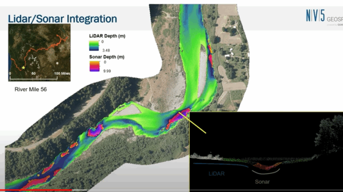
Hey also talked about acquisition technologies, data integration and analysis, application examples, and philosophical drivers. He gave information on Lidar/Sonar integration, thermal infrared uses, and what he calls, the “Anthrocentric” water cycle that maps the source, transport, storage, and use of water.
Hey discussed how remote sensing technologies and analytics provide invaluable information to water source managers. There are also viable market offerings to reduce labour and time, such as Cloud compute and advanced analytics. Hey believes the integration of source, transport, use, storage, habitat, and inundation will help create a holistic understanding of water.
A deep, heartfelt thank you to NV5 Geospatial, a Silver Sponsor for Canada’s National Geospatial Conference, GeoIgnite, Winter Geo.
An intriguing Q and A session followed the Winter Geo livestream. You can watch this entire presentation on Youtube below.


Be the first to comment