
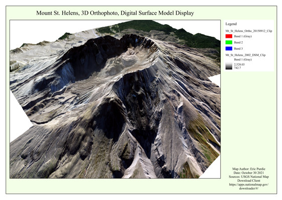
Have you wondered how Google is able to create the 3D models? Now you can do it yourself using QGIS. I’m teaching a course that will enable you to process LiDAR and orthophotos and create a 3D scenes using QGIS.
If you are interested in upgrading your skills. The course will take place online Monday, November 29th.
This Remote Sensing Applications in QGIS course has been designed to teach you to take advantage of the many excellent open-source GIS software programs now available. The instructions provided are clear, concise, and fully illustrated with many screenshots to guide a user through the various in-class activities steps. They include practical, hands-on, activities, training students in the use of QGIS and associated plugins.
Using Climate Change Data to Learn how to use QGIS
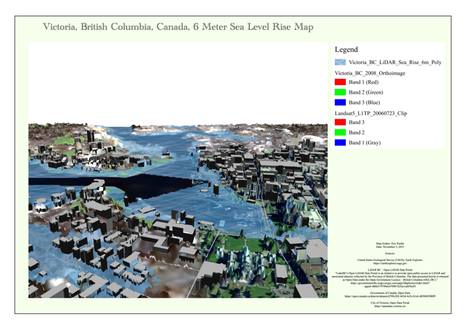
One in-class activity (there are many more) includes a study of sea-level rise in Victoria, BC. The sequence of scenes, shows the sea level rising by 2, 4, 6, 8, and 10 metres. An increase of this magnitude may appear exaggerated at the present time, but the IPCC has predicted that sea-level rise will continue for centuries and millennia even if CO2 emissions stop. During the last interglacial warm spell, the sea level increased by 8.5 metres before the climate changed to an ice age.
There are many possible applications of GIS in other areas. For example, in view of the increasing frequency and severity of extreme weather events, it would be possible to determine the vulnerability of towns and cities to risks such as flooding, wind damage, and wildfires.
Remote Sensing Applications in QGIS Half-Day Course
If you are interested in upgrading your skills. This course will take place Monday Nov 29th, 11:00am – 6:00pm (6 hours).


Be the first to comment