• facebook
  • Twitter
  • Linkedin
  • Youtube
  • Linkedin Group
  • Post a Job
  • Post an Ad
  • Post an Event
  • Post a Directory Listing
  • Post a Press Release
  • Media Kit
  • My Account
  • Login
GoGeomatics
  • MAGAZINE
    • BIM & GIS
    • Community
    • Conference news
    • Earth Observation
    • Education & Careers
    • GEOAI
    • Announcements
    • Reality Capture & Lidar
    • Science
    • Technology
  • Directories
    • ASSOCIATION
    • INDUSTRY
    • EDUCATION
    • Open Data
  • EVENTS
    • GeoIgnite Events
    • Events Calendar
    • GoGeomatics Meetups
  • Services
    • Advertising
    • Marketing
    • Post a Job
    • Post an Ad
    • Post an Event
    • Post a Press Release
    • Post a Directory Listing
    • Media Kit
    • Web Design
  • Find a Job
  • Volunteer
    • Start a GoGeomatics Group
    • Editors & Writers Group
  • About Us
    • About Us
    • Contact Us
    • Frequently Asked Questions
  • Videos
HomeArchaeology GIS

Archaeology GIS

Technology

Past, Present, and Potential Future of Surveying

22 February 2024 George Petropoulos | Archaeology GIS

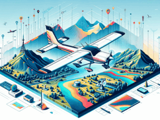
Field surveying is the trade behind many construction and engineering projects globally. From buildings, to railways, and resource based industries, the trade is widely used across many professions as a starting and ending point for […]

Technology

International Geospatial Digest for Feb 5th, 2024

5 February 2024 Volunteer Editors and Group Writers | Antarctica

Climate change could affect major port cities on America’s East Coast Thousands of Emperor Penguins discovered by satellite Unlocking new possibilities through geospatial data URISA’s GISCorps 2023: The Year in Review ESCAP Tool Supports Geospatial […]

Technology

CANADA’S NATIONAL ELEVATION DATA STRATEGY UPDATE NOVEMBER 2023

18 December 2023 David Belanger | airborne topo-bathymetric

Fall 2023 LIDAR ACQUISITIONS 2023 IN SUPPORT OF THE FLOOD HAZARD IDENTIFICATION AND MAPPING PROGRAM (FHIMP) Since 2021, Natural Resources Canada (NRCan) has been leading the Flood Hazard Identification and Mapping Program (FHIMP) in partnership […]

Community

Land Survey Project Management Software: Cyanic Job Book

14 December 2023 Michael Heath | Archaeology GIS

Land Surveying Management Software The GoGeomatics workshop on November 7, 2023, led by industry veteran and Cyanic Automation founder Doug Kondor, offered insights into project management specifically tailored for the surveying and geospatial industry. The […]

Technology

CHORUS – A Next-Generation Earth Observation Constellation to Tackle Our Planet’s Biggest Challenges

12 December 2023 MDA | Archaeology GIS

Access to space-based information, in near real-time, about both natural and human-caused disasters, including earthquakes, hurricanes, oil spills and flooding, provides decision-makers with actionable insights to address some of the world’s most pressing challenges. CHORUS, […]

Community

Happy Holidays From all of us at GoGeomatics Canada

12 December 2023 Jon Murphy | Archaeology GIS

On behalf of the entire team at GoGeomatics: This festive season, we want to express our deepest appreciation for your contribution to the GoGeomatics Canada community. Your involvement has been instrumental in making our platform […]

Community

Jonathan Murphy Joins the Board of buildingSMART Canada

4 December 2023 GoGeomatics Canada | Archaeology GIS

I’m grateful and honored to announce my acceptance of a position on the Board of Directors of buildingSmart Canada. For those unfamiliar, buildingSmart Canada stands as a preeminent organization dedicated to the development and implementation […]

Education & Careers

Dr. Bob Maher, accepts position of Geographer Emeritus at COGS in Lawrencetown.

21 November 2023 Robert Maher | Archaeology GIS

In late October, the Centre of Geographic Sciences (COGS) made a noteworthy announcement to our esteemed faculty and students: I, Dr. Bob Maher, am honored to assume the position of Geographer Emeritus at COGS in […]

Posts pagination

1 2 … 20 »

Events

Notice
There are no upcoming events.

View All Events

Services

  • Post a Job
  • Post an Ad
  • Post an Event
  • Post a Directory Listing
  • Post a Press Release
  • Media Kit
  • My Account
  • Login

Jobs

Post a Job
  • Canada Maps and Poster Gallery Volunteer Leads — GeoIgnite 2026
    remote
  • GIS & Data Analytics Lead
    Beaumont, AB
  • Lead Surveyor, Projects/Arpenteur-géomètre principal, projets; arpenteuse-géomètre principale, projets
    North Bay, Thunder Bay
  • Senior GIS Developer
    Calgary, AB
View All Jobs
  • Directories
    • Associations Directory
    • Industry Directory
    • Education Programs
    • Open Data
  • Volunteer
    • Start a GoGeomatics Group
    • Editors & Writers Group
  • About Us
    • GoGeomatics Media Kit
    • Who We Are
    • Contact Us
    • FAQ’s
    • Advertising
    • Marketing
  • Subscribe
GoGeomatics
GoGeomatics is the largest and most popular communications hub promoting the Canadian geospatial community. The business was incorporated in 2011. GoGeomatics hosts over 100 fun, free, location technology networking events each year in cities across Canada.

© 2025 GoGeomatics

  • facebook
  • Twitter
  • Linkedin
  • Youtube
  • Linkedin Group