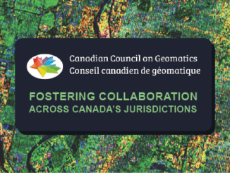
• facebook
  • Twitter
  • Linkedin
  • Youtube
  • Linkedin Group
  • Post a Job
  • Post an Ad
  • Post an Event
  • Post a Directory Listing
  • Post a Press Release
  • Media Kit
  • My Account
  • Login
GoGeomatics
  • MAGAZINE
    • BIM & GIS
    • Community
    • Conference news
    • Earth Observation
    • Education & Careers
    • GEOAI
    • Announcements
    • Reality Capture & Lidar
    • Science
    • Technology
  • Directories
    • ASSOCIATION
    • INDUSTRY
    • EDUCATION
    • Open Data
  • EVENTS
    • GeoIgnite Events
    • Events Calendar
    • GoGeomatics Meetups
  • Services
    • Advertising
    • Marketing
    • Post a Job
    • Post an Ad
    • Post an Event
    • Post a Press Release
    • Post a Directory Listing
    • Media Kit
    • Web Design
  • Find a Job
  • Volunteer
    • Start a GoGeomatics Group
    • Editors & Writers Group
  • About Us
    • About Us
    • Contact Us
    • Frequently Asked Questions
  • Videos
HomeCanada

Canada

||||||||||
Technology

New interactive atlas paints a picture of how climate change will impact the globe and what this means for Canada

22 October 2021 Crystal Fitzpatrick | Canada

The latest Intergovernmental Panel on Climate Change (IPCC) sixth assessment report warns about the future of our planet under the impacts of climate change. Following the findings from the last report, measured in 2011, this […]

|||
Technology

NV5 Geospatial Supports Flood Risk Mapping in Montreal Through Canada’s Largest Riverine Topobathymetric Lidar Survey

20 October 2021 Sven Cowan | Canada

The Greater Montréal Area completed Canada’s largest-ever riverine topobathymetric lidar survey inresponse to two major flooding events within the last five years, which together displaced tens ofthousands from their homes and cost millions to local […]

Newsmakers & Press Releases

Two Great Sessions / Présentation de deux grandes sessions ‘A Roadmap for Data Across Canada’ & ‘Data Liberation Matters’

17 October 2021 GoGeomatics Newsmakers | bilingual

Register Today! Presenting Two Great Sessions from the Canadian Open Data Summit:‘A Roadmap for Data Across Canada’ and ‘Data Liberation Matters’(Français ci-dessous)The Society’s learning opportunity this month includes a pair of sessions from the Canadian […]

|
Education & Careers

Launch of new Canadian Geospatial Training Site: GeoTechTraining

1 October 2021 Jon Murphy | Canada

I’m pleased to announce the launch of our new Geospatial training platform GeoTechTraining.com. GoGeomatics is a constantly evolving enterprise that responds to the needs of the community. The success of the workshop week during GeoIgnite […]

CAG|CAGONT|
Community

Nominations open for Service to Ontario Geography Award 2021

30 September 2021 GoGeomatics Canada | CAG

CAGONT stands for the Canadian Association of Geographers Ontario Division. The purpose of CAGONT is to support the objectives of the Canadian Association of Geographers (CAG) in the encouragement of geographic study, teaching, research and […]

Community

Canadian Geospatial & Geographic Associations Update 2021

20 September 2021 GoGeomatics Canada | ACLS

Networking is incredibly valuable in today’s working world. In any industry, who you know and what you’re a part of means so much. Not to mention that it’s always great to interact with people and […]

||||
Technology

Canadian Geospatial Briefing Sept 20th: Interactive Election Map; MDA awarded with contract for Martian Moons Exploration with Japan Aerospace Exploration Agency; Geomatics Instructor at BCIT uses Drone to Display Elevation Changes at Construction Site; Looking at Foot Traffic in the Downtown Core of Major Canadian Cities Compared to Pre-Pandemic Levels; Apple Maps using Special Backpacks to Gather Data for Look Around Feature

20 September 2021 GoGeomatics Canada | apple maps

Interactive: How Canadians voted in the past 7 federal elections With the federal elections coming up on September 20th, Esri Canada has created an interactive map that highlights the last seven election results going back […]

Newsmakers & Press Releases

In Canada EQ Partners with SafeGraph: Building Footprints and POI data

14 September 2021 GoGeomatics Newsmakers | @safegraph

EQ Inc. , a leader in geospatial data and artificial intelligence driven software, is pleased to announce that it has entered into a partnership with SafeGraph, a leading provider of Points of Interest (“POI”) and […]

Posts pagination

« 1 … 40 41 42 … 63 »

Events

Notice
There are no upcoming events.

View All Events

Services

  • Post a Job
  • Post an Ad
  • Post an Event
  • Post a Directory Listing
  • Post a Press Release
  • Media Kit
  • My Account
  • Login

Jobs

Post a Job
  • Systems Analyst – Asset Management and GIS
    Yellowknife, Northwest Territories
  • BIM Specialist
    Burnaby, BC
  • GIS Analyst
    Virden MB
  • GIS Analyst Student – Summer 2026
    Saint John NB
View All Jobs
  • Directories
    • Associations Directory
    • Industry Directory
    • Education Programs
    • Open Data
  • Volunteer
    • Start a GoGeomatics Group
    • Editors & Writers Group
  • About Us
    • GoGeomatics Media Kit
    • Who We Are
    • Contact Us
    • FAQ’s
    • Advertising
    • Marketing
  • Subscribe
GoGeomatics
GoGeomatics is the largest and most popular communications hub promoting the Canadian geospatial community. The business was incorporated in 2011. GoGeomatics hosts over 100 fun, free, location technology networking events each year in cities across Canada.

© 2026 GoGeomatics

  • facebook
  • Twitter
  • Linkedin
  • Youtube
  • Linkedin Group